| [3] |
Name on the Register[4] |
Image |
Date listed[5] |
Location |
City or town |
Description |
|---|
| 1 |
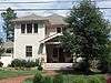
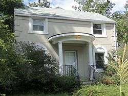
Al's Motors |
|
July 5, 2003
(#03000628) |
3910 Wilson Boulevard
38°52′47″N 77°06′24″W / 38.879722°N 77.106667°W / 38.879722; -77.106667 (Al's Motors) |
Ballston |
Currently a Gold's Gym |
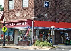
| 2 |
Arlington Forest Historic District |
|
December 2, 2005
(#05001344) |
Bounded by Carlin Springs Rd., George Mason Dr., Henderson Rd., Aberdeen St., Columbus St., Granada, Galveston, and 2nd
38°52′14″N 77°07′08″W / 38.870556°N 77.118889°W / 38.870556; -77.118889 (Arlington Forest Historic District) |
Arlington |
|
| 3 |
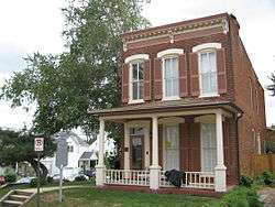
Arlington Heights Historic District |
|
February 21, 2008
(#08000063) |
Bounded by Arlington Boulevard, S. Fillmore St., S. Walter Reed Dr., Columbia Pk., and S. Glebe Rd.
38°52′03″N 77°05′27″W / 38.867500°N 77.090833°W / 38.867500; -77.090833 (Arlington Heights Historic District) |
Arlington |
|
| 4 |
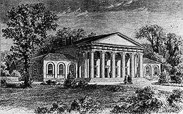
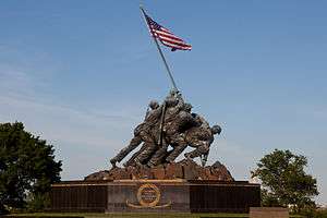
Arlington House, The Robert E. Lee Memorial |
|
October 15, 1966
(#66000040) |
Arlington National Cemetery
38°52′52″N 77°04′21″W / 38.881111°N 77.072500°W / 38.881111; -77.072500 (Arlington House, The Robert E. Lee Memorial) |
Arlington |
Boundary increase on 2014-03-17, listed as the Arlington House Historic District |
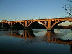
| 5 |
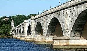
Arlington Memorial Bridge |
|
April 4, 1980
(#80000346) |
Spans the Potomac River
38°53′06″N 77°03′44″W / 38.885000°N 77.062222°W / 38.885000; -77.062222 (Arlington Memorial Bridge) |
Arlington |
Extends into central Washington, D.C. |
| 6 |
Arlington National Cemetery Historic District |
|
April 11, 2014
(#14000146) |
1 Memorial Drive
38°52′48″N 77°04′12″W / 38.880000°N 77.070000°W / 38.880000; -77.070000 (Arlington National Cemetery Historic District) |
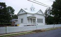
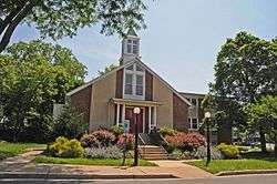
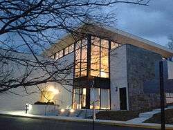
Arlington |
Includes the cemetery, Arlington House, Memorial Drive, and the Hemicycle |
| 7 |
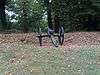
Arlington Ridge Park |
|
September 4, 2009
(#09000688) |
Northwestern corner of N. Meade St. and Marshall Dr.
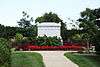
38°53′26″N 77°04′11″W / 38.890556°N 77.069722°W / 38.890556; -77.069722 (Arlington Ridge Park) |
Arlington |
|
| 8 |
Arlington Village Historic District |
|
April 11, 2003
(#03000215) |
S. 13th St., S. 13 Rd., S. 16th St., S. Barton S., S. Cleveland St., and Edgewood St.
38°51′33″N 77°05′02″W / 38.859167°N 77.083889°W / 38.859167; -77.083889 (Arlington Village Historic District) |
Arlington |
|
| 9 |
Ashton Heights Historic District |
|
June 23, 2003
(#03000561) |
Roughly bounded by Wilson Boulevard, N. Irving St., Arlington Boulevard, N. Oxford St., N. Piedmont St., and N. Oakland St.
38°51′08″N 77°03′28″W / 38.852222°N 77.057778°W / 38.852222; -77.057778 (Ashton Heights Historic District) |
Arlington |
|
| 10 |
Aurora Highlands Historic District |
|
October 22, 2008
(#08001018) |
Bounded by 16th St., S., S. Eads St., 26th St., S., and S. Joyce St.
38°51′16″N 77°03′28″W / 38.85445°N 77.057733°W / 38.85445; -77.057733 (Aurora Highlands Historic District) |
Arlington |
|
| 11 |
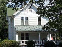
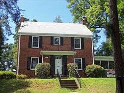
Ball-Sellers House |
|
July 17, 1975
(#75002014) |
5620 S. 3rd St.
38°51′50″N 77°07′30″W / 38.863750°N 77.125000°W / 38.863750; -77.125000 (Ball-Sellers House) |
Glencarlyn |
|
| 12 |
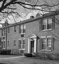
Barcroft Community House |
|
July 28, 1995
(#95000928) |
800 S. Buchanan St.
38°51′35″N 77°06′37″W / 38.859639°N 77.110278°W / 38.859639; -77.110278 (Barcroft Community House) |
Arlington |
|
| 13 |
Benjamin Banneker: SW-9 Intermediate Boundary Stone |
|
May 11, 1976
(#76002094) |
18th and Van Buren Sts.
38°52′59″N 77°09′33″W / 38.882944°N 77.159083°W / 38.882944; -77.159083 (Benjamin Banneker: SW-9 Intermediate Boundary Stone) |
Arlington |
|
| 14 |
Buckingham Historic District |
|
January 21, 1999
(#98001649) |
Roughly bounded by N. 5th, N. Oxford, and N. 2nd Sts., and N. Glebe Rd.; also bounded by N. Oxford St., 5th St., N., N. Henderson Rd., 1st St., N., N. Pershing, N. Thomas St., and 2nd St., N.; also bounded by and including N. Thomas St., 4th St., N., N. Pershing Dr., and N. George Mason Dr.
38°52′30″N 77°06′20″W / 38.875000°N 77.105556°W / 38.875000; -77.105556 (Buckingham Historic District) |
Arlington |
Second and third sets of boundaries represent boundary increases of February 11, 2004 and March 23, 2010 |
| 15 |
Calvert Manor |
|
December 15, 1997
(#97001506) |
1925-1927 N. Calvert St.
38°53′44″N 77°05′31″W / 38.895556°N 77.091944°W / 38.895556; -77.091944 (Calvert Manor) |
Arlington |
|
| 16 |
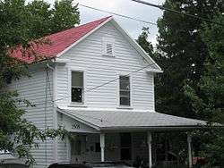
Carlin Hall |
|
August 12, 1993
(#93000833) |
5711 4th St., S.
38°51′47″N 77°07′34″W / 38.863194°N 77.126111°W / 38.863194; -77.126111 (Carlin Hall) |
Glencarlyn |
|
| 17 |
Cherrydale Historic District |
|
May 22, 2003
(#03000461) |
Roughly bounded by Lorcom Ln., N. Utah and N. Taylor Sts., and Interstate 66
38°53′41″N 77°06′12″W / 38.894722°N 77.103333°W / 38.894722; -77.103333 (Cherrydale Historic District) |
Cherrydale |
|
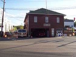
| 18 |
Cherrydale Volunteer Fire House |
|
July 28, 1995
(#95000927) |
3900 N. U.S. Route 29
38°53′47″N 77°06′26″W / 38.896389°N 77.107222°W / 38.896389; -77.107222 (Cherrydale Volunteer Fire House) |
Cherrydale |
|
| 19 |
Claremont Historic District |
|
August 31, 2006
(#06000751) |
Bounded by S. Dinwiddie St., S. Chesterfield Rd., S. Buchanan St., 25th St., S., 24th St., S., 23rd St., S., and 22nd St., S.
38°50′47″N 77°06′20″W / 38.846389°N 77.105556°W / 38.846389; -77.105556 (Claremont Historic District) |
Arlington |
|
| 20 |
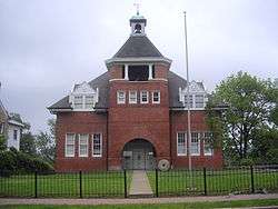
Clarendon School |
|
December 9, 1999
(#99001502) |
3550 Wilson Boulevard
38°52′54″N 77°06′07″W / 38.881667°N 77.101944°W / 38.881667; -77.101944 (Clarendon School) |
Clarendon |
Currently the Arlington Arts Center |
| 21 |
Colonial Village |
|
December 9, 1980
(#80004170) |
Roughly bounded by Wilson Boulevard, U.S. Route 29, N. Veitch St., and Queens Lane
38°53′40″N 77°05′00″W / 38.894444°N 77.083333°W / 38.894444; -77.083333 (Colonial Village) |
Arlington |
|
| 22 |
Columbia Forest Historic District |
|
February 11, 2004
(#04000047) |
Bounded by 11th, S. Edison, S. Dinwiddie, S. Columbus, S. George Mason, and S. Frederick St.
38°51′09″N 77°06′41″W / 38.8525°N 77.1114°W / 38.8525; -77.1114 (Columbia Forest Historic District) |
Arlington |
|
| 23 |
George Crossman House |
|
May 22, 2003
(#03000455) |
2501 N. Underwood St.
38°53′32″N 77°09′38″W / 38.892222°N 77.160694°W / 38.892222; -77.160694 (George Crossman House) |
Arlington |
|
| 24 |
Dominion Hills Historic District |
|
April 24, 2012
(#12000239) |
Roughly bounded by N. Four Mile Run Dr., N. McKinley Rd., N. Larrimore, N. Madison, and N. Montana Sts., and 9th St., N.
38°52′33″N 77°08′29″W / 38.875833°N 77.141389°W / 38.875833; -77.141389 (Dominion Hills Historic District) |
Arlington |
|
| 25 |
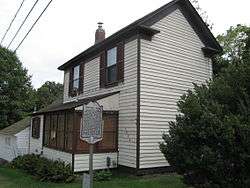
Charles Richard Drew House |
|
May 11, 1976
(#76002095) |
2505 1st St., S.
38°52′22″N 77°05′13″W / 38.872778°N 77.086806°W / 38.872778; -77.086806 (Charles Richard Drew House) |
Arlington |
|
| 26 |
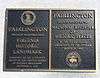
Fairlington Historic District |
|
March 29, 1999
(#99000368) |
Roughly bounded by Quaker Lane, King St., Interstate 395, S. Walter Reed Dr., and S. Abingdon St.
38°50′17″N 77°05′57″W / 38.838056°N 77.099167°W / 38.838056; -77.099167 (Fairlington Historic District) |
Fairlington |
|
| 27 |
Fort C. F. Smith Historic District |
|
February 1, 2000
(#99001719) |
2411 24th St.
38°54′06″N 77°05′25″W / 38.901667°N 77.090278°W / 38.901667; -77.090278 (Fort C. F. Smith Historic District) |
Arlington |
|
| 28 |
Fort Ethan Allen |
|
February 11, 2004
(#04000052) |
Junction of Glebe and Ridgeview Rds.[6]
38°55′27″N 77°07′26″W / 38.924167°N 77.123889°W / 38.924167; -77.123889 (Fort Ethan Allen) |
Arlington |
|
| 29 |
Fort Myer Historic District |
|
November 28, 1972
(#72001380) |
U.S. Route 50
38°52′58″N 77°04′58″W / 38.882778°N 77.082778°W / 38.882778; -77.082778 (Fort Myer Historic District) |
Arlington |
|
| 30 |
George Washington Memorial Parkway |
|
June 2, 1995
(#95000605) |
Roughly the southern side of the Potomac River from the American Legion Bridge to Memorial Bridge, and the northern side from Brickyard Rd. to the Chain Bridge
38°55′15″N 77°06′33″W / 38.920833°N 77.109167°W / 38.920833; -77.109167 (George Washington Memorial Parkway) |
Arlington |
|
| 31 |
Georgetown Pike |
|
August 22, 2012
(#12000537) |
From the District of Columbia boundary at Chain Bridge to the junction with Leesburg Pike at Seneca Rd.
38°55′52″N 77°07′09″W / 38.931111°N 77.119167°W / 38.931111; -77.119167 (Georgetown Pike) |
Arlington |
Extends into Fairfax County |
| 32 |
Glebe Center |
|
February 11, 2004
(#04000055) |
71-89 N. Glebe Rd.
38°52′20″N 77°06′34″W / 38.872222°N 77.109444°W / 38.872222; -77.109444 (Glebe Center) |
Ballston |
|
| 33 |
The Glebe |
|
February 23, 1972
(#72001381) |
4527 17th St., N.
38°53′31″N 77°07′04″W / 38.891944°N 77.117778°W / 38.891944; -77.117778 (The Glebe) |
Arlington |
Has octagon wing |
| 34 |
Glebewood Village Historic District |
|
February 11, 2004
(#04000049) |
N. Brandywine St. between Lee Highway and 10th Place N., and 21st Rd. between N. Brandywine St. and N. Glebe Rd.
38°53′44″N 77°07′26″W / 38.895556°N 77.123889°W / 38.895556; -77.123889 (Glebewood Village Historic District) |
Arlington |
|
| 35 |
Glencarlyn Historic District |
|
September 18, 2008
(#08000910) |
Bounded by S. Carlin Springs Rd., Arlington Boulevard, 5th Rd. S., and Glencarlyn Park
38°51′49″N 77°07′35″W / 38.863611°N 77.126389°W / 38.863611; -77.126389 (Glencarlyn Historic District) |
Glencarlyn |
|
| 36 |
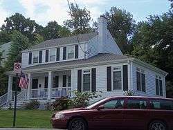
Harry W. Gray House |
|
February 11, 2004
(#64000051) |
1005 S. Quinn St.
38°51′55″N 77°04′29″W / 38.865139°N 77.074722°W / 38.865139; -77.074722 (Harry W. Gray House) |
Arlington |
|
| 37 |
Highland Park-Overlee Knolls |
|
August 18, 2011
(#11000548) |
Roughly bounded by 22nd St., N., N. Lexington St., 16th St., N., N. Longfellow St., McKinley Rd., Interstate 66, and N. Quantico St.
38°53′12″N 77°08′49″W / 38.886667°N 77.146944°W / 38.886667; -77.146944 (Highland Park-Overlee Knolls) |
Arlington |
|
| 38 |
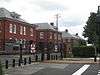
Hume School |
|
June 18, 1979
(#79003027) |
1805 S. Arlington Ridge Rd.
38°51′32″N 77°04′03″W / 38.858750°N 77.067500°W / 38.858750; -77.067500 (Hume School) |
Arlington |
|
| 39 |
Francis Scott Key Bridge |
|
March 1, 1996
(#96000199) |
U.S. Route 29 over the Potomac River
38°54′05″N 77°04′13″W / 38.901389°N 77.070278°W / 38.901389; -77.070278 (Francis Scott Key Bridge) |
Arlington |
|
| 40 |
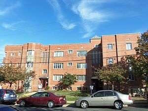
Lee Gardens North Historic District |
|
February 26, 2004
(#04000109) |
2300-2341 N. 11th St.
38°53′08″N 77°05′12″W / 38.885556°N 77.086667°W / 38.885556; -77.086667 (Lee Gardens North Historic District) |
Arlington |
|
| 41 |
Lomax African Methodist Episcopal Zion Church |
|
February 11, 2004
(#04000038) |
2704 24th Rd., S.
38°50′52″N 77°04′56″W / 38.847778°N 77.082222°W / 38.847778; -77.082222 (Lomax African Methodist Episcopal Zion Church) |
Arlington |
|
| 42 |
Lyon Park Historic District |
|
November 12, 2003
(#03000437) |
Roughly bounded by 10th St., N., Arlington Boulevard, and N. Irving St.
38°52′45″N 77°05′26″W / 38.879167°N 77.090556°W / 38.879167; -77.090556 (Lyon Park Historic District) |
Arlington |
|
| 43 |
Lyon Village Historic District |
|
May 10, 2002
(#02000512) |
Roughly bounded by U.S. Route 29, N. Veitch St., N. Franklin Rd., N. Highland St., N. Fillmore St., and N. Kirkwood Rd.
38°53′29″N 77°05′42″W / 38.891389°N 77.095000°W / 38.891389; -77.095000 (Lyon Village Historic District) |
Arlington |
|
| 44 |
Maywood Historic District |
|
May 22, 2003
(#03000460) |
Roughly bounded by Lorcom Ln., Spout Run Parkway, Interstate 66, U.S. Route 29, N. Oakland St., N. Nelson St., and N. Lincoln St.
38°53′53″N 77°06′05″W / 38.898056°N 77.101389°W / 38.898056; -77.101389 (Maywood Historic District) |
Arlington |
|
| 45 |
Monroe Courts Historic District |
|
February 21, 2008
(#08000064) |
1041-1067 N. Nelson and 1036-1062 and 1033-1055 N. Monroe Sts.
38°53′08″N 77°06′16″W / 38.885556°N 77.104444°W / 38.885556; -77.104444 (Monroe Courts Historic District) |
Arlington |
|
| 46 |
Mount Vernon Memorial Highway |
|
May 18, 1981
(#81000079) |
Washington St. and George Washington Memorial Parkway
38°51′54″N 77°02′29″W / 38.865000°N 77.041389°W / 38.865000; -77.041389 (Mount Vernon Memorial Highway) |
Arlington |
|
| 47 |
Northwest No. 1 Boundary Marker of the Original District of Columbia |
|
February 1, 1991
(#91000003) |
3607 Powhatan St.
38°54′12″N 77°09′33″W / 38.903472°N 77.159167°W / 38.903472; -77.159167 (Northwest No. 1 Boundary Marker of the Original District of Columbia) |
Arlington |
|
| 48 |
Northwest No. 2 Boundary Marker of the Original District of Columbia |
|
February 1, 1991
(#91000004) |
5145 N. 38th St.
38°54′49″N 77°08′46″W / 38.913667°N 77.146111°W / 38.913667; -77.146111 (Northwest No. 2 Boundary Marker of the Original District of Columbia) |
Arlington |
|
| 49 |
Northwest No. 3 Boundary Marker of the Original District of Columbia |
|
February 1, 1991
(#91000005) |
4013 N. Tazewell St.
38°55′28″N 77°07′55″W / 38.924583°N 77.132083°W / 38.924583; -77.132083 (Northwest No. 3 Boundary Marker of the Original District of Columbia) |
Arlington |
|
| 50 |
Penrose Historic District |
|
November 15, 2004
(#04000112) |
Roughly bounded by Arlington Boulevard, S. Courthouse Rd., S. Fillmore St., S. Barton St., and Columbia Pike
38°52′08″N 77°05′04″W / 38.868889°N 77.084444°W / 38.868889; -77.084444 (Penrose Historic District) |
Arlington |
|
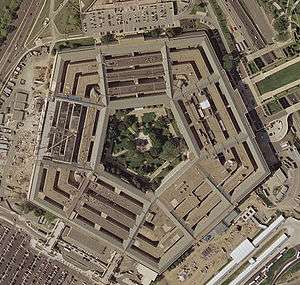
| 51 |
Pentagon Office Building Complex |
|
July 27, 1989
(#89000932) |
State Route 110 at Interstate 395
38°52′16″N 77°03′23″W / 38.871111°N 77.056389°W / 38.871111; -77.056389 (Pentagon Office Building Complex) |
Pentagon City |
|
| 52 |
Quarters 1, Fort Myer |
|
November 28, 1972
(#72001382) |
Grant Ave.
38°52′58″N 77°04′53″W / 38.882778°N 77.081389°W / 38.882778; -77.081389 (Quarters 1, Fort Myer) |
Arlington |
|
| 53 |
Saegmuller House |
|
May 22, 2003
(#03000453) |
5101 Little Falls Rd.
38°54′22″N 77°08′24″W / 38.906111°N 77.140000°W / 38.906111; -77.140000 (Saegmuller House) |
Arlington |
|
| 54 |
Southwest No. 4 Boundary Marker of the Original District of Columbia |
|
February 1, 1991
(#91000009) |
King St. north of the junction with Wakefield St.
38°49′54″N 77°05′36″W / 38.831667°N 77.093333°W / 38.831667; -77.093333 (Southwest No. 4 Boundary Marker of the Original District of Columbia) |
Alexandria |
|
| 55 |
Southwest No. 5 Boundary Marker of the Original District of Columbia |
|
February 1, 1991
(#91000010) |
Northeast of the junction of King St. and Walter Reed Dr.
38°50′31″N 77°06′24″W / 38.842083°N 77.106667°W / 38.842083; -77.106667 (Southwest No. 5 Boundary Marker of the Original District of Columbia) |
Arlington |
|
| 56 |
Southwest No. 6 Boundary Marker of the Original District of Columbia |
|
February 1, 1991
(#91000011) |
S. Jefferson St. south of the junction with Columbia Pike, in the median strip
38°51′07″N 77°07′09″W / 38.851861°N 77.119250°W / 38.851861; -77.119250 (Southwest No. 6 Boundary Marker of the Original District of Columbia) |
Arlington |
|
| 57 |
Southwest No. 7 Boundary Marker of the Original District of Columbia |
|
February 1, 1991
(#91000012) |
Behind 3101 S. Manchester St.
38°51′44″N 77°07′57″W / 38.862361°N 77.132500°W / 38.862361; -77.132500 (Southwest No. 7 Boundary Marker of the Original District of Columbia) |
Arlington |
|
| 58 |
Southwest No. 8 Boundary Marker of the Original District of Columbia |
|
February 1, 1991
(#91000013) |
Junction of Wilson Boulevard and John Marshall Dr., behind an apartment building
38°52′22″N 77°08′45″W / 38.872639°N 77.145861°W / 38.872639; -77.145861 (Southwest No. 8 Boundary Marker of the Original District of Columbia) |
Arlington |
Extends into Fairfax County |
| 59 |
Stratford Junior High School |
|
February 26, 2004
(#04000110) |
4100 Vacation Ln.
38°54′00″N 77°06′44″W / 38.900000°N 77.112222°W / 38.900000; -77.112222 (Stratford Junior High School) |
Cherrydale |
|
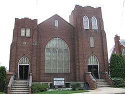
| 60 |
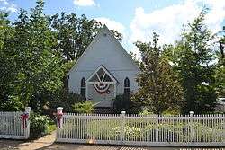
Unitarian Universalist Church of Arlington |
|
November 19, 2014
(#14000943) |
4444 Arlington Boulevard
38°52′06″N 77°06′27″W / 38.868333°N 77.107500°W / 38.868333; -77.107500 (Unitarian Universalist Church of Arlington) |
Arlington |
|
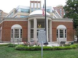
| 61 |
US Post Office-Arlington |
|
February 7, 1986
(#86000151) |
3118 N. Washington Boulevard
38°53′08″N 77°05′44″W / 38.885556°N 77.095417°W / 38.885556; -77.095417 (US Post Office-Arlington) |
Clarendon |
|
| 62 |
Virginia Heights Historic District |
|
February 21, 2008
(#08000065) |
Bounded by 10th Pl., S., S. Frederick St., and S. George Mason Dr.
38°51′02″N 77°06′53″W / 38.850556°N 77.114722°W / 38.850556; -77.114722 (Virginia Heights Historic District) |
Arlington |
|
| 63 |
Walter Reed Gardens Historic District |
|
May 22, 2003
(#03000451) |
2900-2906 13th St., S., 2900-2914 13th Rd., S., and 1301-1319 S. Walter Reed Dr.
38°51′33″N 77°05′13″W / 38.859167°N 77.086944°W / 38.859167; -77.086944 (Walter Reed Gardens Historic District) |
Arlington |
|
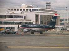
| 64 |
Washington National Airport Terminal and South Hangar Line |
|
September 12, 1997
(#97001111) |
Thomas Ave.
38°50′56″N 77°02′30″W / 38.848889°N 77.041667°W / 38.848889; -77.041667 (Washington National Airport Terminal and South Hangar Line) |
Arlington |
|
| 65 |
Waverly Hills Historic District |
|
February 26, 2004
(#04000111) |
Roughly bounded by 20th Rd., N., N. Utah St, Interstate 66, N. Glebe Rd., and N. Vermont St.
38°53′31″N 77°07′02″W / 38.891944°N 77.117222°W / 38.891944; -77.117222 (Waverly Hills Historic District) |
Arlington |
|
| 66 |
West Cornerstone |
|
February 1, 1991
(#91000014) |
Western side of Meridian St., south of the junction with Williamsburg Boulevard
38°53′36″N 77°10′20″W / 38.893333°N 77.172222°W / 38.893333; -77.172222 (West Cornerstone) |
Falls Church |
|
| 67 |
Westover Historic District |
|
May 2, 2006
(#06000345) |
Bounded by McKinley Rd., N. Washington Boulevard, N. 16th St., N. Jefferson St., N. 11th St., and N. Fairfax Dr.
38°52′58″N 77°08′11″W / 38.882775°N 77.136525°W / 38.882775; -77.136525 (Westover Historic District) |
Arlington |
|
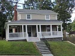
| 68 |
Earle Micajah Winslow House |
|
February 22, 2011
(#11000028) |
2333 N. Vernon St.
38°54′06″N 77°07′09″W / 38.901667°N 77.119167°W / 38.901667; -77.119167 (Earle Micajah Winslow House) |
Arlington |
|
.JPG)
%2C_21_Oct_2012.JPG)
.JPG)
_02.JPG)
.JPG)


_NW_1.jpg)
_NW_2.jpg)
_NW_3.jpg)
_SW_4.jpg)
_SW_5.jpg)
_SW_6_-2.jpg)
_SW_7.jpg)
.JPG)
_West_Stone.jpg)