National Highway 75 (India)
| ||||
|---|---|---|---|---|
.jpg) Schematic map of Renumbered National Highways in India | ||||
| Route information | ||||
| Length | 533 km (331 mi) | |||
| Major junctions | ||||
| West end | Bantval, Karnataka | |||
| East end | Vellore, Tamil Nadu | |||
| Location | ||||
| States | Karnataka and Tamil Nadu | |||
| Primary destinations | Hassana, Nelamangala, Bengaluru, Kolar, Mulbagal, Venkatagirikota, Pernambut, Gudiyattam, Katpadi | |||
| Highway system | ||||
| ||||
National Highway 75 (NH 75) is a National Highway in India, passing through three states of Karnataka, Andhra Pradesh, Tamil Nadu.[1] This national highway was earlier known as national highway 48 ( NH-48 ) before rationalisation of highway numbers in 2010 connecting the port city of Mangaluru (Mangalore) to the state capital of Karnataka at Bengaluru. It traveses all three geographical regions of Karnataka state namely Karavali, Malenadu and Bayaluseemae.
Route
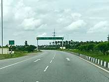
NH 75 near Hassana, Karnataka
It starts at Mangaluru (Mangalore) in Karnataka state and passes through Bantwala, Nellyadi, Sakleshpura, Hassana, Bengaluru, Kolar, Mulbagal, Venkatagirikota, Pernambut, Gudiyattam, Katpadi before terminating at Vellore in Tamil Nadu.[1]
State–wise route length (in km.)
- Andhra Pradesh – 23.40 km (14.54 mi)[1]
See also
References
- 1 2 3 "List of National Highways passing through A.P. State". Roads and Buildings Department. Government of Andhra Pradesh. Archived from the original on 28 March 2016. Retrieved 11 February 2016.
- ↑ "Shiradi ghat will be closed to heavy vehiclesfor six months". https://www.deccanchronicle.com. Retrieved 2018-09-01. External link in
|publisher=(help)

Secondary routes of National Highway 75 | ||
|---|---|---|
 | ||
| Secondary Routes of NH 75 | ||
This article is issued from
Wikipedia.
The text is licensed under Creative Commons - Attribution - Sharealike.
Additional terms may apply for the media files.