Méré, Yvelines
| Méré | ||
|---|---|---|
| Commune | ||
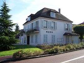 Town hall | ||
| ||
 Méré Location within Île-de-France region  Méré | ||
| Coordinates: 48°47′13″N 1°49′06″E / 48.7869°N 1.8183°ECoordinates: 48°47′13″N 1°49′06″E / 48.7869°N 1.8183°E | ||
| Country | France | |
| Region | Île-de-France | |
| Department | Yvelines | |
| Arrondissement | Rambouillet | |
| Canton | Aubergenville | |
| Government | ||
| • Mayor (2005–2008) | Michel Recoussines | |
| Area1 | 10.32 km2 (3.98 sq mi) | |
| Population (2006)2 | 1,782 | |
| • Density | 170/km2 (450/sq mi) | |
| Time zone | UTC+1 (CET) | |
| • Summer (DST) | UTC+2 (CEST) | |
| INSEE/Postal code | 78389 /78490 | |
| Elevation |
65–184 m (213–604 ft) (avg. 150 m or 490 ft) | |
|
1 French Land Register data, which excludes lakes, ponds, glaciers > 1 km2 (0.386 sq mi or 247 acres) and river estuaries. 2 Population without double counting: residents of multiple communes (e.g., students and military personnel) only counted once. | ||

Méré is a commune in the Yvelines department in the Île-de-France region in north-central France.
See also
References
| Wikimedia Commons has media related to Méré (Yvelines). |
This article is issued from
Wikipedia.
The text is licensed under Creative Commons - Attribution - Sharealike.
Additional terms may apply for the media files.