Dannemarie, Yvelines
| Dannemarie | |
|---|---|
| Commune | |
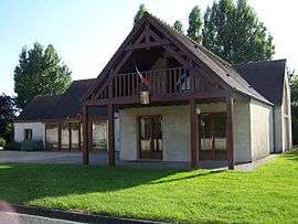 Town hall | |
 Dannemarie Location within Île-de-France region  Dannemarie | |
| Coordinates: 48°45′45″N 1°36′28″E / 48.7625°N 1.6078°ECoordinates: 48°45′45″N 1°36′28″E / 48.7625°N 1.6078°E | |
| Country | France |
| Region | Île-de-France |
| Department | Yvelines |
| Arrondissement | Mantes-la-Jolie |
| Canton | Bonnières-sur-Seine |
| Intercommunality | Pays houdanais |
| Government | |
| • Mayor (2001–2008) | Thierry Barjot |
| Area1 | 3.44 km2 (1.33 sq mi) |
| Population (2006)2 | 248 |
| • Density | 72/km2 (190/sq mi) |
| Time zone | UTC+1 (CET) |
| • Summer (DST) | UTC+2 (CEST) |
| INSEE/Postal code | 78194 /78550 |
| Elevation |
102–134 m (335–440 ft) (avg. 107 m or 351 ft) |
|
1 French Land Register data, which excludes lakes, ponds, glaciers > 1 km2 (0.386 sq mi or 247 acres) and river estuaries. 2 Population without double counting: residents of multiple communes (e.g., students and military personnel) only counted once. | |
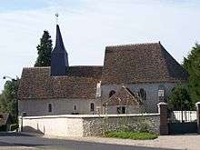
Sainte-Anne
Dannemarie is a commune in the Yvelines department in the Île-de-France in north-central France.
See also
References
| Wikimedia Commons has media related to Dannemarie (Yvelines). |
This article is issued from
Wikipedia.
The text is licensed under Creative Commons - Attribution - Sharealike.
Additional terms may apply for the media files.