Émancé
| Émancé | |
|---|---|
| Commune | |
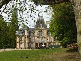 Castle of Sauvage | |
 Émancé Location within Île-de-France region  Émancé | |
| Coordinates: 48°35′28″N 1°43′51″E / 48.5911°N 1.7308°ECoordinates: 48°35′28″N 1°43′51″E / 48.5911°N 1.7308°E | |
| Country | France |
| Region | Île-de-France |
| Department | Yvelines |
| Arrondissement | Rambouillet |
| Canton | Rambouillet |
| Intercommunality | Plaines et forêts d'Yveline |
| Government | |
| • Mayor (2001–2008) | Françoise Grangeon |
| Area1 | 11.99 km2 (4.63 sq mi) |
| Population (2006)2 | 818 |
| • Density | 68/km2 (180/sq mi) |
| Time zone | UTC+1 (CET) |
| • Summer (DST) | UTC+2 (CEST) |
| INSEE/Postal code | 78209 /78125 |
| Elevation |
119–167 m (390–548 ft) (avg. 127 m or 417 ft) |
|
1 French Land Register data, which excludes lakes, ponds, glaciers > 1 km2 (0.386 sq mi or 247 acres) and river estuaries. 2 Population without double counting: residents of multiple communes (e.g., students and military personnel) only counted once. | |
Émancé is a commune in the Yvelines department in the Île-de-France in north-central France. It is around 50 km south west of Paris.
There is a population of feral wallabies nearby in the Forest of Rambouillet.[1] This population has been present since the seventies, when some individuals escaped from a zoological park in Émancé after a storm.[2][3]
See also
| Wikimedia Commons has media related to Émancé. |
References
- ↑ "Roos are driving French hopping mad". Smh.com.au. 2009-07-29. Retrieved 2010-03-02.
- ↑ "Archived copy". Archived from the original on 2007-10-13. Retrieved 2009-05-27.
- ↑ "Des wallabies en liberté dans ma forêt de Rambouillet". Passion Nature 78. Retrieved 4 June 2013.
This article is issued from
Wikipedia.
The text is licensed under Creative Commons - Attribution - Sharealike.
Additional terms may apply for the media files.