Chavenay
| Chavenay | ||
|---|---|---|
| Commune | ||
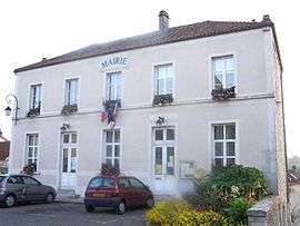 The town hall in Chavenay | ||
| ||
 Chavenay Location within Île-de-France region  Chavenay | ||
| Coordinates: 48°51′16″N 1°59′14″E / 48.8544°N 1.9872°ECoordinates: 48°51′16″N 1°59′14″E / 48.8544°N 1.9872°E | ||
| Country | France | |
| Region | Île-de-France | |
| Department | Yvelines | |
| Arrondissement | Saint-Germain-en-Laye | |
| Canton | Saint-Cyr-l'École | |
| Government | ||
| • Mayor (2008–2014) | Denis Flamant (PR) | |
| Area1 | 6.03 km2 (2.33 sq mi) | |
| Population (2006)2 | 1,899 | |
| • Density | 310/km2 (820/sq mi) | |
| Time zone | UTC+1 (CET) | |
| • Summer (DST) | UTC+2 (CEST) | |
| INSEE/Postal code | 78152 /78450 | |
| Elevation |
71–129 m (233–423 ft) (avg. 100 m or 330 ft) | |
|
1 French Land Register data, which excludes lakes, ponds, glaciers > 1 km2 (0.386 sq mi or 247 acres) and river estuaries. 2 Population without double counting: residents of multiple communes (e.g., students and military personnel) only counted once. | ||

Chavenay, also known as Vallon de Chavenay, is a commune in the Yvelines department in the Île-de-France region in north-central France. It is located close to Saint-Nom-la-Bretèche, Saint-Germain-en-Laye, and Versailles.
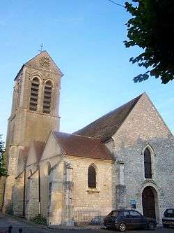
Chavenay church
Twin towns
Along with Crespières, Feucherolles and Saint-Nom-la-Bretèche Chavenay is twinned with Rösrath, Germany.
See also
References
| Wikimedia Commons has media related to Chavenay. |
This article is issued from
Wikipedia.
The text is licensed under Creative Commons - Attribution - Sharealike.
Additional terms may apply for the media files.