Gambais
| Gambais | ||
|---|---|---|
| Commune | ||
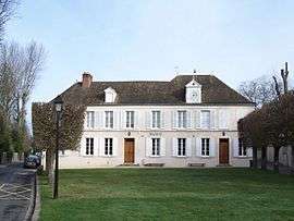 Town hall | ||
| ||
 Gambais Location within Île-de-France region  Gambais | ||
| Coordinates: 48°46′26″N 1°40′26″E / 48.7739°N 1.6739°ECoordinates: 48°46′26″N 1°40′26″E / 48.7739°N 1.6739°E | ||
| Country | France | |
| Region | Île-de-France | |
| Department | Yvelines | |
| Arrondissement | Rambouillet | |
| Canton | Aubergenville | |
| Government | ||
| • Mayor (2001–2008) | Jean-Claude Lecoq | |
| Area1 | 23.02 km2 (8.89 sq mi) | |
| Population (2006)2 | 2,375 | |
| • Density | 100/km2 (270/sq mi) | |
| Time zone | UTC+1 (CET) | |
| • Summer (DST) | UTC+2 (CEST) | |
| INSEE/Postal code | 78263 /78950 | |
| Elevation | 94–182 m (308–597 ft) | |
|
1 French Land Register data, which excludes lakes, ponds, glaciers > 1 km2 (0.386 sq mi or 247 acres) and river estuaries. 2 Population without double counting: residents of multiple communes (e.g., students and military personnel) only counted once. | ||

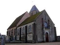
Saint-Aignan

Henri Landru's Gambais Villa 1 March 1919
Gambais is a commune in the Yvelines department in the Île-de-France region in north-central France. The commune is 58 km west from the center of Paris.
See also
References
| Wikimedia Commons has media related to Gambais. |
This article is issued from
Wikipedia.
The text is licensed under Creative Commons - Attribution - Sharealike.
Additional terms may apply for the media files.