Le Perray-en-Yvelines
| Le Perray-en-Yvelines | ||
|---|---|---|
| Commune | ||
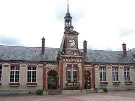 The town hall in Le Perray-en-Yvelines | ||
| ||
 Le Perray-en-Yvelines Location within Île-de-France region  Le Perray-en-Yvelines | ||
| Coordinates: 48°41′41″N 1°51′18″E / 48.6947°N 1.855°ECoordinates: 48°41′41″N 1°51′18″E / 48.6947°N 1.855°E | ||
| Country | France | |
| Region | Île-de-France | |
| Department | Yvelines | |
| Arrondissement | Rambouillet | |
| Canton | Rambouillet | |
| Intercommunality | Les Etangs | |
| Government | ||
| • Mayor (2008–2014) | Paulette Deschamps | |
| Area1 | 13.47 km2 (5.20 sq mi) | |
| Population (2006)2 | 6,506 | |
| • Density | 480/km2 (1,300/sq mi) | |
| Time zone | UTC+1 (CET) | |
| • Summer (DST) | UTC+2 (CEST) | |
| INSEE/Postal code | 78486 /78610 | |
| Elevation |
155–179 m (509–587 ft) (avg. 175 m or 574 ft) | |
|
1 French Land Register data, which excludes lakes, ponds, glaciers > 1 km2 (0.386 sq mi or 247 acres) and river estuaries. 2 Population without double counting: residents of multiple communes (e.g., students and military personnel) only counted once. | ||
.svg.png)
Le Perray-en-Yvelines is a commune in the Yvelines department in the west of Île-de-France in north-central France.
See also
References
| Wikimedia Commons has media related to Le Perray-en-Yvelines. |
This article is issued from
Wikipedia.
The text is licensed under Creative Commons - Attribution - Sharealike.
Additional terms may apply for the media files.