Adainville

L'église Saint-Denis
| Adainville | ||
|---|---|---|
| Commune | ||
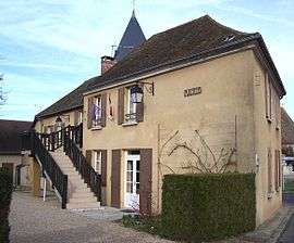 The town hall in Adainville | ||
| ||
 Adainville Location within Île-de-France region  Adainville | ||
| Coordinates: 48°43′28″N 1°39′16″E / 48.7244°N 1.6544°ECoordinates: 48°43′28″N 1°39′16″E / 48.7244°N 1.6544°E | ||
| Country | France | |
| Region | Île-de-France | |
| Department | Yvelines | |
| Arrondissement | Mantes-la-Jolie | |
| Canton | Bonnières-sur-Seine | |
| Intercommunality | Pays Houdanais | |
| Government | ||
| • Mayor (2014-2020) | Marie-Hélène Quinault | |
| Area1 | 10.16 km2 (3.92 sq mi) | |
| Population (2014)2 | 762 | |
| • Density | 75/km2 (190/sq mi) | |
| Time zone | UTC+1 (CET) | |
| • Summer (DST) | UTC+2 (CEST) | |
| INSEE/Postal code | 78006 /78113 | |
| Elevation | 105–184 m (344–604 ft) | |
|
1 French Land Register data, which excludes lakes, ponds, glaciers > 1 km2 (0.386 sq mi or 247 acres) and river estuaries. 2 Population without double counting: residents of multiple communes (e.g., students and military personnel) only counted once. | ||
.svg.png)
Adainville is a commune in the Yvelines department in north-central France.
Population
| Historical population | ||
|---|---|---|
| Year | Pop. | ±% |
| 1793 | 361 | — |
| 1800 | 257 | −28.8% |
| 1806 | 406 | +58.0% |
| 1821 | 395 | −2.7% |
| 1831 | 491 | +24.3% |
| 1836 | 507 | +3.3% |
| 1841 | 518 | +2.2% |
| 1846 | 530 | +2.3% |
| 1851 | 493 | −7.0% |
| 1856 | 517 | +4.9% |
| 1861 | 520 | +0.6% |
| 1866 | 542 | +4.2% |
| 1872 | 535 | −1.3% |
| 1876 | 497 | −7.1% |
| 1881 | 494 | −0.6% |
| 1886 | 480 | −2.8% |
| 1891 | 487 | +1.5% |
| 1896 | 449 | −7.8% |
| 1901 | 448 | −0.2% |
| 1906 | 463 | +3.3% |
| 1911 | 421 | −9.1% |
| 1921 | 325 | −22.8% |
| 1926 | 321 | −1.2% |
| 1931 | 320 | −0.3% |
| 1936 | 285 | −10.9% |
| 1946 | 303 | +6.3% |
| 1954 | 270 | −10.9% |
| 1962 | 265 | −1.9% |
| 1968 | 324 | +22.3% |
| 1975 | 399 | +23.1% |
| 1982 | 522 | +30.8% |
| 1990 | 839 | +60.7% |
| 1999 | 824 | −1.8% |
| 2008 | 770 | −6.6% |
| 2014 | 762 | −1.0% |
See also
References
| Wikimedia Commons has media related to Adainville. |
This article is issued from
Wikipedia.
The text is licensed under Creative Commons - Attribution - Sharealike.
Additional terms may apply for the media files.