Bouafle
| Bouafle | ||
|---|---|---|
| Commune | ||
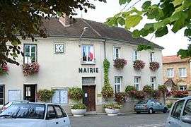 Town hall | ||
| ||
 Bouafle Location within Île-de-France region  Bouafle | ||
| Coordinates: 48°57′54″N 1°53′49″E / 48.965°N 1.897°ECoordinates: 48°57′54″N 1°53′49″E / 48.965°N 1.897°E | ||
| Country | France | |
| Region | Île-de-France | |
| Department | Yvelines | |
| Arrondissement | Mantes-la-Jolie | |
| Canton | Aubergenville | |
| Intercommunality | CU Grand Paris Seine et Oise | |
| Government | ||
| • Mayor (2004–2010) | Jean Dumontel | |
| Area1 | 6.92 km2 (2.67 sq mi) | |
| Population (2006)2 | 2,184 | |
| • Density | 320/km2 (820/sq mi) | |
| Time zone | UTC+1 (CET) | |
| • Summer (DST) | UTC+2 (CEST) | |
| INSEE/Postal code | 78090 /78410 | |
| Elevation |
31–179 m (102–587 ft) (avg. 85 m or 279 ft) | |
|
1 French Land Register data, which excludes lakes, ponds, glaciers > 1 km2 (0.386 sq mi or 247 acres) and river estuaries. 2 Population without double counting: residents of multiple communes (e.g., students and military personnel) only counted once. | ||
.svg.png)
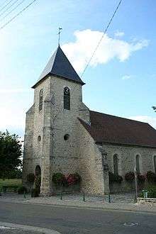
Saint-Martin
Bouafle is a commune in the Yvelines department in north-central France.
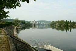
The Seine River and the bridge
See also
References
| Wikimedia Commons has media related to Bouafle. |
This article is issued from
Wikipedia.
The text is licensed under Creative Commons - Attribution - Sharealike.
Additional terms may apply for the media files.