Croissy-sur-Seine
| Croissy-sur-Seine | ||
|---|---|---|
| Commune | ||
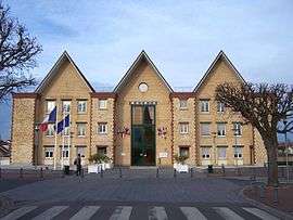 Town hall | ||
| ||
 Croissy-sur-Seine Location within Île-de-France region  Croissy-sur-Seine | ||
| Coordinates: 48°52′42″N 2°08′36″E / 48.8783°N 02.1433°ECoordinates: 48°52′42″N 2°08′36″E / 48.8783°N 02.1433°E | ||
| Country | France | |
| Region | Île-de-France | |
| Department | Yvelines | |
| Arrondissement | Saint-Germain-en-Laye | |
| Canton | Chatou | |
| Intercommunality | CA Saint Germain Boucles Seine | |
| Government | ||
| • Mayor (2014–2020) | Jean-Roger Davin | |
| Area1 | 3.44 km2 (1.33 sq mi) | |
| Population (2006)2 | 10,325 | |
| • Density | 3,000/km2 (7,800/sq mi) | |
| Time zone | UTC+1 (CET) | |
| • Summer (DST) | UTC+2 (CEST) | |
| INSEE/Postal code | 78190 /78290 | |
| Elevation |
19–34 m (62–112 ft) (avg. 26 m or 85 ft) | |
|
1 French Land Register data, which excludes lakes, ponds, glaciers > 1 km2 (0.386 sq mi or 247 acres) and river estuaries. 2 Population without double counting: residents of multiple communes (e.g., students and military personnel) only counted once. | ||

Croissy-sur-Seine is a commune in the Yvelines department in the Île-de-France region in north-central France. It is a affluent suburban town on the western outskirts of Paris. Many expatriates reside in Croissy, given as it is the site of the British School of Paris, a private international school. The French journalist and drama critic Louis Ganderax (1855–1940) died in the commune.
Croissy was Russia's base camp for Euro 2016, which ran from June 10 to July 10, 2016.
Geography
Croissy is located on a loop of the river Seine, which forms its eastern, southern, and western boundaries. Croissy's landward neighbours are Chatou, Le Vesinet, and Le Pecq.
- Area: 3.44 km2 (1.33 sq mi)
- Average altitude: 26 m
Features
The "centre-ville" provides a reasonable number of shops from bakeries to banks. An active morning market takes place on Fridays and Sundays.
There are several parks, some situated on the islands in the Seine. The commune is home to the 13th century chapel of St Leonard, situated near the banks of the Seine.
Transport
In good traffic conditions, the centre of Paris is 20 minutes from Croissy; in daily commuting conditions it will take one hour.
Croissy is not directly served by rail transportation since the commune wants to keep the area residential. The nearest RER station is Chatou-Croissy (on the RER A line St Germain branch). The nearest SNCF service is at Bougival
Education
Public schools in the commune include:[1]
Preschools:
- Écoles maternelle Les Cerisiers
- Écoles maternelle Jean Moulin
Elementary schools:
- École primaire Jules Verne
- École primaire Leclerc
There is one public junior high school, Collège public Jean Moulin.[1]
British School of Paris, a private school founded by Mary Cosyn, is in this commune.
Nearby private schools:[1]
- École et collège Sainte-Thérèse (Bougival)
- École primaire Jeanne d'Arc Notre Dame (Chatou)
- Ecole Sainte-Jeanne d'Arc (Le Vésinet)
- Le Bon Sauveur (Le Vésinet) - preschool through senior high school/sixth form college
See also
References
- 1 2 3 "Etablissements scolaires." Croissy-sur-Seine. Retrieved on September 1, 2016.
External links
| Wikimedia Commons has media related to Croissy-sur-Seine. |
- Croissy-sur-Seine city council website (in French)