Loiron-Ruillé
| Loiron-Ruillé | |
|---|---|
| Commune | |
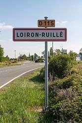 The road into Loiron-Ruillé | |
 Loiron-Ruillé Location within Pays de la Loire region  Loiron-Ruillé | |
| Coordinates: 48°03′36″N 0°56′06″W / 48.060°N 0.935°WCoordinates: 48°03′36″N 0°56′06″W / 48.060°N 0.935°W | |
| Country | France |
| Region | Pays de la Loire |
| Department | Mayenne |
| Arrondissement | Laval |
| Canton | Loiron |
| Government | |
| • Mayor (2016-2020) | Bernard Bourgeais |
| Area1 | 39.86 km2 (15.39 sq mi) |
| Population (2013)2 | 2,461 |
| • Density | 62/km2 (160/sq mi) |
| Time zone | UTC+1 (CET) |
| • Summer (DST) | UTC+2 (CEST) |
| INSEE/Postal code | 53137 /53320 |
|
1 French Land Register data, which excludes lakes, ponds, glaciers > 1 km2 (0.386 sq mi or 247 acres) and river estuaries. 2 Population without double counting: residents of multiple communes (e.g., students and military personnel) only counted once. | |
Loiron-Ruillé is a commune in the department of Mayenne, western France. The municipality was established on 1 January 2016 by merger of the former communes of Loiron and Ruillé-le-Gravelais.[1]
See also
References
| Wikimedia Commons has media related to Loiron-Ruillé. |
- ↑ Arrêté préfectoral 18 November 2015 (in French)
This article is issued from
Wikipedia.
The text is licensed under Creative Commons - Attribution - Sharealike.
Additional terms may apply for the media files.