Athée, Mayenne
| Athée | |
|---|---|
| Commune | |
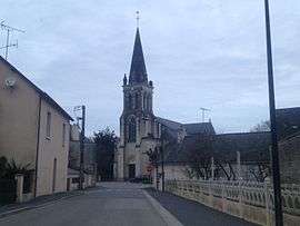 The church in Athée | |
 Athée Location within Pays de la Loire region  Athée | |
| Coordinates: 47°53′16″N 0°56′56″W / 47.8878°N 0.9489°WCoordinates: 47°53′16″N 0°56′56″W / 47.8878°N 0.9489°W | |
| Country | France |
| Region | Pays de la Loire |
| Department | Mayenne |
| Arrondissement | Château-Gontier |
| Canton | Cossé-le-Vivien |
| Intercommunality | CC Pays Craon |
| Government | |
| • Mayor (2016-2020) | Marie-Josèphe Guillet |
| Area1 | 17.23 km2 (6.65 sq mi) |
| Population (2015)2 | 501 |
| • Density | 29/km2 (75/sq mi) |
| Time zone | UTC+1 (CET) |
| • Summer (DST) | UTC+2 (CEST) |
| INSEE/Postal code | 53012 /53400 |
| Elevation |
39–88 m (128–289 ft) (avg. 60 m or 200 ft) |
|
1 French Land Register data, which excludes lakes, ponds, glaciers > 1 km2 (0.386 sq mi or 247 acres) and river estuaries. 2 Population without double counting: residents of multiple communes (e.g., students and military personnel) only counted once. | |
Athée is a commune in the Mayenne department in northwestern France.
Geography
The Oudon River flows through the commune and forms most of its southwestern border and part of its northeastern border.
Population
| Historical population | ||
|---|---|---|
| Year | Pop. | ±% |
| 1962 | 550 | — |
| 1968 | 542 | −1.5% |
| 1975 | 466 | −14.0% |
| 1982 | 461 | −1.1% |
| 1990 | 408 | −11.5% |
| 1999 | 488 | +19.6% |
| 2006 | 489 | +0.2% |
| 2009 | 507 | +3.7% |
| 2015 | 501 | −1.2% |
See also
References
| Wikimedia Commons has media related to Athée (Mayenne). |
This article is issued from
Wikipedia.
The text is licensed under Creative Commons - Attribution - Sharealike.
Additional terms may apply for the media files.