Chemazé
| Chemazé | |
|---|---|
| Commune | |
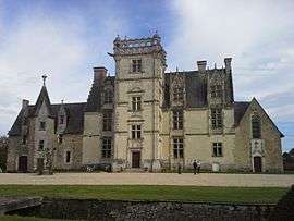 The Château de Saint-Ouen, in Chamazé | |
 Chemazé Location within Pays de la Loire region  Chemazé | |
| Coordinates: 47°47′17″N 0°46′25″W / 47.7881°N 0.7736°WCoordinates: 47°47′17″N 0°46′25″W / 47.7881°N 0.7736°W | |
| Country | France |
| Region | Pays de la Loire |
| Department | Mayenne |
| Arrondissement | Château-Gontier |
| Canton | Azé |
| Government | |
| • Mayor (2001–2008) | André Le Pape |
| Area1 | 38.54 km2 (14.88 sq mi) |
| Population (2006)2 | 1,206 |
| • Density | 31/km2 (81/sq mi) |
| Time zone | UTC+1 (CET) |
| • Summer (DST) | UTC+2 (CEST) |
| INSEE/Postal code | 53066 /53200 |
| Elevation |
38–91 m (125–299 ft) (avg. 87 m or 285 ft) |
|
1 French Land Register data, which excludes lakes, ponds, glaciers > 1 km2 (0.386 sq mi or 247 acres) and river estuaries. 2 Population without double counting: residents of multiple communes (e.g., students and military personnel) only counted once. | |
Chemazé is a commune in the Mayenne department in north-western France.
See also
| Wikimedia Commons has media related to Chemazé. |
This article is issued from
Wikipedia.
The text is licensed under Creative Commons - Attribution - Sharealike.
Additional terms may apply for the media files.