Le Bourgneuf-la-Forêt
| Le Bourgneuf-la-Forêt | |
|---|---|
| Commune | |
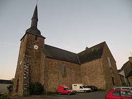 The church in Le Bourgneuf-la-Forêt | |
 Le Bourgneuf-la-Forêt Location within Pays de la Loire region  Le Bourgneuf-la-Forêt | |
| Coordinates: 48°09′55″N 0°58′07″W / 48.1653°N 0.9686°WCoordinates: 48°09′55″N 0°58′07″W / 48.1653°N 0.9686°W | |
| Country | France |
| Region | Pays de la Loire |
| Department | Mayenne |
| Arrondissement | Laval |
| Canton | Loiron |
| Government | |
| • Mayor (2008–2014) | Michel Fortuné |
| Area1 | 28.60 km2 (11.04 sq mi) |
| Population (2009)2 | 1,779 |
| • Density | 62/km2 (160/sq mi) |
| Time zone | UTC+1 (CET) |
| • Summer (DST) | UTC+2 (CEST) |
| INSEE/Postal code | 53039 /53410 |
| Elevation |
110–201 m (361–659 ft) (avg. 158 m or 518 ft) |
|
1 French Land Register data, which excludes lakes, ponds, glaciers > 1 km2 (0.386 sq mi or 247 acres) and river estuaries. 2 Population without double counting: residents of multiple communes (e.g., students and military personnel) only counted once. | |
Le Bourgneuf-la-Forêt is a commune in the Mayenne department in northwestern France.
Population
| Historical population | ||
|---|---|---|
| Year | Pop. | ±% |
| 1962 | 1,474 | — |
| 1968 | 1,435 | −2.6% |
| 1975 | 1,402 | −2.3% |
| 1982 | 1,397 | −0.4% |
| 1990 | 1,466 | +4.9% |
| 1999 | 1,537 | +4.8% |
| 2009 | 1,779 | +15.7% |
See also
References
| Wikimedia Commons has media related to Le Bourgneuf-la-Forêt. |
This article is issued from
Wikipedia.
The text is licensed under Creative Commons - Attribution - Sharealike.
Additional terms may apply for the media files.