Saulges
| Saulges | |
|---|---|
| Commune | |
 The chapel of Saint Cénéré at the edge of the Erve | |
 Saulges Location within Pays de la Loire region  Saulges | |
| Coordinates: 47°59′00″N 0°24′16″W / 47.9833°N 0.4044°WCoordinates: 47°59′00″N 0°24′16″W / 47.9833°N 0.4044°W | |
| Country | France |
| Region | Pays de la Loire |
| Department | Mayenne |
| Arrondissement | Mayenne |
| Canton | Meslay-du-Maine |
| Government | |
| • Mayor (2014–2020) | Jacqueline Lepage |
| Area1 | 21.81 km2 (8.42 sq mi) |
| Population (2006)2 | 341 |
| • Density | 16/km2 (40/sq mi) |
| Time zone | UTC+1 (CET) |
| • Summer (DST) | UTC+2 (CEST) |
| INSEE/Postal code | 53257 /53340 |
| Elevation |
47–112 m (154–367 ft) (avg. 100 m or 330 ft) |
|
1 French Land Register data, which excludes lakes, ponds, glaciers > 1 km2 (0.386 sq mi or 247 acres) and river estuaries. 2 Population without double counting: residents of multiple communes (e.g., students and military personnel) only counted once. | |
Saulges is a commune in the Mayenne department in north-western France.
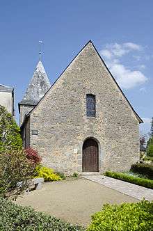
Saint Pierre chapel in Saulges
See also
| Wikimedia Commons has media related to Saulges. |
This article is issued from
Wikipedia.
The text is licensed under Creative Commons - Attribution - Sharealike.
Additional terms may apply for the media files.