Ruillé-le-Gravelais
| Ruillé-le-Gravelais | ||
|---|---|---|
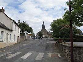 The church in Ruillé-le-Gravelais | ||
| ||
 Ruillé-le-Gravelais Location within Pays de la Loire region  Ruillé-le-Gravelais | ||
| Coordinates: 48°03′24″N 0°57′15″W / 48.0567°N 0.9542°WCoordinates: 48°03′24″N 0°57′15″W / 48.0567°N 0.9542°W | ||
| Country | France | |
| Region | Pays de la Loire | |
| Department | Mayenne | |
| Arrondissement | Laval | |
| Canton | Loiron | |
| Government | ||
| • Mayor (2008–2014) | Hervé Lemoine | |
| Area1 | 16.94 km2 (6.54 sq mi) | |
| Population (2006)2 | 826 | |
| • Density | 49/km2 (130/sq mi) | |
| Time zone | UTC+1 (CET) | |
| • Summer (DST) | UTC+2 (CEST) | |
| INSEE/Postal code | 53194 /53320 | |
| Elevation |
90–191 m (295–627 ft) (avg. 105 m or 344 ft) | |
|
1 French Land Register data, which excludes lakes, ponds, glaciers > 1 km2 (0.386 sq mi or 247 acres) and river estuaries. 2 Population without double counting: residents of multiple communes (e.g., students and military personnel) only counted once. | ||

Ruillé-le-Gravelais is a former commune in the Mayenne department in north-western France. On 1 January 2016, it was merged into the new commune of Loiron-Ruillé.[1]
Geography
The river Oudon flows through the middle of the commune and forms part of its southern border.
See also
| Wikimedia Commons has media related to Ruillé-le-Gravelais. |
References
- ↑ Arrêté préfectoral 18 November 2015
This article is issued from
Wikipedia.
The text is licensed under Creative Commons - Attribution - Sharealike.
Additional terms may apply for the media files.