Brée
| Brée | |
|---|---|
| Commune | |
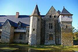 The Château de la Grande Courbe, in Brée | |
 Brée Location within Pays de la Loire region  Brée | |
| Coordinates: 48°09′04″N 0°31′05″W / 48.1511°N 0.5181°WCoordinates: 48°09′04″N 0°31′05″W / 48.1511°N 0.5181°W | |
| Country | France |
| Region | Pays de la Loire |
| Department | Mayenne |
| Arrondissement | Mayenne |
| Canton | Évron |
| Government | |
| • Mayor (2008–2014) | Claude Garnier |
| Area1 | 16.41 km2 (6.34 sq mi) |
| Population (2009)2 | 510 |
| • Density | 31/km2 (80/sq mi) |
| Time zone | UTC+1 (CET) |
| • Summer (DST) | UTC+2 (CEST) |
| INSEE/Postal code | 53043 /53150 |
| Elevation |
72–125 m (236–410 ft) (avg. 80 m or 260 ft) |
|
1 French Land Register data, which excludes lakes, ponds, glaciers > 1 km2 (0.386 sq mi or 247 acres) and river estuaries. 2 Population without double counting: residents of multiple communes (e.g., students and military personnel) only counted once. | |
Brée is a commune in the Mayenne department in northwestern France.
Population
| Historical population | ||
|---|---|---|
| Year | Pop. | ±% |
| 1962 | 498 | — |
| 1968 | 504 | +1.2% |
| 1975 | 515 | +2.2% |
| 1982 | 540 | +4.9% |
| 1990 | 482 | −10.7% |
| 1999 | 459 | −4.8% |
| 2009 | 510 | +11.1% |
See also
References
| Wikimedia Commons has media related to Brée. |
This article is issued from
Wikipedia.
The text is licensed under Creative Commons - Attribution - Sharealike.
Additional terms may apply for the media files.