Couptrain
| Couptrain | ||
|---|---|---|
| Commune | ||
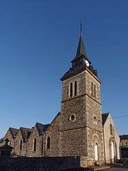 The church of Our Lady of the Assumption, in Couptrain | ||
| ||
 Couptrain Location within Pays de la Loire region  Couptrain | ||
| Coordinates: 48°29′03″N 0°17′32″W / 48.4842°N 0.2922°WCoordinates: 48°29′03″N 0°17′32″W / 48.4842°N 0.2922°W | ||
| Country | France | |
| Region | Pays de la Loire | |
| Department | Mayenne | |
| Arrondissement | Mayenne | |
| Canton | Villaines-la-Juhel | |
| Government | ||
| • Mayor (2008–2014) | Gérard Lecoq | |
| Area1 | 0.71 km2 (0.27 sq mi) | |
| Population (2006)2 | 167 | |
| • Density | 240/km2 (610/sq mi) | |
| Time zone | UTC+1 (CET) | |
| • Summer (DST) | UTC+2 (CEST) | |
| INSEE/Postal code | 53080 /53250 | |
| Elevation |
153–194 m (502–636 ft) (avg. 165 m or 541 ft) | |
|
1 French Land Register data, which excludes lakes, ponds, glaciers > 1 km2 (0.386 sq mi or 247 acres) and river estuaries. 2 Population without double counting: residents of multiple communes (e.g., students and military personnel) only counted once. | ||

Couptrain is a commune in the Mayenne department in north-western France.
See also
| Wikimedia Commons has media related to Couptrain. |
This article is issued from
Wikipedia.
The text is licensed under Creative Commons - Attribution - Sharealike.
Additional terms may apply for the media files.