Fougerolles-du-Plessis
| Fougerolles-du-Plessis | ||
|---|---|---|
| Commune | ||
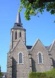 The Church of the Immaculate Conception | ||
| ||
 Fougerolles-du-Plessis Location within Pays de la Loire region  Fougerolles-du-Plessis | ||
| Coordinates: 48°28′29″N 0°58′20″W / 48.4747°N 0.9722°WCoordinates: 48°28′29″N 0°58′20″W / 48.4747°N 0.9722°W | ||
| Country | France | |
| Region | Pays de la Loire | |
| Department | Mayenne | |
| Arrondissement | Mayenne | |
| Canton | Gorron | |
| Government | ||
| • Mayor (2017–2020) | Jean Paul Juin | |
| Area1 | 33.29 km2 (12.85 sq mi) | |
| Population (2006)2 | 1,427 | |
| • Density | 43/km2 (110/sq mi) | |
| Time zone | UTC+1 (CET) | |
| • Summer (DST) | UTC+2 (CEST) | |
| INSEE/Postal code | 530100 /53190 | |
| Elevation |
128–232 m (420–761 ft) (avg. 180 m or 590 ft) | |
|
1 French Land Register data, which excludes lakes, ponds, glaciers > 1 km2 (0.386 sq mi or 247 acres) and river estuaries. 2 Population without double counting: residents of multiple communes (e.g., students and military personnel) only counted once. | ||

Fougerolles-du-Plessis is a commune in the Mayenne department in north-western France.
See also
| Wikimedia Commons has media related to Fougerolles-du-Plessis. |
This article is issued from
Wikipedia.
The text is licensed under Creative Commons - Attribution - Sharealike.
Additional terms may apply for the media files.