Bais, Mayenne
| Bais | ||
|---|---|---|
| Commune | ||
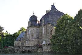 The Château de Montesson, in Bais | ||
| ||
 Bais Location within Pays de la Loire region  Bais | ||
| Coordinates: 48°15′15″N 0°21′51″W / 48.2542°N 0.3642°WCoordinates: 48°15′15″N 0°21′51″W / 48.2542°N 0.3642°W | ||
| Country | France | |
| Region | Pays de la Loire | |
| Department | Mayenne | |
| Arrondissement | Mayenne | |
| Canton | Évron | |
| Government | ||
| • Mayor (2008–2014) | Sylvie Pichot | |
| Area1 | 26.23 km2 (10.13 sq mi) | |
| Population (2009)2 | 1,297 | |
| • Density | 49/km2 (130/sq mi) | |
| Time zone | UTC+1 (CET) | |
| • Summer (DST) | UTC+2 (CEST) | |
| INSEE/Postal code | 53016 /53160 | |
| Elevation |
155–337 m (509–1,106 ft) (avg. 183 m or 600 ft) | |
|
1 French Land Register data, which excludes lakes, ponds, glaciers > 1 km2 (0.386 sq mi or 247 acres) and river estuaries. 2 Population without double counting: residents of multiple communes (e.g., students and military personnel) only counted once. | ||

Bais is a commune in the Mayenne department in northwestern France.
Population
| Historical population | ||
|---|---|---|
| Year | Pop. | ±% |
| 1962 | 1,160 | — |
| 1968 | 1,105 | −4.7% |
| 1975 | 1,251 | +13.2% |
| 1982 | 1,457 | +16.5% |
| 1990 | 1,571 | +7.8% |
| 1999 | 1,487 | −5.3% |
| 2009 | 1,297 | −12.8% |
See also
References
| Wikimedia Commons has media related to Bais (Mayenne). |
This article is issued from
Wikipedia.
The text is licensed under Creative Commons - Attribution - Sharealike.
Additional terms may apply for the media files.