La Veta, Colorado
| Town of La Veta, Colorado Spanish for The Vein (geology) | |
|---|---|
| Statutory Town | |
 Old Ritter Schoolhouse, built 1876 | |
 Location of La Veta in Huerfano County, Colorado. | |
| Coordinates: 37°30′28″N 105°0′29″W / 37.50778°N 105.00806°WCoordinates: 37°30′28″N 105°0′29″W / 37.50778°N 105.00806°W | |
| Country |
|
| State |
|
| County[1] | Huerfano |
| Incorporated (town) | June 16, 1886[2] |
| Government | |
| • Type | Statutory Town[1] |
| • Town Board |
Larry Klinke Dale Davis Laurie Erwin |
| Area[3] | |
| • Total | 1.37 sq mi (3.54 km2) |
| • Land | 1.37 sq mi (3.54 km2) |
| • Water | 0.00 sq mi (0.00 km2) |
| Elevation[4] | 7,037 ft (2,145 m) |
| Population (2010)[5] | |
| • Total | 800 |
| • Estimate (2016)[6] | 777 |
| • Density | 568.40/sq mi (219.54/km2) |
| Time zone | UTC-7 (Mountain (MST)) |
| • Summer (DST) | UTC-6 (MDT) |
| ZIP code[7] | 81055 |
| Area code(s) | 719 |
| FIPS code | 08-44100 |
| GNIS feature ID | 0204782 |
| Website | Town of La Veta Colorado |
The Town of La Veta is a statutory town in Huerfano County, Colorado, United States. The town population was 800 as of the 2010 United States Census.[5]
History
Col. John M. Francisco, the sutler at Fort Garland, and his business partner, Henry Daigre, purchased 48,000 acres of land in Cuchara Valley in 1862. The land was part of the Vigil land grant. They established a settlement for farmers and ranchers, with Francisco Fort as the commercial center.[8] The 100-foot-square building was constructed with 2-foot thick adobe walls, interior rooms, that opened up to a central plaza. It was built with a flat roof with gun ports along the parapets. In 1863, the fort was attacked by a bank of Ute people. Men got on the roof to defend the fort, and a volunteer rode to Fort Lyon. The Utes retreated, though, before the troops arrived.[8]
In 1871, the settlement was named Spanish Peak and a post office was established. New settlers came to the area with the arrival of the Denver & Rio Grande Railroad. The narrow gauge railroad, which crossed La Veta Pass, was the highest U.S. railroad pass at the time. A depot was built one block north of the fort and the town was platted by the railroad in 1876. The fort is now operated by the Huerfano Historical Society.[8] A post office called La Veta has been in operation since 1876.[9] The community was named for a mineral deposit near the original town site, La Veta meaning "mineral vein" in Spanish.[10]
Geography
La Veta is located at 37°30′28″N 105°0′29″W / 37.50778°N 105.00806°W (37.507681, -105.008038).[11]
According to the United States Census Bureau, the town has a total area of 1.37 square miles (3.5 km2), all of it land. At one time (1919) there were sulphur springs in La Veta owned by Dr. Acker. They were last managed by W J Pierce of Colorado Springs (see http://www.kmitch.com/Huerfano/news1915.html)
Demographics
| Historical population | |||
|---|---|---|---|
| Census | Pop. | %± | |
| 1880 | 165 | — | |
| 1890 | 361 | 118.8% | |
| 1900 | 254 | −29.6% | |
| 1910 | 691 | 172.0% | |
| 1920 | 737 | 6.7% | |
| 1930 | 782 | 6.1% | |
| 1940 | 897 | 14.7% | |
| 1950 | 701 | −21.9% | |
| 1960 | 632 | −9.8% | |
| 1970 | 589 | −6.8% | |
| 1980 | 611 | 3.7% | |
| 1990 | 726 | 18.8% | |
| 2000 | 924 | 27.3% | |
| 2010 | 800 | −13.4% | |
| Est. 2016 | 777 | [6] | −2.9% |
| U.S. Decennial Census[12] | |||
As of the 2010 United States Census, there were 800 people, 415 households, and 222 families residing in the town. The population density was 583.9 people per square mile (225.4/km²). There were 566 housing units at an average density of 413.1 per square mile (161.7/km²). The racial makeup of the town was 91.1% White, 0.9% American Indian, 0.4% Pacific Islander, 2.6% from other races, and 5.0% from two or more races. Hispanics and Latinos of any race were 11.4% of the population.[5]
There were 415 households of which 20.2% had children under the age of 18 living with them, 43.1% were married couples living together, 6.7% had a female householder with no husband present, 3.6% had a male householder with no wife present, and 46.5% were non-families. 42.7% of all households were made up of individuals, and 15.2% had someone living alone who was 65 years of age or older. The average household size was 1.93, and the average family size was 2.60.[5]
The median age in the town was 52.8 years. 18.9% of residents were under the age of 18; 2.9% were between the ages of 18 and 24; 16.4% were from 25 to 44; 39.2% were from 45 to 64; and 22.6% were 65 years of age or older. The gender makeup of the town was 46.8% male and 53.2% female.[5]
The median income for a household was $37,457, and the median income for a family was $66,964. Males had a median income of $50,577 versus $26,250 for females. The per capita income for the city was $26,066. About 12.0% of families and 10.9% of the population were below the poverty line, including 19.3% of those under age 18 and none of those age 65 or over.[5]
Education
There is one school in the town of La Veta, La Veta RE2. It has a total of 229 students. La Veta has the highest CSAP scores in Huerfano county. The school sports teams are the La Veta Redskins, which for the last few years have been going to state tournaments in almost every sport.
Climate
| Climate data for La Veta, Colorado (Elevation 7,037ft) | |||||||||||||
|---|---|---|---|---|---|---|---|---|---|---|---|---|---|
| Month | Jan | Feb | Mar | Apr | May | Jun | Jul | Aug | Sep | Oct | Nov | Dec | Year |
| Record high °F (°C) | 70 (21) |
62 (17) |
74 (23) |
79 (26) |
85 (29) |
90 (32) |
97 (36) |
94 (34) |
85 (29) |
82 (28) |
75 (24) |
65 (18) |
97 (36) |
| Average high °F (°C) | 46.9 (8.3) |
47.9 (8.8) |
48.5 (9.2) |
57.2 (14) |
67.6 (19.8) |
76.7 (24.8) |
83.7 (28.7) |
81.1 (27.3) |
72.9 (22.7) |
66.3 (19.1) |
57.3 (14.1) |
44.0 (6.7) |
62.5 (16.9) |
| Average low °F (°C) | 16.5 (−8.6) |
12.7 (−10.7) |
17.3 (−8.2) |
31.3 (−0.4) |
37.5 (3.1) |
43.8 (6.6) |
53.8 (12.1) |
50.6 (10.3) |
41.2 (5.1) |
31.9 (−0.1) |
24.6 (−4.1) |
13.3 (−10.4) |
31.2 (−0.4) |
| Record low °F (°C) | −25 (−32) |
−10 (−23) |
−17 (−27) |
12 (−11) |
17 (−8) |
32 (0) |
42 (6) |
32 (0) |
20 (−7) |
5 (−15) |
−5 (−21) |
−17 (−27) |
−25 (−32) |
| Average precipitation inches (mm) | 0.40 (10.2) |
1.00 (25.4) |
1.42 (36.1) |
1.47 (37.3) |
1.63 (41.4) |
1.49 (37.8) |
3.14 (79.8) |
2.50 (63.5) |
1.95 (49.5) |
0.68 (17.3) |
0.40 (10.2) |
0.84 (21.3) |
16.94 (430.3) |
| Average snowfall inches (cm) | 9.3 (23.6) |
20.9 (53.1) |
24.0 (61) |
13.9 (35.3) |
1.0 (2.5) |
0 (0) |
0 (0) |
0 (0) |
1.0 (2.5) |
7.9 (20.1) |
5.9 (15) |
16.4 (41.7) |
100.3 (254.8) |
| Source: The Western Regional Climate Center[13] | |||||||||||||
Notable person
- Bob McGraw (1895-1978), baseball pitcher[14]
Gallery
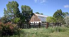 Goss Homestead barn, near La Veta. The Goss family settled in Huerfano County in the late 19th century.
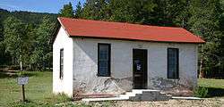 The original stone D&RG Depot was built in 1877 as part of the Denver and Rio Grande Railroad narrow-gauge railroad erected on what is today called Old La Veta Pass and "Uptop Ghost Town"
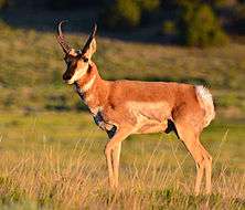 Pronghorn near La Veta, 2014
See also
References
- 1 2 "Active Colorado Municipalities". State of Colorado, Department of Local Affairs. Archived from the original on 2010-11-23. Retrieved 2007-09-01.
- ↑ "Colorado Municipal Incorporations". State of Colorado, Department of Personnel & Administration, Colorado State Archives. 2004-12-01. Retrieved 2007-09-02.
- ↑ "2016 U.S. Gazetteer Files". United States Census Bureau. Retrieved Jul 25, 2017.
- ↑ "US Board on Geographic Names". United States Geological Survey. 2007-10-25. Retrieved 2008-01-31.
- 1 2 3 4 5 6 "American FactFinder 2". United States Census Bureau. Retrieved 2012-10-24.
- 1 2 "Population and Housing Unit Estimates". Retrieved June 9, 2017.
- ↑ "ZIP Code Lookup". United States Postal Service. Archived from the original (JavaScript/HTML) on November 23, 2010. Retrieved October 23, 2007.
- 1 2 3 Jessen, Kenneth (September 28, 2014). "Francisco Fort became the center of La Veta". Reporter-Herald. Loveland, Colorado. Retrieved 2018-06-11.
- ↑ "Post offices". Jim Forte Postal History. Retrieved 29 June 2016.
- ↑ Dawson, John Frank. Place names in Colorado: why 700 communities were so named, 150 of Spanish or Indian origin. Denver, CO: The J. Frank Dawson Publishing Co. p. 31.
- ↑ "US Gazetteer files: 2010, 2000, and 1990". United States Census Bureau. 2011-02-12. Retrieved 2011-04-23.
- ↑ "Census of Population and Housing". Census.gov. Retrieved June 4, 2015.
- ↑ "Seasonal Temperature and Precipitation Information". Western Regional Climate Center. Retrieved April 14, 2013.
- ↑ "Bob McGraw". Pro-Football-Reference.com. Retrieved 2016-06-17.
- Christofferson, Nancy C.; Huerfano World Newspaper; Walsenburg, CO.; 1991
- Christofferson, Nancy C.; Coal Was King: Huerfano County's Mining History; 2000; USA
- Denver Daily Tribune; 1877
- Lathrop/Law Property; Current owners of "Uptop" Old La Veta Pass
- Orton, Agnes Bombard and other Southern Colorado Auxiliary of the Territorial Daughters of Colorado; Pioneers of the Territory of Southern Colorado; Volume 2; Monte Vista, Colorado; 1980
External links
| Wikimedia Commons has media related to La Veta, Colorado. |
Municipalities and communities of Huerfano County, Colorado, United States | ||
|---|---|---|
| City |  | |
| Town | ||
| Unincorporated communities | ||
| Ghost towns | ||
