Farisita, Colorado
| Farisita, Colorado | |
|---|---|
| Town | |
 Farisita  Farisita | |
| Coordinates: 37°44′41.03″N 105°4′16.99″W / 37.7447306°N 105.0713861°WCoordinates: 37°44′41.03″N 105°4′16.99″W / 37.7447306°N 105.0713861°W | |
| Country |
|
| State |
|
| Counties | Huerfano |
| Time zone | UTC-7 (MST) |
| • Summer (DST) | UTC-6 (MDT) |
| ZIP code | 81040 |
| Area code(s) | 719 |
Farista is a town in Huerfano County, Colorado, United States.[1]
History
Fort Talpa
Fort Talpa, a Spanish adobe post, was built in the 1820s as a means of protection from possible attacks by Native Americans.[2] In 1941, it was still standing next to the town of Farista's general store.[3]
Settlement
A settlement was established called Talpa.[3] A post office called Farisita was established in 1923, and remained in operation until 1990.[3][4] An early postmaster named the town for his daughter, Jeanette "Farisita" Farris.[5] The town had a morada, or meeting house, for the religious group Los Hermanos Penitentes. It was located across the river and among the trees.[3]
See also
![]()
References
- ↑ U.S. Geological Survey Geographic Names Information System: Farisita, Colorado
- ↑ Jolie Anderson Gallagher (April 2, 2013). Colorado Forts: Historic Outposts on the Wild Frontier. Arcadia Publishing Incorporated. p. PT8. ISBN 978-1-61423-903-1.
- 1 2 3 4 Best Books (1941). Colorado, a Guide to the Highest State,. Best Books. p. 350. ISBN 978-1-62376-006-9.
- ↑ "Post offices". Jim Forte Postal History. Archived from the original on 6 March 2016. Retrieved 25 June 2016.
- ↑ Dawson, John Frank. Place names in Colorado: why 700 communities were so named, 150 of Spanish or Indian origin. Denver, CO: The J. Frank Dawson Publishing Co. p. 21.
External links
![]()
Municipalities and communities of Huerfano County, Colorado, United States | ||
|---|---|---|
| City | 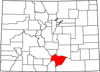 | |
| Town | ||
| Unincorporated communities | ||
| Ghost towns | ||
This article is issued from
Wikipedia.
The text is licensed under Creative Commons - Attribution - Sharealike.
Additional terms may apply for the media files.