Kanpur Nagar district
| Kanpur Nagar district | |
|---|---|
| District of Uttar Pradesh | |
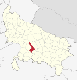 Location of Kanpur Nagar district in Uttar Pradesh | |
| Country | India |
| State | Uttar Pradesh |
| Administrative division | Kanpur |
| Headquarters | Kanpur |
| Tehsils | Kanpur Sadar, Bilhaur, Ghatampur |
| Government | |
| • Lok Sabha constituencies | Kanpur |
| • Assembly seats |
Sishamau Arya Nagar Kidwai Nagar Govind Nagar Kanpur Cantonment Bithoor Kalyanpur Maharajpur Ghatampur Akbarpur-Rania |
| Population (2011) | |
| • Total | 4,581,268[1] |
| Demographics | |
| • Literacy | 70.78% |
| Major highways | NH 2 |
| Website | Official website |
Kanpur district (Kanpur Nagar district) is one of the districts of the Uttar Pradesh state of India. It is a part of Kanpur division and its district headquarters is Kanpur.
Notable Poets
- Kavi Bhushan an Indian poet in the courts of the Bundeli king Chhatrasal and the Maratha king Shivaji. Bhushan resided in the Tikwapur village in Ghatampur tehsil of Kanpur district, Uttar Pradesh.
Cities and towns in Kanpur district: A Araul Armapur Estate B Bhimsen, Kanpur Bhitargaon Bidhnu Bilhaur Binaur Birhana Road, Kanpur Bithoor C Chakeri Choubepur Kalan G Gajner, Kanpur Gangupur Ghatampur Govind Nagar J Jajmau K Kalyanpur, Uttar Pradesh Kanpur Cantonment Karbigwan Kidwai Nagar L Latouche Road, Kanpur M Maharajpur, Kanpur Makanpur The Mall, Kanpur McRobertganj Meston Road, Kanpur N New Kanpur City Northern Railway Colony P Padri Lalpur Patara, Kanpur R Rawatpur S Sarh, Kanpur Sarsaul Shivrajpur T Tilsahri V VIP Road, Kanpur
Demographics
According to the 2011 census Kanpur district has a population of 6,377,452,[1] roughly equal to the nation of Costa Rica[2] or the US state of Louisiana.[3] This gives it a ranking of 32nd in India (out of a total of 640).[1] The district has a population density of 1,449 inhabitants per square kilometre (3,750/sq mi) .[1] Its population growth rate over the decade 2001-2011 was 9.72%.[1] Kanpur Nagar has a sex ratio of 852 females for every 1000 males,[1] and a literacy rate of 81.31%.[1]
| Rank | Metropolitan Area | Area (km sq.) | 2011/2001 (Provisional figures) | Coverage |
|---|---|---|---|---|
| 1 | Kanpur | 450 | 2,920,067 | Includes Kanpur Cantonment and Chakeri |
| 2 | Kanpur Cantonment | 50 | 108,035 | |
| 3 | Armapur Estate | 20 | 20,797 | |
| 4 | Northern Railway Colony | 15 | 29,708 | |
| 5 | Ghatampur | 12 | 35,496 | |
| 6 | Bilhaur | 10 | 18,056 | |
| 7 | Chakeri | 5 | 9,868 | |
| 8 | Bithoor | 5 | 9,647 | |
| 9 | Choubepur Kalan | 5 | 8,352 | |
| 10 | Shivrajpur | 3 | 7548 |
References
- 1 2 3 4 5 6 7 "District Census 2011". Census2011.co.in. 2011. Retrieved 2011-09-30.
- ↑ US Directorate of Intelligence. "Country Comparison:Population". Retrieved 2011-10-01.
Costa Rica 4,576,562 July 2011 est
- ↑ "2010 Resident Population Data". U. S. Census Bureau. Archived from the original on 23 August 2011. Retrieved 2011-09-30.
Louisiana 4,533,372
External links
| Wikimedia Commons has media related to Kanpur Nagar district. |
Places adjacent to Kanpur Nagar district | |
|---|---|
Coordinates: 26°27′36″N 80°19′48″E / 26.46000°N 80.33000°E