Green Mountain Falls, Colorado
| Green Mountain Falls, Colorado | |
|---|---|
| Statutory Town | |
 Old land office in the park | |
| Motto(s): “A Very Special Place” | |
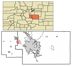 Location of Green Mountain Falls in El Paso County and Teller County, Colorado. | |
| Coordinates: 38°56′5″N 105°1′4″W / 38.93472°N 105.01778°WCoordinates: 38°56′5″N 105°1′4″W / 38.93472°N 105.01778°W | |
| Country |
|
| State |
|
| Counties[1] |
El Paso County Teller County |
| Incorporated (town) | August 19, 1880[2] |
| Government | |
| • Type | Statutory Town[1] |
| Area[3] | |
| • Total | 1.07 sq mi (2.77 km2) |
| • Land | 1.07 sq mi (2.76 km2) |
| • Water | 0.00 sq mi (0.00 km2) |
| Elevation | 7,800 ft (2,364 m) |
| Population (2010) | |
| • Total | 640 |
| • Estimate (2016)[4] | 667 |
| • Density | 625.12/sq mi (241.30/km2) |
| Time zone | UTC-7 (MST) |
| • Summer (DST) | UTC-6 (MDT) |
| ZIP code[5] | 80819 (PO Box) |
| Area code(s) | 719 |
| FIPS code | 08-32650 |
| GNIS feature ID | 0191196 |
| Website | City Website |
Green Mountain Falls is a statutory town in El Paso and Teller counties in the U.S. state of Colorado. The population was 640 at the 2010 census.[6] On April 5, 2016, Jane Newberry was elected mayor. She ran as a slate of candidates calling themselves Smoother Road Ahead for GMF. The group also included board of trustees candidates David Pearlman, Cameron Thorne and Erin Kowal. The police force resigned in the days following an April 14, 2016 closed-door meeting of the outgoing town board and mayor.[7][8][9][10]
In 1968, officials in Green Mountain Falls conducted a resurvey of the 1890 legal description of the town's corporate limits and found "that the town hall, the magistrate's office, the post office, the community center, the civic swimming pool, and nearly half of the residents are located outside city limits"[11] and were forced to redraw the legal boundaries.[12]
Geography
Green Mountain Falls is located at 38°56′5″N 105°1′4″W / 38.93472°N 105.01778°W (38.934621, -105.017645).[13] According to the United States Census Bureau, the town has a total area of 1.1 square miles (3.0 km²), all of it land.
Demographics
| Historical population | |||
|---|---|---|---|
| Census | Pop. | %± | |
| 1900 | 40 | — | |
| 1910 | 30 | −25.0% | |
| 1920 | 100 | 233.3% | |
| 1930 | 41 | −59.0% | |
| 1940 | 87 | 112.2% | |
| 1950 | 106 | 21.8% | |
| 1960 | 179 | 68.9% | |
| 1970 | 359 | 100.6% | |
| 1980 | 607 | 69.1% | |
| 1990 | 663 | 9.2% | |
| 2000 | 773 | 16.6% | |
| 2010 | 640 | −17.2% | |
| Est. 2016 | 667 | [4] | 4.2% |
| U.S. Decennial Census[14] | |||
As of the census[15] of 2000, there were 773 people, 372 households, and 203 families residing in the town. The population density was 677.9 people per square mile (261.8/km²). There were 600 housing units at an average density of 526.2 per square mile (203.2/km²). The racial makeup of the town was 94.18% White, 0.13% African American, 1.55% Native American, 0.39% Asian, 0.13% Pacific Islander, 1.68% from other races, and 1.94% from two or more races. Hispanic or Latino of any race were 5.56% of the population.
There were 372 households out of which 23.1% had children under the age of 18 living with them, 43.5% were married couples living together, 7.0% had a female householder with no husband present, and 45.4% were non-families. 36.0% of all households were made up of individuals and 7.3% had someone living alone who was 65 years of age or older. The average household size was 2.08 and the average family size was 2.74.
In the town, the population was spread out with 19.1% under the age of 18, 5.7% from 18 to 24, 33.2% from 25 to 44, 34.0% from 45 to 64, and 7.9% who were 65 years of age or older. The median age was 41 years. For every 100 females, there were 104.0 males. For every 100 females age 18 and over, there were 92.9 males.
The median income for a household in the town was $43,816, and the median income for a family was $55,268. Males had a median income of $34,000 versus $26,354 for females. The per capita income for the town was $24,892. About 4.3% of families and 7.6% of the population were below the poverty line, including 10.1% of those under age 18 and 7.8% of those age 65 or over.
See also
References
- 1 2 "Active Colorado Municipalities". State of Colorado, Department of Local Affairs. Archived from the original on 2010-11-23. Retrieved 2007-09-01.
- ↑ "Colorado Municipal Incorporations". State of Colorado, Department of Personnel & Administration, Colorado State Archives. 2004-12-01. Retrieved 2007-09-02.
- ↑ "2016 U.S. Gazetteer Files". United States Census Bureau. Retrieved Jul 25, 2017.
- 1 2 "Population and Housing Unit Estimates". Retrieved June 9, 2017.
- ↑ "ZIP Code Lookup". United States Postal Service. Archived from the original (JavaScript/HTML) on November 23, 2010. Retrieved September 26, 2007.
- ↑ "Profile of General Population and Housing Characteristics: 2010 Demographic Profile Data (DP-1): Green Mountain Falls town, Colorado". U.S. Census Bureau, American Factfinder. Archived from the original on September 11, 2013. Retrieved April 11, 2012.
- ↑ http://www.coloradoindependent.com/158997/green-mountain-falls-police
- ↑ http://gazette.com/green-mountain-falls-has-new-but-familiar-mayor/article/1573557
- ↑ http://gazette.com/entire-green-mountain-falls-police-force-quits-ahead-of-new-mayors-swearing-in/article/1574577
- ↑ http://edition.cnn.com/2016/04/24/us/colorado-police-department-resigns/
- ↑ "News Briefs— National", Chicago Tribune, March 9, 1968, p3
- ↑ "1890 Mistake Changes Town", The Post-Crescent (Appleton WI), March 8, 1968, p2
- ↑ "US Gazetteer files: 2010, 2000, and 1990". United States Census Bureau. 2011-02-12. Retrieved 2011-04-23.
- ↑ "Census of Population and Housing". Census.gov. Archived from the original on May 12, 2015. Retrieved June 4, 2015.
- ↑ "American FactFinder". United States Census Bureau. Archived from the original on 2013-09-11. Retrieved 2008-01-31.
External links
Municipalities and communities of El Paso County, Colorado, United States | ||
|---|---|---|
| Cities | 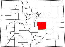 | |
| Towns | ||
| CDPs | ||
| Unincorporated communities | ||
| Former populated places | ||
| Footnotes | ‡This populated place also has portions in an adjacent county or counties | |
Municipalities and communities of Teller County, Colorado, United States | ||
|---|---|---|
| Cities | 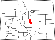 | |
| Town | ||
| CDPs | ||
| Unincorporated community | ||
| Ghost towns | ||
| Footnotes | ‡This populated place also has portions in an adjacent county or counties | |
