Yoder, Colorado
| Yoder, Colorado | |
|---|---|
| Unincorporated community | |
 Yoder, looking west. | |
 Yoder Location within the state of Colorado | |
| Coordinates: 38°50′22″N 104°13′20″W / 38.83944°N 104.22222°WCoordinates: 38°50′22″N 104°13′20″W / 38.83944°N 104.22222°W | |
| Country | United States |
| State | Colorado |
| County | El Paso County[1] |
| Elevation[2] | 6,145 ft (1,873 m) |
| Time zone | UTC-7 (MST) |
| • Summer (DST) | UTC-6 (MDT) |
| ZIP code | 80864[3] |
| Area code(s) | 719 |
| GNIS feature ID | 0193568 |
Yoder is an unincorporated community and a U.S. Post Office located in El Paso County, Colorado, United States. The Yoder Post Office has the ZIP Code 80864.[3]
A post office called Yoder has been in operation since 1904.[4] Ira M. Yoder, an early postmaster, gave the community his name.[5]
Students are served by the Edison Junior-Senior High School of the Edison School District 54JT, as well as by the Miami-Yoder School District 60JT.
References
- ↑ "US Board on Geographic Names". United States Geological Survey. October 25, 2007. Retrieved January 31, 2008.
- ↑ "Geographic Names Information System Feature Detail Report". USGS. Retrieved August 15, 2007.
- 1 2 "ZIP Code Lookup". United States Postal Service. January 3, 2007. Archived from the original (JavaScript/HTML) on November 23, 2010. Retrieved January 3, 2007.
- ↑ "Post offices". Jim Forte Postal History. Retrieved July 11, 2016.
- ↑ Dawson, John Fran k. Place names in Colorado: why 700 communities were so named, 150 of Spanish or Indian origin. Denver, Colorado: The J. Frank Dawson Publishing Co. p. 52.
Municipalities and communities of El Paso County, Colorado, United States | ||
|---|---|---|
| Cities | 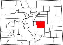 | |
| Towns | ||
| CDPs | ||
| Unincorporated communities | ||
| Former populated places | ||
| Footnotes | ‡This populated place also has portions in an adjacent county or counties | |
This article is issued from
Wikipedia.
The text is licensed under Creative Commons - Attribution - Sharealike.
Additional terms may apply for the media files.