Gang Khurd
| Gaag Khurd | |
|---|---|
| Village | |
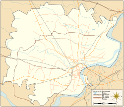 Gaag Khurd Village location on Varanasi district map  Gaag Khurd Gaag Khurd (Uttar Pradesh)  Gaag Khurd Gaag Khurd (India) | |
| Coordinates: 25°25′42″N 82°48′15″E / 25.428244°N 82.804135°ECoordinates: 25°25′42″N 82°48′15″E / 25.428244°N 82.804135°E | |
| Country |
|
| State | Uttar Pradesh |
| District | Varanasi district |
| Tehsil | Pindra |
| Elevation | 82.888 m (271.942 ft) |
| Population (2011) | |
| • Total | 517 |
| Languages | |
| • Official | Hindi |
| Time zone | UTC+5:30 (IST) |
| Postal code | 221206 |
| Telephone code | +91-542 |
| Vehicle registration | UP65 XXXX |
| Village code | 208495 |
| Lok Sabha constituency | Varanasi |
| Vidhan Sabha constituency | Pindra |
Gaag Khurd is a village in Pindra Tehsil of Varanasi district in the Indian state of Uttar Pradesh. Only one shia Muslim Village between Varanasi and Jaunpur District. The village comes under Gangkala gram panchayat. The village is about 27 kilometers North-West of Varanasi city, 266 kilometers South-East of state capital Lucknow and 791 kilometers South-East of the national capital Delhi.[1][2][3][4][5][6]
Demography
Gang Khurd has a total population of 517 people amongst 48 families. Sex ratio of Gaag Khurd is 1,093 and child sex ratio is 1,132. Uttar Pradesh state average for both ratios is 912 and 902 respectively [note].[5]
| Details | Male | Female | Total | Comments |
|---|---|---|---|---|
| Number of houses | - | - | 48 | (census 2011) [5] |
| Adult | 209 | 227 | 436 | |
| Children (0–6 years) | 38 | 43 | 81 | |
| Total population | 247 | 270 | 517 | |
| Literacy | 84.69% | 68.72% | 76.38% | |
Transportation
Gang Khurd can be accessed by road and does not have a railway station of its own. Closest railway station to this village is Babatpur Railway Station (14 kilometres North-East). Nearest operational airports are Varanasi airport (9 kilometres North-East) and Allahabad Airports (130 kilometres West).[7][8]
See also
Notes
- ^ All demographic data is based on 2011 Census of India.
References
- ↑ "Village coordinates". latlong.net. Retrieved 25 July 2015.
- ↑ "Elevation". daftlogic.com. Retrieved 25 July 2015.
- ↑ "Delimitation of Parliamentary and Assembly Constituencies Order, 2008" (PDF). Election Commission of India official website. Retrieved 25 July 2015.
- ↑ "Village code & Tehsil". Local Government directory. Retrieved 25 July 2015.
- 1 2 3 "Demography". 2011 census. Retrieved 25 July 2015.
- ↑ "Village info". Wiki Edit. Retrieved 25 July 2015.
- ↑ "Rail information". indiarailinfo.com. Retrieved 25 July 2015.
- ↑ "Location". Google Maps. Retrieved 25 July 2015.
Villages in Varanasi district | ||
|---|---|---|
| Pindra Tehsil |
| |
| Varanasi Tehsil | ||
India : Uttar Pradesh : Varanasi | ||