Tropic of Capricorn
Coordinates: 23°26′14″S 0°0′0″W / 23.43722°S -0.00000°E
.jpg)
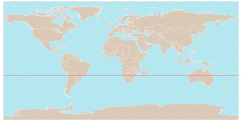
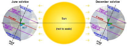
The Tropic of Capricorn (or the Southern Tropic) is the circle of latitude that contains the subsolar point on the December (or southern) solstice. It is thus the southernmost latitude where the Sun can be directly overhead. Its northern equivalent is the Tropic of Cancer.
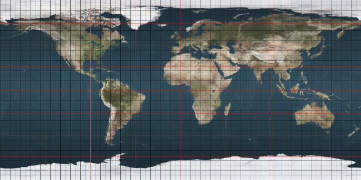
The Tropic of Capricorn is one of the five major circles of latitude that mark maps of Earth. As of 23 October 2018, its latitude is 23°26′12.6″ (or 23.43685°)[1] south of the Equator, but it is very gradually moving northward, currently at the rate of 0.47 arcseconds, or 15 metres, per year.
Name
When this line of latitude was named in the last centuries BC, the Sun was in the constellation Capricornus (Latin for goat horn) at the December solstice, the time each year that the Sun reaches its zenith at this latitude. Due to the precession of the equinoxes, this is no longer the case; today the Sun is in Sagittarius at the December solstice. The word "tropic" itself comes from the Greek "trope (τροπή)", meaning to turn or change direction, referring to the fact that the Sun appears to "turn back" at the solstices.
Geography and environment
The Tropic of Capricorn is the dividing line between the Southern Temperate Zone to the south and the tropics to the north. The Northern Hemisphere equivalent of the Tropic of Capricorn is the Tropic of Cancer.
The Tropic of Capricorn's position is not fixed, but constantly changes because of a slight wobble in the Earth's longitudinal alignment relative to its orbit around the Sun. Earth's axial tilt varies over a 41,000 year period from 22.1 to 24.5 degrees and currently resides at about 23.4 degrees. This wobble means that the Tropic of Capricorn is currently drifting northward at a rate of almost half an arcsecond (0.468″) of latitude, or 15 metres, per year (it was at exactly 23° 27′S in 1917 and will be at 23° 26'S in 2045). See under circles of latitude for information.
There are approximately 13 hours, 35 minutes of daylight during the summer solstice. During the winter solstice, there are 10 hours, 41 minutes of daylight.
In Australia, areas on the Tropic have some of the most variable rainfall in the world[2] and thus even the wetter areas cannot be generally farmed, since irrigation sources invariably dry up in drought years. In southern Africa, where rainfall is more reliable, farming is possible, though yields are low even with fertilisers.
In South America, whilst in the continental cratons soils are almost as old as in Australia and Southern Africa, the presence of the geologically young and evolving Andes means that this region is on the western side of the subtropical anticyclones and thus receives warm and humid air from the Atlantic Ocean. As a result, areas in Brazil adjacent to the Tropic are extremely important agricultural regions, producing large quantities of crops such as sugarcane, and the natural rainforest vegetation has been almost entirely cleared, except for a few remaining patches of Atlantic Forest. Further south in Argentina, the temperate grasslands of the Pampas region is one of the most productive agricultural regions in the world, producing of wheat, soybeans, maize, and beef, making the country one of the largest worldwide agricultural exporters, similar to the role played by the Prairies region in Canada.
West of the Andes, however, the Humboldt Current makes conditions extremely arid, creating the Atacama Desert, one of the driest in the world, so that no glaciers exist between Volcán Sajama at 18˚30'S and Cerro Tres Cruces at 27˚S.[3] Vegetation here is almost non-existent, though on the eastern slopes of the Andes rainfall is adequate for rainfed agriculture.
Further south in the region of Patagonia, shared between Argentina and Chile, climate becomes colder, with heavy snowfall in the winter months and throughout the year. On the Western portion of Patagonia, climate is more humid, and dominated by fjords, coniferous forests and lakes owing to the presence of thawing currents from the permafrost in the peaks of the Andes mountains which divide the region. This makes the region a popular destination for ski and winter sports, particularly on the Argentine city of Bariloche and surrounding area. On the Eastern portion of Patagonia climate is generally cold and dry steppe, with high mesas and strong wind conditions.
The southern tip of the island of Tierra del Fuego and other islands of the South Atlantic have Sub-Antarctic climate conditions.
Around the world
Starting at the Prime Meridian and heading eastwards, the Tropic of Capricorn passes through 10 countries:
Places located along the Tropic of Capricorn
The following cities and landmarks are either located near the Tropic of Capricorn, or the tropic passes through them.
|
|
|
 Atsimo-Andrefana Region, Madagascar
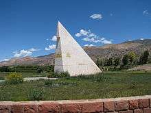
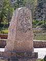 The Tropic of Capricorn marked in Jujuy Province in northern Argentina
 Monument marking the Tropic of Capricorn as it passes through Botswana
.jpg) A sign marking the Tropic of Capricorn as it passes through Namibia
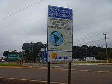
A sign marking the Tropic of Capricorn as it passes through Namibia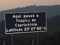 Roadway plaque marking the Tropic of Capricorn in the city of Santana do Parnaíba, Brazil, at the correct latitude for year 1917.
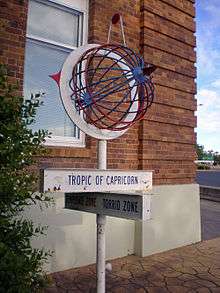
 Roadside monument marking Tropic of Capricorn in Rockhampton, Queensland, Australia, 28 January 2005
 Monument marking Tropic of Capricorn in Rockhampton, Queensland, Australia, 1970
 Road sign marking Tropic of Capricorn in Western Australia, Australia, 26 August 2008
 Monument marking the Tropic of Capricorn just north of Alice Springs, Northern Territory, Australia
List of countries entirely south of the Tropic of Capricorn
As the major portion of earth's land is located in the Northern Hemisphere there are only four countries entirely south of the Tropic of Capricorn (there are 74 countries entirely north of the Tropic of Cancer):
Length
Length of the Tropic on 11 June 2015, at 23°26′14″S is 36,788 kilometres (22,859 mi).[4]
Note
- ↑ The Cook islands, Tokelau and Niue, which are part of the Realm of New Zealand lie above the Tropic of Capricorn.
References
External links
| Wikimedia Commons has media related to Tropic of Capricorn. |
| Look up tropic of capricorn in Wiktionary, the free dictionary. |
- Temporal Epoch Calculations
- Useful constants" See: Obliquity of the ecliptic
- Montana State University: Milankovitch Cycles & Glaciation
See also
 |