| Rank | Country | Easternmost point | Longitude |
|---|
| 1 |  Russia Russia | Big Diomede Island, Chukotka Autonomous Okrug
Cape Dezhnev (mainland) | 169°01'W
169°40'W |
| 2 | 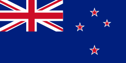 New Zealand New Zealand | Chatham Islands
East Cape (North Island) | 175°45' W
178°54' E |
| 3 | 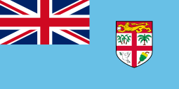 Fiji Fiji | Vatoa island | 178°15' W |
| 4 | 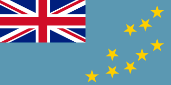 Tuvalu Tuvalu | Nukulaelae island | 179°51'E |
| 5 | 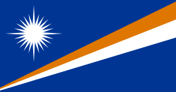 Marshall Islands Marshall Islands | Knox Atoll | 172°09'E |
| 6 |  Vanuatu Vanuatu | Futuna Island, Tafea Province | 170°13'E |
| 7 |  Solomon Islands Solomon Islands | Fatutaka island, Temotu Province | 170°10'E |
| 8 |  Australia Australia | Norfolk Island
Cape Byron, (mainland) | 167°57' E
153°38'E |
| 9 |  Nauru Nauru | East coast of Nauru island | 166°57'E |
| 10 |  Federated States of Micronesia Federated States of Micronesia | Eastern point of Kosrae island (Kosrae state) | 163°01'E |
| 11 |  Papua New Guinea Papua New Guinea | Nukumanu Islands, North Solomons
Milne Bay (mainland) | 159°24'E
150°52'E |
| 12 |  Japan Japan | Minami Torishima, Ogasawara, Tokyo
Nosappu, Hokkaido (Four main islands) | 153°59'11"E
145°49'E |
| 13 |  Indonesia Indonesia | Merauke | 141°05'E |
| 14 |  China China | Close to Haiqing, Heilongjiang | 134°46'25"E |
| 15 |  Palau Palau | Kayangel atoll | 134°42'E |
| 16 |  South Korea South Korea | The easternmost of Liancourt Rocks (disputed with Japan)
Jukdo (undisputed)
East point of Seokbyung-ri (mainland) | 131°52'E
130°56'E
129°35'E |
| 17 |  North Korea North Korea | Border with Russia at the Sea of Japan coast | 130°40'E |
| 18 |  East Timor East Timor | Island of Jaco, Lautém District | 127°19'30"E |
| 19 |  Philippines Philippines | Pusan Point, Caraga, Davao Oriental | 126°34'E |
| 20 |  Taiwan Taiwan | Mien-hwa Islet, Keelung City | 122°06'25"E |
| 21 |  Mongolia Mongolia | Border with the People's Republic of China, Dornod Province | 119°56'E |
| 22 |  Malaysia Malaysia | Eastern cape of Borneo, Sabah state | 119°10'E |
| 23 |  Brunei Brunei | Border with Malaysia near mount Bukit Pagon | 115°25'E |
| 24 |  Vietnam Vietnam | Hon Gom peninsula, Khánh Hòa Province | 109°30'E |
| 25 |  Cambodia Cambodia | Ratanakiri Province, border with Vietnam | 107°35'E |
| 26 |  Laos Laos | Border with Vietnam, Sekong Province | 106°40'E |
| 27 |  Thailand Thailand | Border with Laos, Ubon Ratchathani Province | 105°40'E |
| 28 |  Singapore Singapore | Pedra Branca | 104°24'E |
| 29 |  Myanmar Myanmar | Shan State, border with Laos and China | 101°10'E |
| 30 |  India India | Kibithu, Arunachal Pradesh | 97°20'E |
| 31 |  Bangladesh Bangladesh | Chittagong Division, border with Burma | 92°35'E |
| 32 |  Bhutan Bhutan | Border with India | 92°05'E |
| 33 |  Nepal Nepal | Border with India, Mechi Zone | 88°15'E |
| 34 |  Kazakhstan Kazakhstan | Border with Russia and China, East Kazakhstan Province | 87°30'E |
| 35 |  Sri Lanka Sri Lanka | Eastern coast of Sri Lanka, Eastern Province | 81°40'E |
| 36 |  Kyrgyzstan Kyrgyzstan | Border with China, Issyk Kul Province | 80°20'E |
| 37 |  Pakistan Pakistan | Border with China and India, Northern Areas | 77°30'E |
| 38 |  Tajikistan Tajikistan | Border with China, Gorno-Badakhshan Autonomous Province | 75°05'E |
| 39 |  Afghanistan Afghanistan | Badakhshan, border with Tajikistan and China | 75°00'E |
| 40 |  Maldives Maldives | Felidhu Atoll, administrative division of Vaavu Atoll | 73°31'E |
| 41 |  Uzbekistan Uzbekistan | Border with Kyrgyzstan, Andijan Province | 73°20'E |
| 42 |  United Kingdom United Kingdom | British Indian Ocean Territory, Diego Garcia island
Lowestoft Ness, Suffolk (mainland) | 72°30'E
1°46'E |
| 43 |  Turkmenistan Turkmenistan | Border with Uzbekistan, Lebap Province | 66°40'E |
| 44 |  Mauritius Mauritius | Rodrigues island | 63°30'E |
| 45 |  Iran Iran | East of Kuhak, Sistan va Baluchestan Region | 63°18'03"E |
| 46 |  Oman Oman | Eastern cape of Arabian Peninsula, Ash Sharqiyah Region | 59°50'E |
| 47 |  United Arab Emirates United Arab Emirates | Border with Oman on the shore of Gulf of Oman, Fujairah emirate | 56°24'E |
| 48 |  Seychelles Seychelles | Coëtivy Island | 56°16'E |
| 49 |  France France | Sainte-Rose, Réunion
San-Giuliano, Haute-Corse (metropolitan France)
Lauterbourg (mainland) | 55°50'E
9°33′E
8°13′E |
| 50 |  Saudi Arabia Saudi Arabia | Border with Oman, Eastern Province | 55°30'E |
| 51 |  Yemen Yemen | Cape Ra's Momi Socotra island, 'Adan Governorate
border with Oman (mainland) | 54°30'E
53°10'E |
| 52 |  Qatar Qatar | Cape to the east of Umm Sa'id, Mesaieed municipality | 51°39'E |
| 53 |  Somalia Somalia | Cape Hafun, Puntland | 51°27'52"E |
| 54 |  Bahrain Bahrain | Muharraq Island | 50°43'E |
| 55 |  Madagascar Madagascar | Cape Masoala on Indian Ocean coast, Antsiranana Province | 50°40'E |
| 56 |  Azerbaijan Azerbaijan | Jiloy, Baku | 50°33'E |
| 57 |  Kuwait Kuwait | Qaruh Island, off Al Ahmadi Governorate coast | 48°40'E |
| 58 |  Iraq Iraq | Al-Faw Peninsula | 48°32'E |
| 59 |  Ethiopia Ethiopia | Border with Somalia, Somali Region | 48°00'E |
| 60 |  Georgia Georgia | Kakheti, border with Azerbaijan | 46°40'E |
| 61 |  Armenia Armenia | Syunik' | 46°37' E |
| 62 |  Turkey Turkey | The point that Turkey, Azerbaijan and Iran touches Iğdır Province | 44°49'4"E |
| 63 |  Comoros Comoros | Domoni, Anjouan island | 44°32'E |
| 64 |  Djibouti Djibouti | Coast to the northeast of Obock, Obock Region | 43°25'E |
| 65 |  Eritrea Eritrea | Border with Djibouti, Southern Red Sea Region | 43°7'E |
| 66 |  Syria Syria | Border with Iraq, Al-Hasakah Governorate | 42°25'E |
| 67 |  Kenya Kenya | Border with Ethiopia and Somalia, North Eastern Province | 41°00'E |
| 68 |  Mozambique Mozambique | Indian Ocean coast east of Nacala, Nampula Province | 40°45'E |
| 69 |  Tanzania Tanzania | Border with Mozambique at Atlantic coast, Mtwara Region | 40°29'E |
| 70 |  Ukraine Ukraine | Border with Russia, Luhansk Oblast | 40°15'E |
| 71 |  Jordan Jordan | Border with Iraq and Saudi Arabia, Mafraq Governorate | 39°20'E |
| 72 |  Sudan Sudan | Border with Eritrea on the shore of Red Sea, Red Sea state | 38°35'E |
| 73 |  South Africa South Africa | Prince Edward Island, Prince Edward Islands
Monte Ouro (mainland) | 38°00'E
32°53'E |
| 74 |  Lebanon Lebanon | Border with Syria, Baalbek District | 36°38'E |
| 75 |  Malawi Malawi | Border with Mozambique, Machinga District | 35°55'E |
| 76 |  Egypt Egypt | Cape Banas to the northeast of Berenice, Red Sea Governorate | 35°45'E |
| 77 |  South Sudan South Sudan | Trippoint (South Sudan, Ethiopia, Kenya) | 35°48'E |
| 78 |  Israel Israel | Border with disputed region of Golan Heights | 35°40'E |
| 79 |  Uganda Uganda | Border with Kenya, Nakapiripirit District | 35°02'E |
| 80 |  Cyprus Cyprus | Klidhes Islands | 34°36'E |
| 81 |  Norway Norway | Kræmerpynten on Kvitøya, Svalbard
Kibergsneset (mainland) | 33°30'59" E
31°01'E |
| 82 |  Zimbabwe Zimbabwe | Border with Mozambique, Manicaland | 33°00'E |
| 83 |  Zambia Zambia | Border with Malawi, Northern Province, Zambia | 32°50'E |
| 84 |  Belarus Belarus | Mogilev oblast | 32°46'E |
| 85 |  Swaziland Swaziland | Border with Mozambique and South Africa, Lubombo District | 32°08'E |
| 86 |  Finland Finland | Virmajärvi, Ilomantsi | 31°35'17" E |
| 87 |  Democratic Republic of the Congo Democratic Republic of the Congo | Border with Uganda at Lake Albert | 31°30'E |
| 88 |  Rwanda Rwanda | Border with Tanzania, Eastern Province | 30°53'E |
| 89 |  Burundi Burundi | Cankuzo Province, border with Tanzania | 30°50'E |
| 90 |  Moldova Moldova | Palanca, Ştefan Vodă, border with Ukraine | 30°10'E |
| 91 |  Romania Romania | Sulina, a town in Tulcea County, on the Danube Delta | 29°40'E |
| 92 |  Greece Greece | Strongyli
Pythio (mainland) | 29°38'E
26°38'E |
| 93 |  Lesotho Lesotho | Border with South Africa east of Mokhotlong, Mokhotlong District | 29°28'E |
| 94 |  Botswana Botswana | Border with Zimbabwe and South Africa at Limpopo river | 29°20'E |
| 95 |  Bulgaria Bulgaria | Cape Shabla, Dobrich Province | 28°36'E |
| 96 |  Latvia Latvia | Border with Russia, Ludza District | 28°15'E |
| 97 |  Estonia Estonia | Narva, Ida-Viru County | 28°12'36"E |
| 98 |  Central African Republic Central African Republic | Haut-Mbomou, border with Sudan and Democratic Republic of the Congo | 27°28'E |
| 99 |  Lithuania Lithuania | Border with Belarus, Ignalina district municipality | 26°50'E |
| 100 |  Namibia Namibia | Border with Zambia and Zimbabwe, Caprivi Region | 25°15'E |
| 101 |  Libya Libya | Border with Egypt on Mediterranean coast, Al Butnan | 25°05'E |
| 102 |  Sweden Sweden | Border with Finland in Kataja, Haparanda, Norrbotten County (in the province of Norrbotten)
Border with Finland in Haparanda (mainland) | 24°10'0"E
24°15'E |
| 103 |  Poland Poland | Bug river, near Zosin, Hrubieszów County | 24°09'E |
| 104 |  Angola Angola | unnamed location on a river section of the border with Zambia (north of the town Sapeta in Zambia), Moxico Province | 24°00'E |
| 105 |  Chad Chad | Border with Sudan | 24°00'E |
| 106 |  Serbia Serbia | Senokos | 23°01'E |
| 107 |  Macedonia Macedonia | Border with Bulgaria, Eastern Statistical Region | 23°00'E |
| 108 |  Hungary Hungary | Border with Romania and Ukraine, Szabolcs-Szatmár-Bereg County | 22°55'E |
| 109 |  Slovakia Slovakia | Border with Poland and Ukraine, Prešov Region | 22°30'E |
| 110 |  Albania Albania | Devoll District | 21°4'6"E |
| 111 |  Montenegro Montenegro | Jablanica, Rožaje municipality | 20°21'E |
| 112 |  Bosnia and Herzegovina Bosnia and Herzegovina | Republika Srpska, border with Serbia | 19°30'E |
| 113 |  Croatia Croatia | Radevac, a part of Ilok (administratively part of the city of Ilok, Vukovar-Srijem county) | 19°27'E |
| 114 |  Czech Republic Czech Republic | Bukovec, Moravian–Silesian Region | 18°51'32"E |
| 115 |  Republic of the Congo Republic of the Congo | Border with Democratic Republic of the Congo at Oubangi River | 18°40'E |
| 116 |  Italy Italy | Capo d'Otranto, Apulia | 18°31'E |
| 117 |  Austria Austria | The corner of a field near Deutsch Jahrndorf, Burgenland | 17°9'38"E |
| 118 |  Slovenia Slovenia | Municipality of Lendava – Benica | 16°36'E |
| 119 |  Cameroon Cameroon | East Province, border with Central African Republic and Republic of the Congo | 16°12'E |
| 120 |  Niger Niger | Border with Chad, Agadez Region | 16°00'E |
| 121 |  Denmark Denmark | Østerskær, Christiansø | 15°11'E |
| 122 |  Germany Germany | Deschka, Saxony | 15°2'E |
| 123 |  Malta Malta | Xrobb il-Ghagin, Malta | 14°34'11"E |
| 124 |  Gabon Gabon | Border with Republic of the Congo, Haut-Ogooué Province | 14°30'E |
| 125 |  Nigeria Nigeria | Border with Cameroon, Borno State | 13°15'E |
| 126 |  San Marino San Marino | Faetano | 12°31'00"E |
| 127 |  Vatican City Vatican City | Easternmost edge of Saint Peter's Square | 12°27'30.01"E |
| 128 |  Algeria Algeria | Tripoint with Libya and Niger, Illizi Province | 12°00'E |
| 129 |  Tunisia Tunisia | Border with Libya, Medenine Governorate | 11°35'E |
| 130 |  Equatorial Guinea Equatorial Guinea | Border with Gabon | 11°20'E |
| 131 |  Switzerland Switzerland | Piz Chavalatsch, Müstair, Grisons | 10°29'31"E |
| 132 |  Liechtenstein Liechtenstein | Border post 28, above Nenzinger Himmel | 9°33'26"E |
| 133 |  Monaco Monaco | Near the Monte-Carlo Sporting Club d'Ete | 7°26'23"E |
| 134 |  São Tomé and Príncipe São Tomé and Príncipe | Eastern Príncipe Island east of Santo António, São Tomé and Príncipe | 7°26'E |
| 135 |  Netherlands Netherlands | Nieuweschans | 7°13'40"E |
| 136 |  Luxembourg Luxembourg | on Sauer River near Rosport | 6°32'E |
| 137 | .svg.png) Belgium Belgium | Krewinkel, municipality of Büllingen, Liège | 6°22'E |
| 138 |  Spain Spain | La Mola Island, Mahón, Menorca
Cap de Creus (mainland) | 4°19'E
3°19'E |
| 139 |  Mali Mali | Border with Niger, Kidal and Gao regions | 4°00'E |
| 140 |  Benin Benin | Border with Nigeria | 3°50'E |
| 141 |  Burkina Faso Burkina Faso | Est Region, border with Niger and Benin in the Atakora River | 2°25'E |
| 142 |  Andorra Andorra | La Palomera, Canillo | 1°47'10" E |
| 143 |  Togo Togo | Border with Benin at Atlantic coast, Maritime Region | 1°46'E |
| 144 |  Ghana Ghana | Border with Togo, Volta Region | 1°10'E |
| 145 |  Morocco Morocco | Border with Algeria, Oriental Region | 1°10'W |
| 146 |  Côte d'Ivoire Côte d'Ivoire | Border with Ghana | 2°35'W |
| 147 |  Mauritania Mauritania | Border with Algeria and Mali, Tiris Zemmour Region | 4°45'W |
| 148 |  Ireland Ireland | Wicklow Head, County Wicklow | 5°59'W |
| 149 |  Portugal Portugal | Freguesia of Paradela, municipality of Miranda do Douro, Bragança District | 6°11'W |
| — |  Faroe Islands Faroe Islands | Fugloy | 6°16'W |
| 150 |  Liberia Liberia | Border with Côte d'Ivoire, River Gee County | 7°22'W |
| 151 | 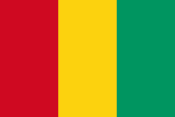 Guinea Guinea | Border with Côte d'Ivoire, Nzérékoré Region | 7°45'W |
| 152 | 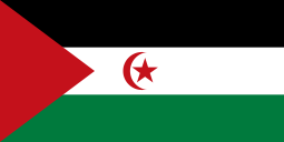 Western Sahara Western Sahara | Border with Morocco, Algeria and Mauritania | 8°40'W |
| 153 | 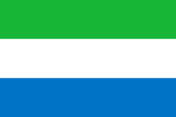 Sierra Leone Sierra Leone | Border with Guinea and Liberia, Eastern Province | 10°17'W |
| 154 | 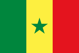 Senegal Senegal | Border with Mali, Tambacounda Region | 11°22'W |
| 155 |  Greenland Greenland | Nordostrundingen | 12°08' W |
| 156 |  Iceland Iceland | Hvalbakur, Suður-Múlasýsla | 13°14'W |
| 157 |  Guinea-Bissau Guinea-Bissau | Border with Guinea, Gabú Region | 13°40'W |
| 158 |  Gambia Gambia | Border with Senegal, Upper River Division | 13°48'W |
| 159 |  Cape Verde Cape Verde | Ponta Meringuel on Boa Vista island | 22°40'W |
| 160 |  Brazil Brazil | Ilha do Sul, Ilhas Martin Vaz, Espírito Santo
Ponta do Seixas (mainland) | 28°50'26"W
34°47'W |
| 161 |  Canada Canada | Cape Spear, Newfoundland and Labrador
Cape St. Charles (mainland) | 52°37' W
55°37' W |
| 162 |  Uruguay Uruguay | Border with Brazil at Lagoa Mirim, Cerro Largo Department | 53°5'W |
| 163 |  Argentina Argentina | Bernardo de Irigoyen, Misiones Province | 53°41'00"W |
| 164 |  Suriname Suriname | Border with French Guiana, Sipaliwini District | 54°00'W |
| 165 |  Paraguay Paraguay | Border with Brazil, Canindeyú Department | 54°15'W |
| 166 |  Guyana Guyana | Border with Suriname and Brazil, East Berbice-Corentyne | 56°30'W |
| 167 |  Bolivia Bolivia | Border with Brazil | 57°30'W |
| 168 |  Barbados Barbados | Near Kitridge Point, Saint Philip | 59°26'W |
| 169 |  Venezuela Venezuela | Border with Guyana near Caribbean Sea coast, Delta Amacuro State | 59°45'W |
| 170 |  Trinidad and Tobago Trinidad and Tobago | Easternmost cape of Tobago, near Charlotteville | 60°31'W |
| 171 |  Saint Vincent and the Grenadines Saint Vincent and the Grenadines | Bettowia island, Grenadines Parish | 61°08'W |
| 172 |  Saint Lucia Saint Lucia | Eastern coast, Laborie Quarter | 60°54'W |
| 173 |  Dominica Dominica | Cape in the southeast of Saint David Parish | 61°15'W |
| 174 |  Grenada Grenada | Petite Martinique island, Saint Patrick Parish | 61°23'W |
| 175 |  Antigua and Barbuda Antigua and Barbuda | A rock east of Antigua | 61°40'W |
| 176 |  Saint Kitts and Nevis Saint Kitts and Nevis | Eastern cape of Nevis, Saint James Windward Parish | 62°31'W |
| 177 |  United States United States | Point Udall, Saint Croix, US Virgin Islands
West Quoddy Head (50 States) | 64°34'W
66°56'W |
| 178 |  Chile Chile | Nueva Island in Magallanes and Antártica Chilena Region
Nevados de Poquis (mainland) | 66°24'55"W
66°58'W |
| 179 |  Colombia Colombia | Border with Brazil and Venezuela | 67°00'W |
| 180 |  Dominican Republic Dominican Republic | Punta de Agua, La Altagracia Province | 68°20'W |
| 181 |  Peru Peru | Mouth of the Heath River in the Tambopata District, Tambopata Province, Madre de Dios Region | 68°39'27"W |
| 182 |  Haiti Haiti | Border with Dominican Republic, Centre department | 71°38'W |
| 183 |  Bahamas Bahamas | Mayaguana island | 72°45'W |
| 184 |  Cuba Cuba | Punta Maisi near Maisi, Guantánamo Province | 74°08'W |
| 185 |  Ecuador Ecuador | Orellana Province, border with Peru | 75°15'W |
| 186 |  Jamaica Jamaica | Morant Point, Saint Thomas Parish | 76°12'W |
| 187 |  Panama Panama | Border with Colombia, Darién Province | 77°09'W |
| 188 |  Costa Rica Costa Rica | Border with Panama, Limón Province | 82°30'W |
| 189 |  Nicaragua Nicaragua | Miskito Cays archipelago, North Caribbean Coast Autonomous Region | 82°46'W |
| 190 |  Honduras Honduras | Border with Nicaragua on Atlantic coast, Gracias a Dios Department | 83°35'W |
| 191 |  Mexico Mexico | Southeast tip of Isla Mujeres, Quintana Roo | 86°42'36" W |
| 192 |  Belize Belize | Lighthouse Reef | 87°35'W |
| 193 |  El Salvador El Salvador | Island of Meanguera del Golfo, La Unión Department | 87°42'W |
| 194 |  Guatemala Guatemala | Border with Honduras, Izabal Department | 88°15'W |
| 195 |  Kiribati Kiribati | Caroline Island | 150°13'W |
| 196 |  Samoa Samoa | Fanuatapu island, Aiga-i-le-Tai district | 171°20'W |
| 197 |  Tonga Tonga | Tafahi, Tongatapu administrative area | 173°43'W |