James Shoal
| Disputed island Other names: Beting Serupai Zēngmǔ Ànshā (曾母暗沙) | |
|---|---|
| Geography | |
 | |
| Location | South China Sea |
| Coordinates | 03°58′26″N 112°20′56″E / 3.97389°N 112.34889°ECoordinates: 03°58′26″N 112°20′56″E / 3.97389°N 112.34889°E |
| Administered by | |
| Malaysia | |
| State | Sarawak |
| Claimed by | |
| People's Republic of China | |
| Prefecture-level city Province |
Sansha[1] Hainan |
| Republic of China (Taiwan) | |
| Municipality | Kaohsiung |
_(cropped).jpg)
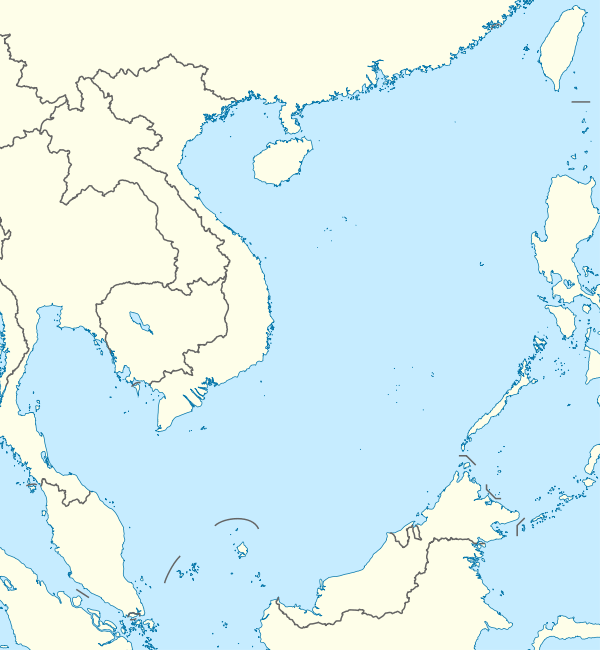
James Shoal, also called Beting Serupai in Malaysia and Zengmu Reef (Chinese: 曾母暗沙; pinyin: Zēngmǔ Ànshā) in Greater China, is a small bank in the South China Sea, with a depth of 22 metres (72 ft),[2] located about 45 nautical miles (83 km; 52 mi) off the Borneo coast of Malaysia. It is claimed by Malaysia, the People's Republic of China, and the Republic of China (Taiwan). The shoal and its surrounds are administered by Malaysia.
History
James Shoal, along with its two nearby features, Parsons’ Shoal (Betting Tugau, 八仙暗沙, 9.35 km due south) and Lydie Shoal (Betting Mukah, 27.94 km west-southwest), were recognised by British surveyors in the early 19th Century via many of its surveys. James Shoal first appeared on the British Admiralty Chart in the 1870s. In 1933 a government committee of the Republic of China gave Chinese names to many features in the South China Sea. These were mainly translations or transliterations of the names on the British charts.[3] The name 'James' was transliterated as Zeng Mu (the letters 'J' and 'M'). 'Shoal' was translated as 'Tan' - meaning sandbank. It appears the Chinese committee thought, wrongly that James Shoal was an island. In 1947 the RoC changed the name to 'Ansha' - meaning 'reef'[4]
Location
Lying about 45 nautical miles (83 km; 52 mi) northwest of Bintulu, Malaysia on the Continental shelf of Borneo, the shoal is 80 kilometres (50 mi) from the Malaysian coast and about 1,800 kilometres (1,100 mi) from the Chinese mainland. Geographically, it sits south of the Spratly Islands, but is sometimes grouped with them as part of international disputes over sovereignty in the South China Sea.
The shoal is embedded in the continental shelf of Malaysia and well within its 200 nautical mile EEZ.[5]
Nearby shoals are Parsons' Shoal and Lydie Shoal,[6] and the Luconia Shoals, the latter 97 to 223 km to the north.
Territorial dispute
Malaysia's claim
Malaysia's claim on the shoal is based on the continental shelf principle, on the basis that Malaysia is the only country whose continental shelf covers James Shoal. International law defines continental shelf as a natural extension of a country’s landmass to a distance of 200 nautical miles (maximum 350 nautical miles). Drawn from the mainland or any of its islands in the South China Sea, the continental shelf of China is well short of James Shoal. Similarly, James Shoal is also not part of the extended continental shelf of Vietnam, the Philippines or Taiwan.[6]
In May 2009, Vietnam and Malaysia put up a Joint submission on the Extended Continental Shelf to the UN Committee on the Limit of Continental Shelf (CLCS) whereby Vietnam acknowledged that James Shoal is not part of its extended continental shelf.[5][6]
James Shoal is 500 nautical miles (930 km; 580 mi) from Thitu Island (Pagasa) in the Spratlys that the Philippines has occupied since 1971, and more than 400 nautical miles (740 km; 460 mi) from Itu Aba, an island that Taiwan has occupied since 1956. It is also outside Brunei's extended maritime zone which the 2009 Letter of Exchange that Brunei has with Malaysia attests to. In 1969, Malaysia and Indonesia signed a Treaty on the continental shelf, off Tanjung Datu, Sarawak, which has placed James Shoal on the Malaysian side.[6]
Malaysian jurisdiction
Malaysia has also effectively asserted its jurisdiction over its continental shelf including the areas in and around James Shoal, Parson's Shoal and the Lydie Shoal. The activities of the Malaysian authorities include the construction and maintenance of a light-buoy on nearby Parson's Shoal on a 24/7 basis, daily patrolling and policing of the area by the Royal Malaysian Navy and the Malaysian Maritime Enforcement Agency and undertaking economic activities like exploration for and production of hydrocarbon resources on a sustained basis.[6]
Under international law, such display of peaceful and continuous activities over a long period is tantamount to establishing a titre de souverain (acts of the sovereign).[6]
China's claim
The shoal is claimed to be the southernmost territory of China by the People's Republic of China and Taiwan. China transliterated the British name as Zeng Mu Tan in 1933, and renamed it Zeng Mu Ansha in 1947. The People's Liberation Army Navy visited the shoal in May 1981, again in 1994, and on 26 March 2013.[7][8] China Marine Surveillance ships visited the shoal and placed a sovereignty stele in the maritime area of the shoal to mark it as Chinese territory on 26 March 1990, again in January 1992, on 15 January 1995, on 20 April 2010 and in 2012.[9][10]
On 29 January 2014, Chinese state news agency Xinhua reported that three Chinese warships (one amphibious landing craft and two destroyers) returned to James Shoal to conduct military drills and perform an oath swearing ceremony.[11] The Royal Malaysian Navy chief Tan Sri Abdul Aziz Jaafar denied the report, saying that the Chinese exercise took place hundreds of miles to the north in international waters.[12]
Chinese students are taught and tested in schools that James Shoal is the southernmost point of Chinese territory, and that territory within the Nine-dash line has always belonged to China, without any reference to the disputes over the islands and surrounding waters by neighbouring countries.[13]
Oil and gas reserves
Active exploration and development of oil and gas fields by Malaysia has been taking place around the James Shoal since 2014, with several production facilities erected in the surrounding area. Malaysia has also been undertaking exploration for and production of hydrocarbon resources on a sustained basis in the area, effectively asserting jurisdiction over the area.[6][14]
See also
References
- ↑ Announcement by the PRC Ministry of Civil Affairs regarding State Council's establishment of Sansha City (民政部关于国务院批准设立地级三沙市的公告-中华人民共和国民政部) (in Chinese)
- ↑ "Sector 11 - Borneo Northwest Coast" (PDF). Sailing Directions pub. 163. US NGA.
- ↑ Bill Hayton, The South China Sea: the struggle for power in Asia, Chapter 2
- ↑ Bill Hayton (9 February 2013). "How a non-existent island became China's southernmost territory". South China Morning Post.
- 1 2 "Joint Submission to United Nations Commission on the Limits of the Continental Shelf (CLCS)" (PDF). United Nations. 20 May 2009. Retrieved 15 March 2015.
- 1 2 3 4 5 6 7 "China's James Shoal Claim: Malaysia the Undisputed Owner". RSIS (Rajaratnam School of International Studies), Nanyang Technology University, Singapore. 1 July 2014.
- ↑ "Chinese navy exercises 'surprise' neighbours". Al Jazeera English. 27 March 2013. Retrieved 13 September 2013.
- ↑ "The Beting Serupai incident". New Straits Times. 16 April 2013. Retrieved 13 September 2013.
- ↑ 南沙主权碑的故事 (The Story of sovereignty steles in Nansha Islands).2015-02-25. 《中国海洋报》.作者:罗茜.
- ↑ 我在曾母暗沙投下祖国界碑 (I dropped a boundary tablet in Zeng Mu Ansha). 赵林如.《今日国土》. 2011年第一期.
- ↑ "Loss of James Shoal could wipe out state's EEZ". The Borneo Post. 5 February 2014. Retrieved 17 May 2014.
- ↑ "Chinese ships patrol area contested by Malaysia". reuters.com. Thomson Reuters. 26 January 2014. Retrieved 8 February 2014.
- ↑ Zheping Huang; Echo Huang (13 July 2016). "China's citizens are livid at the South China Sea ruling because they've always been taught it is theirs". Quartz.
- ↑ "IndoPacificReview". Archived from the original on 24 September 2015. Retrieved 15 March 2015.
| Pratas Islands | |||||||||||||||||
|---|---|---|---|---|---|---|---|---|---|---|---|---|---|---|---|---|---|
| Paracel Islands |
| ||||||||||||||||
| NorthEast SCS | |||||||||||||||||
| Spratly Islands |
| ||||||||||||||||
| Southern SCS | |||||||||||||||||
| Tudjuh Archipelago | |||||||||||||||||
| History | |||||||||||||||||
| Transport |
| ||||||||||||||||
| |||||||||||||||||
| Rivers | |
|---|---|
| Mountains | |
| Caves | |
| Islands |
|