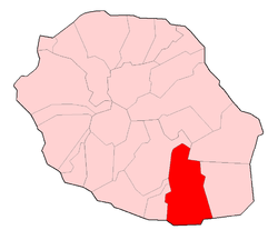
Saint-Joseph, Réunion
| Saint-Joseph | |
|---|---|
| Commune | |
 Manapany in Saint-Joseph | |
 | |
| Coordinates: 21°22′43″S 55°37′09″E / 21.3786°S 55.6192°ECoordinates: 21°22′43″S 55°37′09″E / 21.3786°S 55.6192°E | |
| Country | France |
| Overseas region and department | Réunion |
| Arrondissement | Saint-Pierre |
| Canton | Saint-Joseph and Saint-Pierre-3 |
| Intercommunality | Communes du Sud |
| Government | |
| • Mayor (2014-2020) | Patrick Lebreton |
| Area1 | 178.50 km2 (68.92 sq mi) |
| Population (2012)2 | 37,069 |
| • Density | 210/km2 (540/sq mi) |
| INSEE/Postal code | 97412 /97480 |
| Elevation |
0–2,448 m (0–8,031 ft) (avg. 46 m or 151 ft) |
|
1 French Land Register data, which excludes lakes, ponds, glaciers > 1 km2 (0.386 sq mi or 247 acres) and river estuaries. 2 Population without double counting: residents of multiple communes (e.g., students and military personnel) only counted once. | |

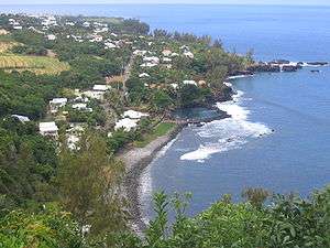
Scenery in Saint-Joseph
Saint-Joseph is a commune in the French overseas department of Réunion. It is located on the extreme south end of the island of Réunion. As such, it features the southernmost point of the European Union.
Villages
See also
References
External links
| Wikimedia Commons has media related to Saint-Joseph, Réunion. |
- Official website (in French)
This article is issued from
Wikipedia.
The text is licensed under Creative Commons - Attribution - Sharealike.
Additional terms may apply for the media files.