| Rank | Country | Westernmost point | Longitude |
|---|
| 1 |  United States United States | Orote Point, Guam
Peaked Island Alaska (westernmost point in the 50 states)
Cape Alava (contiguous states) | 144°37'5.5"E
172°26'E
124°43'W |
| 2 |  Kiribati Kiribati | Banaba Island | 169°32'13"E |
| 3 |  Tonga Tonga | Niuafo'ou, Tongatapu administrative area | 175°38'W |
| 4 |  Samoa Samoa | Cape to the southwest of Falealupo, Gaga'ifomauga district | 172°48'W |
| 5 |  Canada Canada | Yukon–Alaska border | 141°00'W |
| 6 |  Mexico Mexico | Roca Elefante at Guadalupe Island, in the Pacific Ocean
Near Tijuana (mainland) | 118°22'00"W
117°02'W |
| 7 |  Chile Chile | Motu Nui, off Easter Island
Taitao Peninsula (mainland) | 109°27'10"W
75°38'W |
| 8 |  Guatemala Guatemala | Border with Mexico on Pacific coast, San Marcos Department | 92°15'W |
| 9 |  Ecuador Ecuador | Galápagos Islands, Fernandina Island
Cabo Pasado (mainland) | 92°01'W
80°05'W |
| 10 |  El Salvador El Salvador | Border with Guatemala, Ahuachapán Department | 90°15'W |
| 11 |  Belize Belize | Border with Guatemala, at Sarstoon River | 89°12'W |
| 12 |  Honduras Honduras | Border with El Salvador and Guatemala, Ocotepeque Department | 88°43'W |
| 13 |  Nicaragua Nicaragua | Pacific coast at Gulf of Fonseca, Chinandega Department | 87°40'W |
| 14 |  Costa Rica Costa Rica | Cocos Island
Santa Elena Peninsula (mainland) | 87°05'W
85°50'W |
| 15 |  Cuba Cuba | Cape San Antonio on Guanahacabibes Peninsula, Pinar del Río Province | 84°58'W |
| 16 |  Panama Panama | Border with Costa Rica, Chiriquí Province | 83°04'W |
| 17 |  Colombia Colombia | West of San Andrés island
Nariño Department (mainland) | 81°44'W
79°00'W |
| 18 |  Peru Peru | Punta Pariñas in the La Brea District, Talara Province, Piura Region | 81°19'35"W |
| 19 |  Bahamas Bahamas | Alice Town, Bimini | 79°15'W |
| 20 |  Jamaica Jamaica | South Negril Point, Westmoreland Parish | 78°22'W |
| 21 |  Haiti Haiti | Cape near Anse-d'Hainault, Grand'Anse | 74°28'W |
| 22 |  Brazil Brazil | Serra do Divisor, Acre | 73°59'04"W |
| 23 |  Argentina Argentina | Cerro Agasiz, Santa Cruz Province | 73°30'00"W |
| 24 |  Venezuela Venezuela | Border with Colombia, Zulia State | 73°20'W |
| 25 |  Denmark Denmark | Carey Islands, Greenland
Mainland: Blåvandshuk (Ribe County) | 73°14'W
8°05'E |
| 26 |  Greenland Greenland | Carey Islands | 73°14'W |
| 27 |  Dominican Republic Dominican Republic | Las Lajas, border with Haiti, Independencia Province | 72°00'W |
| 28 |  Netherlands Netherlands | Aruba
Netherlands (Europe): Sint Anna ter Muiden | 70°01'W
3°21'E |
| 29 |  Bolivia Bolivia | Border with Peru | 69°40'W |
| 30 |  Saint Kitts and Nevis Saint Kitts and Nevis | Western cape of Saint Kitts, Saint Anne Sandy Point Parish | 62°51'W |
| 31 |  Paraguay Paraguay | Border with Bolivia and Argentina, Boquerón department | 62°35'W |
| 32 |  Trinidad and Tobago Trinidad and Tobago | Westernmost cape of Trinidad, near Fullaron | 61°56'W |
| 33 |  Antigua and Barbuda Antigua and Barbuda | Antigua | 61°55'W |
| 34 |  France France | La Pointe-Noire, Guadeloupe
Isle of Ushant (Metropolitan France)
Mainland: Pointe de Corsen | 61°48'W
5°08'W
4°47'W |
| 35 |  Grenada Grenada | Point Salines, Saint George Parish, Grenada island | 61°48'W |
| 36 |  Dominica Dominica | Cape in the southwest of Saint John Parish | 61°30'W |
| 37 |  Saint Vincent and the Grenadines Saint Vincent and the Grenadines | Union Island, Grenadines Parish | 61°26'W |
| 38 |  Guyana Guyana | Mount Venamo, border with Venezuela, Cuyuni-Mazaruni | 61°25'W |
| 39 |  Saint Lucia Saint Lucia | Western coast, Soufrière, Saint Lucia | 61°04'W |
| 40 |  Barbados Barbados | Harrison's Point, Saint Lucy | 59°40'W |
| 41 |  Uruguay Uruguay | Border with Argentina on Uruguay River, Soriano Department | 58°25'W |
| 42 |  Suriname Suriname | Border with Guyana, Sipaliwini District | 58°05'W |
| 43 |  Portugal Portugal | Monchique Islet, freguesia of Fajã Grande, municipality of Lajes das Flores (Azores)
Cabo da Roca (mainland) |
31°16'8"W
9°50'W |
| 44 |  Cape Verde Cape Verde | Cape near Tarrafal do Monte Trigo, Santo Antão Island | 25°25'W |
| 45 |  Iceland Iceland | Bjargtangar, Vestur-Barðastrandarsýsla | 24°32'W |
| 46 |  Spain Spain | Punta de la Orchilla, El Hierro, Canary Islands
Cape Touriñán (mainland) | 18°09'W
9°18'W |
| 47 |  Senegal Senegal | Dakar city, Dakar Region | 17°27'W |
| 48 |  Mauritania Mauritania | Ras Nouadhibou peninsula, Dakhlet Nouadhibou Region | 17°03'W |
| 49 |  Western Sahara Western Sahara | Nouadhibou | 17°03'W |
| 50 |  Gambia Gambia | Atlantic coast, West Coast Division | 16°45'W |
| 51 |  Guinea-Bissau Guinea-Bissau | Cape Roxo, border with Senegal on Atlantic coast, Cacheu Region | 16°42'W |
| 52 |  Guinea Guinea | Border with Guinea-Bissau on Atlantic coast, Boké Region | 15°03'W |
| 53 |  United Kingdom United Kingdom | Rockall
Bradoge Bridge, near Belleek, Fermanagh (inhabited islands)
Great Britain (inhabited islands): Vatersay | 13°41'W
08°10'W
07°34'W |
| 54 |  Sierra Leone Sierra Leone | Border with Guinea at Atlantic coast, Northern Province | 13°18'W |
| 55 |  Morocco Morocco | Border with Western Sahara on Atlantic coast, Oued Ed-Dahab-Lagouira region | 13°15'W |
| 56 |  Mali Mali | Border with Senegal and Mauritania, Kayes Region | 12°00'W |
| 57 |  Liberia Liberia | Border with Sierra Leone on Atlantic coast, Grand Cape Mount County | 11°30'W |
| 58 |  Ireland Ireland | Tearaght Island, County Kerry
Dunmore Head (mainland) | 10°40'W
10°28'W |
| 59 |  Norway Norway | Høybergodden, Jan Mayen
Vardetangen (mainland) | 9°04'39"W
4°56'E |
| 60 |  Algeria Algeria | Border with Morocco and Western Sahara | 8°40'W |
| 61 |  Côte d'Ivoire Côte d'Ivoire | Border with Liberia | 8°35'W |
| — |  Faroe Islands Faroe Islands | Rock to the west of Mykines | 7°47'W |
| 62 |  Burkina Faso Burkina Faso | Cascades Region, border with Mali and Côte d'Ivoire | 5°30'W |
| 63 |  Ghana Ghana | Border with Côte d'Ivoire, Western Region | 3°15'W |
| 64 |  Togo Togo | Border with Ghana and Burkina Faso, Savanes Region | 0°09'W |
| 65 |  Niger Niger | Border with Mali and Burkina Faso, Tillabéri Region | 0°07'E |
| 66 |  Benin Benin | Border with Togo | 0°50'E |
| 67 |  Andorra Andorra | Coll de l'Aquell, Sant Julià de Lòria | 1°24'32"E |
| 68 | .svg.png) Belgium Belgium | De Panne, West Flanders | 2°35'E |
| 69 |  Nigeria Nigeria | Border with Benin, Ogun State | 2°45'E |
| 70 |  Equatorial Guinea Equatorial Guinea | Annobón island | 5°37'E |
| 71 |  Luxembourg Luxembourg | Near Surré | 5°44'E |
| 72 |  Germany Germany | Isenbruch, near Millen, North Rhine-Westphalia | 5°53'E |
| 73 |  Switzerland Switzerland | Chancy, Geneva | 5°57'22.69"E |
| 74 |  São Tomé and Príncipe São Tomé and Príncipe | Neves, São Tomé Island | 6°33'E |
| 75 |  Italy Italy | Rocca Bernauda, Piedmont | 6°37'E |
| 76 |  Monaco Monaco | Near the southern end of the Boulevard du Jardin Exotique | 07°24'33"E |
| 77 |  Tunisia Tunisia | Border with Algeria, Tozeur Governorate | 7°35'E |
| 78 |  Gabon Gabon | Cape Lopez, Ogooué-Maritime Province | 8°42' E |
| 79 |  Cameroon Cameroon | Southwest Region, border with Nigeria | 8°45'E |
| 80 |  Libya Libya | Border with Algeria, Ghat District | 9°20'E |
| 81 |  Liechtenstein Liechtenstein | River Rhine | 9°28'18"E |
| 82 |  Austria Austria | River Rhine near Bangs, Vorarlberg | 9°31'51"E |
| 83 |  Sweden Sweden | Stora Drammen, Stromstad, Västra Götaland County (in the province of Bohuslän) | 10°57'27"E |
| 84 |  Republic of the Congo Republic of the Congo | Border with Gabon at Atlantic coast | 11°10'E |
| 85 |  Angola Angola | Baia dos Tigres island, Namibe Province | 11°40'E |
| 86 |  Namibia Namibia | Atlantic coast, Kunene Region | 11°45'E |
| 87 |  Czech Republic Czech Republic | Krásná (Cheb District) near Aš, Karlovy Vary Region | 12°05'29"E |
| 88 |  Democratic Republic of the Congo Democratic Republic of the Congo | Border with Angola at Atlantic coast | 12°20'E |
| 89 |  San Marino San Marino | Acquaviva | 12°24'30"E |
| 90 |  Vatican City Vatican City | Intersection of Viale Vaticano and Via Aurelia | 12°26'44.62"E |
| 91 |  Slovenia Slovenia | Municipality of Kobarid - Breginj | 13°23'E |
| 92 |  Croatia Croatia | Cape Lako (rt Lako), Basanija (administratively part of the city of Umag, Istria County) | 13°30'E |
| 93 |  Chad Chad | Border with Niger | 13°40'E |
| 94 |  Poland Poland | Oder river, near Osinów Dolny, West Pomeranian Voivodeship | 14°07'E |
| 95 |  Malta Malta | San Dimitri Point, Gozo | 14°12'E |
| 96 |  Central African Republic Central African Republic | Nana-Mambéré, border with Cameroon | 14°20'E |
| 97 |  Bosnia and Herzegovina Bosnia and Herzegovina | Border with Croatia near Bihać | 15°50'E |
| 98 |  Hungary Hungary | Border with Austria and Slovenia, Vas County | 16°8'E |
| 99 |  South Africa South Africa | Alexander Bay, border with Namibia at Atlantic coast, Northern Cape province | 16°30'E |
| 100 |  Slovakia Slovakia | Border with Austria, Bratislava Region | 16°50'E |
| 101 |  Montenegro Montenegro | Prijevor, Herceg Novi municipality | 18°26'E |
| 102 |  Serbia Serbia | Bezdan | 18°51'E |
| 103 |  Finland Finland | Märket, Eckerö, Åland Islands
Kolttapahta (mainland) | 19°13'11" E
20°32'E |
| 104 |  Albania Albania | Sazan Island, Vlorë | 19°16'32"E |
| 105 |  Greece Greece | Othonas, off Corfu
Sagiada (mainland) | 19°23'E
19°59'E |
| 106 |  Russia Russia | Narmeln, Vistula Spit, Kaliningrad Oblast | 19°38'E |
| 107 |  Botswana Botswana | Border with Namibia | 20°00'E |
| 108 |  Romania Romania | Beba Veche, a village in Timiș County, on the border with Hungary and Serbia | 20°19'E |
| 109 |  Macedonia Macedonia | Border with Albania, Southwestern Statistical Region | 20°30'E |
| 110 |  Lithuania Lithuania | Border with Russia on Curonian Spit, Neringa municipality | 20°58'E |
| 111 |  Latvia Latvia | Baltic Sea coast, Liepāja District | 21°00'E |
| 112 |  Estonia Estonia | Nootamaa island, Atla village, Lääne-Saare Parish, Saare County
Mainland: Cape Ramsi, Einbi/Enby village, Noarootsi Parish, Lääne County | 21°45'51"E
23°24'15"E |
| 113 |  Sudan Sudan | Border with Chad, West Darfur | 21°50'E |
| 114 |  Zambia Zambia | Border with Angola | 22°00'E |
| 115 |  Ukraine Ukraine | Border with Slovakia near Uzhhorod, Zakarpattia Oblast | 22°15'E |
| 116 |  Bulgaria Bulgaria | Mount Vrashka Chuka near Kireevo, Vidin Province | 22°21'E |
| 117 |  Belarus Belarus | Brest oblast | 23°10'E |
| 118 |  South Sudan South Sudan | Radom National Park | 23°23'E |
| 119 |  Egypt Egypt | Border with Libya, Matrouh Governorate | 24°40'E |
| 120 |  Zimbabwe Zimbabwe | Border with Zambia and Botswana, Matabeleland North Province | 25°20'E |
| 121 |  Turkey Turkey | Cape Avlaka, Gokceada (Imbros Island), Çanakkale
Cape Baba (mainland) | 25°39'56"E
26°03'E |
| 122 |  Moldova Moldova | Criva, Briceni | 26°40'E |
| 123 |  Lesotho Lesotho | Border with South Africa west of Mabotse, Mafeteng District | 27°00'E |
| 124 |  Rwanda Rwanda | Border with Democratic Republic of the Congo, Western Province | 28°52'E |
| 125 |  Burundi Burundi | Cibitoke Province, border with Democratic Republic of the Congo | 28°59'E |
| 126 |  Tanzania Tanzania | Border with Democratic Republic of the Congo amid Lake Tanganyika, Kigoma Region | 29°10'E |
| 127 |  Uganda Uganda | Border with Democratic Republic of the Congo, Kisoro District | 29°34'E |
| 128 |  Mozambique Mozambique | Border with Zambia, Tete Province | 30°15'E |
| 129 |  Swaziland Swaziland | Border with South Africa, Manzini District | 30°48'E |
| 130 |  Cyprus Cyprus | Cape Arnauti | 32°16'E |
| 131 |  Malawi Malawi | Border with Mozambique, Mchinji District | 32°40'E |
| 132 |  Ethiopia Ethiopia | Border with Sudan, Gambela Region | 33°00'E |
| 133 |  Israel Israel | Border with Egypt and Gaza Strip | 34°15'E |
| 134 |  Saudi Arabia Saudi Arabia | Tiran Island, Tabuk Province (Disputed territory with Egypt)
Ras al Alsheikh (mainland) |
34°33'E
34°50'E |
| 135 |  Jordan Jordan | Border with Saudi Arabia at the Gulf of Aqaba, Aqaba Governorate | 34°55'E |
| 136 |  Kenya Kenya | Border with Uganda at Lake Victoria, Western Province | 35°00'E |
| 137 |  Lebanon Lebanon | Mediterranean coast near border with Israel, Tyre District | 35°06'E |
| 138 |  Syria Syria | Border with Israel in Israeli-occupied Golan Heights, Quneitra Governorate | 35°30'E |
| 139 |  Eritrea Eritrea | Border with Sudan, west of Teseney, Gash-Barka Region | 36°50'E |
| 140 |  Iraq Iraq | Al Anbar Governorate | 38°50'E |
| 141 |  Somalia Somalia | Border with Kenya | 41°00'E |
| 142 |  Georgia Georgia | Adjara | 41°30'E |
| 143 |  Yemen Yemen | Jabal al-Tair Island | 41°49'E |
| 144 |  Djibouti Djibouti | Border with Ethiopia, Dikhil Region | 41°46'E |
| 145 |  Comoros Comoros | Moroni, Grande Comore island | 43°12'E |
| 146 |  Armenia Armenia | Shirak | 43°27'E |
| 147 |  Madagascar Madagascar | Cape Ankaboa on Mozambique Channel coast, Toliara Province | 43°30'E |
| 148 |  Iran Iran | Sufi Ali, West Azerbaijan Province | 44°02'50"E |
| 149 |  Azerbaijan Azerbaijan | Sadarak, Nakhchivan | 44°46'E |
| 150 |  Seychelles Seychelles | Assumption Island | 46°29'E |
| 151 |  Kuwait Kuwait | Border with Iraq and Saudi Arabia, Al Jahra Governorate | 46°34'E |
| 152 |  Kazakhstan Kazakhstan | Border with Russia, West Kazakhstan Province | 50°00'E |
| 153 |  Bahrain Bahrain | Umm an Nasan island | 50°23'E |
| 154 |  Qatar Qatar | Coast west of Dukhan, Al-Jamiliyah municipality | 50°45'E |
| 155 |  United Arab Emirates United Arab Emirates | Small island to the northwest of the border with Saudi Arabia at the Persian Gulf coast, Abu Dhabi emirate | 51°33'E |
| 156 |  Oman Oman | Border with Saudi Arabia, Dhofar Governorate | 52°00'E |
| 157 |  Turkmenistan Turkmenistan | Border with Kazakhstan at Caspian Sea shore, Balkan Province | 52°25'E |
| 158 |  Uzbekistan Uzbekistan | Border with Kazakhstan, Karakalpakstan autonomous republic | 56°00'E |
| 159 |  Mauritius Mauritius | North Island of Agaléga Islands | 56°35'E |
| 160 |  Afghanistan Afghanistan | Border with Iran, Herat | 60°30'E |
| 161 |  Pakistan Pakistan | Border with Iran and Afghanistan, Balochistan province | 61°00'E |
| 162 |  Tajikistan Tajikistan | Border with Uzbekistan, Sughd Province | 67°25'E |
| 163 |  India India | Sir Creek West of Guhar Moti, Gujarat | 68°03'E |
| 164 |  Kyrgyzstan Kyrgyzstan | Border with Tajikistan, Batken Province | 69°20'E |
| 165 |  Australia Australia | McDonald Islands, Heard Island and McDonald Islands
Steep Point (mainland) | 72°35'E
113°09'E |
| 166 |  Maldives Maldives | Makunudhoo (Haa Dhaalu Atoll) | 72°42'E |
| 167 |  China China | Not to a hundred km in the South-west of Wuqia, Xinjiang | 73°33'29"E |
| 168 |  Sri Lanka Sri Lanka | Kachchatheevu island, Northern Province | 79°31'E |
| 169 |  Nepal Nepal | Border with India, Mahakali Zone | 80°03'E |
| 170 |  Mongolia Mongolia | Border with Russia and China, Bayan-Ölgii Province | 88°00'E |
| 171 |  Bangladesh Bangladesh | Rajshahi Division, border with India | 88°03'E |
| 172 |  Bhutan Bhutan | Border with India | 88°45'E |
| 173 |  Myanmar Myanmar | Rakhine State, border with Bangladesh | 92°15'E |
| 174 |  Indonesia Indonesia | Sabang | 94°45'E |
| 175 | 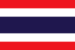 Thailand Thailand | Border with Burma, Mae Hong Son Province | 97°20'E |
| 176 | 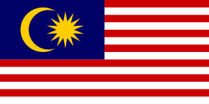 Malaysia Malaysia | Western coast of Langkawi island, Kedah state | 99°37'E |
| 177 | 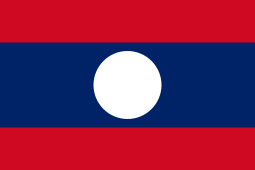 Laos Laos | Border with Burma and Thailand, Bokeo Province | 100°08'E |
| 178 | 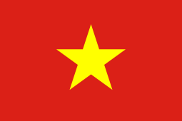 Vietnam Vietnam | Border with Laos and China, Điện Biên Province | 102°08'E |
| 179 |  Cambodia Cambodia | Battambang Province, border with Thailand | 102°25'E |
| 180 |  Singapore Singapore | Western tip of Singapore island, West Region | 103°36'E |
| 181 |  Brunei Brunei | Border with Malaysia near Kuala Belait | 114°05'E |
| 182 |  Philippines Philippines | Kalayaan, Palawan | 114°17'E |
| 183 |  Japan Japan | Cape Irizaki, Yonaguni Island
Kōzakihana (four main islands) | 122°56'01"E
129°43'E |
| 184 |  Timor-Leste Timor-Leste | Border with Indonesia west of Citrana, Oecusse District | 124°00'E |
| 185 |  North Korea North Korea | Border with China at Yellow Sea coast | 124°10'E |
| 186 |  South Korea South Korea | Baengnyeongdo Island, Incheon | 124°39'E |
| 187 |  Palau Palau | Tobi Island | 131°07'26"E |
| 188 |  Micronesia Micronesia | Ngulu Atoll, Yap state | 137°30'E |
| 189 |  Papua New Guinea Papua New Guinea | Border with Indonesia, Western Province | 140°55'E |
| 190 |  Solomon Islands Solomon Islands | Treasury Islands, Western Province | 155°33'30"E |
| 191 |  Marshall Islands Marshall Islands | Ujelang Atoll | 160°54'E |
| 192 | 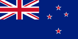 New Zealand New Zealand | Cape Lovitt, Auckland Islands
West Cape (South Island) | 166°42'E
165°50'E |
| 193 | 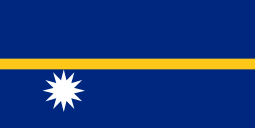 Nauru Nauru | West coast of Nauru island | 166°53'E |
| 194 | 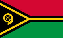 Vanuatu Vanuatu | Hiw Island | 166°33'E |
| 195 | 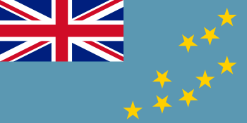 Tuvalu Tuvalu | Lakena | 176°03'E |
| 196 |  Fiji Fiji | Viwa Island | 176°53'E |