Brass, Nigeria
| Brass | |
|---|---|
 Brass Location in Nigeria | |
| Coordinates: 4°18′54″N 6°14′30″E / 4.31500°N 6.24167°ECoordinates: 4°18′54″N 6°14′30″E / 4.31500°N 6.24167°E | |
| Country |
|
| State | Bayelsa State |
| Headquarters | Twon-Brass |
| Government | |
| • Type | LGA |
| Area | |
| • Total | 1,404 km2 (542 sq mi) |
| Population (2006 census) | |
| • Total | 185,049 |
| Time zone | UTC+1 (WAT) |
| 3-digit postal code prefix | 562 |
| ISO 3166 code | NG.BY.BR |
Brass is a Local Government Area in Bayelsa State, Nigeria. Its headquarters are in the town of Twon-Brass on Brass Island along the coast. It has a coastline of approximately 90 km on the Bight of Bonny. Much of the area of the LGA is occupied by the Edumanom National Forest.
It has an area of 1,404 km² and a population of 185,049 at the 2006 census.
The postal code of the area is 562.[1]
References
- ↑ "Post Offices- with map of LGA". NIPOST. Archived from the original on 2009-10-07. Retrieved 2009-10-20.
State capital: Yenagoa | ||
| Local Government Areas | 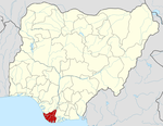 | |
This article is issued from
Wikipedia.
The text is licensed under Creative Commons - Attribution - Sharealike.
Additional terms may apply for the media files.