Charnay, Rhône
| Charnay | ||
|---|---|---|
| Commune | ||
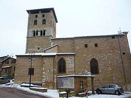 The church in Charnay | ||
| ||
 Charnay Location within Auvergne-Rhône-Alpes region  Charnay | ||
| Coordinates: 45°53′29″N 4°40′09″E / 45.8914°N 4.6692°ECoordinates: 45°53′29″N 4°40′09″E / 45.8914°N 4.6692°E | ||
| Country | France | |
| Region | Auvergne-Rhône-Alpes | |
| Department | Rhône | |
| Arrondissement | Villefranche-sur-Saône | |
| Canton | Le Bois-d'Oingt | |
| Intercommunality | Communauté de communes Beaujolais-Saône-Pierres-Dorées | |
| Government | ||
| • Mayor (2008–2014) | Laurent Dubuy | |
| Area1 | 7.06 km2 (2.73 sq mi) | |
| Population (2007)2 | 1,067 | |
| • Density | 150/km2 (390/sq mi) | |
| Time zone | UTC+1 (CET) | |
| • Summer (DST) | UTC+2 (CEST) | |
| INSEE/Postal code | 69047 /69380 | |
| Elevation |
206–446 m (676–1,463 ft) (avg. 450 m or 1,480 ft) | |
|
1 French Land Register data, which excludes lakes, ponds, glaciers > 1 km2 (0.386 sq mi or 247 acres) and river estuaries. 2 Population without double counting: residents of multiple communes (e.g., students and military personnel) only counted once. | ||

Charnay is a commune in the Rhône department in eastern France.
The village is part of the Beaujolais wine region and is home to numerous wineries. It is also regionally famous for its authentic medieval village.
Gallery
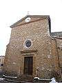 The church
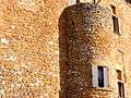 The medieval castle, built in golden colored stones
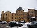 The medieval castle, now Charnay's city hall
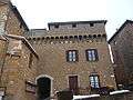 The medieval village
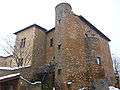 The medieval village
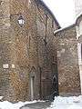 The medieval village
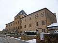 The Mansarde castle (16th century)
See also
References
| Wikimedia Commons has media related to Charnay (Rhône). |
This article is issued from
Wikipedia.
The text is licensed under Creative Commons - Attribution - Sharealike.
Additional terms may apply for the media files.