Simandres
| Simandres | |
|---|---|
| Commune | |
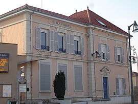 The town hall in Simandres | |
 Simandres Location within Auvergne-Rhône-Alpes region  Simandres | |
| Coordinates: 45°37′14″N 4°52′26″E / 45.6206°N 4.8739°ECoordinates: 45°37′14″N 4°52′26″E / 45.6206°N 4.8739°E | |
| Country | France |
| Region | Auvergne-Rhône-Alpes |
| Department | Rhône |
| Arrondissement | Lyon |
| Canton | Saint-Symphorien-d'Ozon |
| Government | |
| • Mayor (2008–2014) | José Rodrigues |
| Area1 | 10.45 km2 (4.03 sq mi) |
| Population (2007)2 | 1,509 |
| • Density | 140/km2 (370/sq mi) |
| Time zone | UTC+1 (CET) |
| • Summer (DST) | UTC+2 (CEST) |
| INSEE/Postal code | 69295 /69360 |
| Elevation |
178–377 m (584–1,237 ft) (avg. 250 m or 820 ft) |
|
1 French Land Register data, which excludes lakes, ponds, glaciers > 1 km2 (0.386 sq mi or 247 acres) and river estuaries. 2 Population without double counting: residents of multiple communes (e.g., students and military personnel) only counted once. | |
Simandres is a commune in the Rhône department in eastern France.
See also
References
| Wikimedia Commons has media related to Simandres. |
This article is issued from
Wikipedia.
The text is licensed under Creative Commons - Attribution - Sharealike.
Additional terms may apply for the media files.