Haute-Rivoire
| Haute-Rivoire | |
|---|---|
| Commune | |
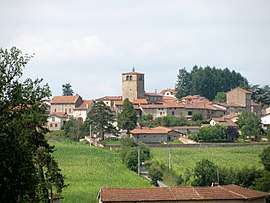 The church and surrounding buildings in Haute-Rivoire | |
 Haute-Rivoire Location within Auvergne-Rhône-Alpes region  Haute-Rivoire | |
| Coordinates: 45°42′59″N 4°23′50″E / 45.7164°N 4.3972°ECoordinates: 45°42′59″N 4°23′50″E / 45.7164°N 4.3972°E | |
| Country | France |
| Region | Auvergne-Rhône-Alpes |
| Department | Rhône |
| Arrondissement | Lyon |
| Canton | L'Arbresle |
| Intercommunality | Communauté de communes Chamousset en Lyonnais |
| Government | |
| • Mayor (2008–2014) | Gilbert Courtine |
| Area1 | 20.29 km2 (7.83 sq mi) |
| Population (2006)2 | 1,301 |
| • Density | 64/km2 (170/sq mi) |
| Time zone | UTC+1 (CET) |
| • Summer (DST) | UTC+2 (CEST) |
| INSEE/Postal code | 69099 /69610 |
| Elevation |
437–667 m (1,434–2,188 ft) (avg. 630 m or 2,070 ft) |
|
1 French Land Register data, which excludes lakes, ponds, glaciers > 1 km2 (0.386 sq mi or 247 acres) and river estuaries. 2 Population without double counting: residents of multiple communes (e.g., students and military personnel) only counted once. | |
Haute-Rivoire is a commune in the Rhône department in eastern France.
See also
References
| Wikimedia Commons has media related to Haute-Rivoire. |
This article is issued from
Wikipedia.
The text is licensed under Creative Commons - Attribution - Sharealike.
Additional terms may apply for the media files.