Lacenas
| Lacenas | |
|---|---|
| Commune | |
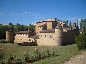 The Château du Sou, in Lacenas | |
 Lacenas Location within Auvergne-Rhône-Alpes region  Lacenas | |
| Coordinates: 45°59′39″N 4°38′46″E / 45.9942°N 4.6461°ECoordinates: 45°59′39″N 4°38′46″E / 45.9942°N 4.6461°E | |
| Country | France |
| Region | Auvergne-Rhône-Alpes |
| Department | Rhône |
| Arrondissement | Arrondissement of Villefranche-sur-Saône |
| Canton | Canton of Gleizé |
| Government | |
| • Mayor (2008–2014) | Georges Grevoz |
| Area1 | 3.36 km2 (1.30 sq mi) |
| Population (2004)2 | 850 |
| • Density | 250/km2 (660/sq mi) |
| Time zone | UTC+1 (CET) |
| • Summer (DST) | UTC+2 (CEST) |
| INSEE/Postal code | 69105 /69640 |
| Elevation |
229–371 m (751–1,217 ft) (avg. 300 m or 980 ft) |
|
1 French Land Register data, which excludes lakes, ponds, glaciers > 1 km2 (0.386 sq mi or 247 acres) and river estuaries. 2 Population without double counting: residents of multiple communes (e.g., students and military personnel) only counted once. | |
Lacenas is a commune in the Rhône department in eastern France.
Twin towns — sister cities

See also
References
| Wikimedia Commons has media related to Lacenas. |
This article is issued from
Wikipedia.
The text is licensed under Creative Commons - Attribution - Sharealike.
Additional terms may apply for the media files.