Azolette
| Azolette | |
|---|---|
| Commune | |
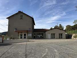 The town hall of Azolette | |
 Azolette Location within Auvergne-Rhône-Alpes region  Azolette | |
| Coordinates: 46°11′35″N 4°25′07″E / 46.1931°N 4.4186°ECoordinates: 46°11′35″N 4°25′07″E / 46.1931°N 4.4186°E | |
| Country | France |
| Region | Auvergne-Rhône-Alpes |
| Department | Rhône |
| Arrondissement | Villefranche-sur-Saône |
| Canton | Thizy-les-Bourgs |
| Intercommunality | CC Saône Beaujolais |
| Government | |
| • Mayor (2014-2020) | Maurice Tournier |
| Area1 | 4.18 km2 (1.61 sq mi) |
| Population (2014)2 | 125 |
| • Density | 30/km2 (77/sq mi) |
| Time zone | UTC+1 (CET) |
| • Summer (DST) | UTC+2 (CEST) |
| INSEE/Postal code | 69016 /69790 |
| Elevation |
480–650 m (1,570–2,130 ft) (avg. 540 m or 1,770 ft) |
|
1 French Land Register data, which excludes lakes, ponds, glaciers > 1 km2 (0.386 sq mi or 247 acres) and river estuaries. 2 Population without double counting: residents of multiple communes (e.g., students and military personnel) only counted once. | |
Azolette is a commune of the Rhône department in eastern France.
See also
References
| Wikimedia Commons has media related to Azolette. |
This article is issued from
Wikipedia.
The text is licensed under Creative Commons - Attribution - Sharealike.
Additional terms may apply for the media files.