Saint-Lager
| Saint-Lager | |
|---|---|
| Commune | |
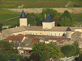 The Château of Saint-Lager | |
 Saint-Lager Location within Auvergne-Rhône-Alpes region  Saint-Lager | |
| Coordinates: 46°06′45″N 4°40′25″E / 46.1125°N 4.6736°ECoordinates: 46°06′45″N 4°40′25″E / 46.1125°N 4.6736°E | |
| Country | France |
| Region | Auvergne-Rhône-Alpes |
| Department | Rhône |
| Arrondissement | Arrondissement of Villefranche-sur-Saône |
| Canton | Canton of Belleville |
| Intercommunality | Communauté de communes Beaujolais-Val-de-Saône |
| Government | |
| • Mayor (2008–2014) | Isabel Buchsenschutz |
| Area1 | 7.74 km2 (2.99 sq mi) |
| Population (1999)2 | 874 |
| • Density | 110/km2 (290/sq mi) |
| Time zone | UTC+1 (CET) |
| • Summer (DST) | UTC+2 (CEST) |
| INSEE/Postal code | 69218 /69220 |
| Elevation |
189–481 m (620–1,578 ft) (avg. 225 m or 738 ft) |
|
1 French Land Register data, which excludes lakes, ponds, glaciers > 1 km2 (0.386 sq mi or 247 acres) and river estuaries. 2 Population without double counting: residents of multiple communes (e.g., students and military personnel) only counted once. | |
Saint-Lager is a commune in the Rhône department in eastern France.
See also
References
| Wikimedia Commons has media related to Saint-Lager. |
This article is issued from
Wikipedia.
The text is licensed under Creative Commons - Attribution - Sharealike.
Additional terms may apply for the media files.