Bady Bassitt
| Bady Bassitt | |||
|---|---|---|---|
| Municipality | |||
| |||
 Location in São Paulo state | |||
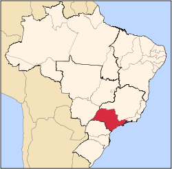
 Bady Bassitt Location in Brazil | |||
| Coordinates: 20°55′5″S 49°26′43″W / 20.91806°S 49.44528°WCoordinates: 20°55′5″S 49°26′43″W / 20.91806°S 49.44528°W | |||
| Country |
| ||
| Region | Southeast Region | ||
| State | São Paulo | ||
| Mesoregion | São José do Rio Preto | ||
| Microregion | São José do Rio Preto | ||
| Government | |||
| • Mayor | Edmur Pradela | ||
| Area | |||
| • Total | 110 km2 (40 sq mi) | ||
| Elevation | 510 m (1,670 ft) | ||
| Population (2015) | |||
| • Total | 16,359 | ||
| • Density | 150/km2 (390/sq mi) | ||
| Time zone | BRT/BRST (UTC-3/-2) | ||
| Postal code | 15115-000 | ||
| Area code | +55 17 | ||
| Website |
www | ||


Bady Bassitt is a municipality in the state of São Paulo, Brazil. The population is 16,359 (2015 est.) in an area of 110 km².[1] The town is located 7 km from São José do Rio Preto. The municipality belongs to the Microregion of São José do Rio Preto.
History
In 1908, Bady Bassitt was a village named Borboleta (butterfly). In this year, a road coming from Rio Preto was open. Camilo de Morais opened the first store in Borboleta, in 1912.
On February 13, 1914, the village of Borboleta was officially established, and on December 12, 1926, the village was elevated to district of Rio Preto.
On February 18, 1959, the municipality of Borboleta is officially established, and in 1963, the name was changed to the current form, an homage to Bady Bassitt, a politician from São José do Rio Preto.[2]
Geography
Neighbouring places
- Mirassol, northwest
- São José do Rio Preto, northeast
- Nova Aliança, southwest
- Potirendaba, south
- Cedral, southeast
Hydrography
The municipality features several streams:
- Córrego Borá
- Córrego dos Macacos
- Córrego Borboleta (Main stream)
Demographics
Population history
| Year | Population |
|---|---|
| 2000 | 11,550 |
| 2010 | 14,603 |
| 2015 | 16,359 |
Statistics
- Area: 108.5 km²
- Population density: 134.54/km² (IBGE/2010) - 222.90/km² (SEADE/2011)
- Urbanization: 93.5% (2010)
- Sex ratio (Males to Females): 98.2 (2011)
- Birth rate: 11.8/1,000 inhabitants (2009)
- Infant mortality: 5.95/1,000 births (2009)
- Homicide rate: 0.0/100 thousand ppl (2008)
- HDI: 0.812 (UNDP/2000)
Economy
The Tertiary sector is the economic basis of Bady. Commerce, services and administration corresponds to 60.5% of the city GDP. Industry is 35.2% of the GDP, and the Primary sector corresponds to 4.1%.[3]
Transportation
The city is linked with the BR-153 (Transbrasiliana), the SP-310 (in Rio Preto) and the SP-355 (Maurício Goulart) highways.
External links
- (in Portuguese) http://www.badybassitt.sp.gov.br
- (in Portuguese) Bady Bassitt on citybrazil.com.br
References
- ↑ Instituto Brasileiro de Geografia e Estatística
- ↑ "History of the City on the Prefecture Site". Badybassitt.sp.gov.br. Archived from the original on 6 July 2011. Retrieved 15 July 2011.
- 1 2 "Municipal Profile at SEADE". SEADE.gov.br. Archived from the original on 23 August 2011. Retrieved 15 July 2011.
- ↑ "Population at "Censo 2010"" (PDF) (in Portuguese). IBGE.gov.br. Retrieved 7 Jul 2011.
Capital: São Paulo | |||||||||||||||||||||
|  | ||||||||||||||||||||
|
| |||||||||||||||||||||
| |||||||||||||||||||||
| |||||||||||||||||||||
| |||||||||||||||||||||
| |||||||||||||||||||||
| |||||||||||||||||||||
| |||||||||||||||||||||
| |||||||||||||||||||||
| |||||||||||||||||||||
| |||||||||||||||||||||
| |||||||||||||||||||||
| |||||||||||||||||||||