Monteiro Lobato, São Paulo
| Monteiro Lobato | |
|---|---|
| Municipality | |
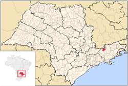 Location in São Paulo state | |
 Monteiro Lobato Location in Brazil | |
| Coordinates: 22°57′24″S 45°50′23″W / 22.95667°S 45.83972°WCoordinates: 22°57′24″S 45°50′23″W / 22.95667°S 45.83972°W | |
| Country |
|
| Region | Southeast Brazil |
| State | São Paulo |
| Metropolitan Region | Vale do Paraíba e Litoral Norte |
| Area | |
| • Total | 332.74 km2 (128.47 sq mi) |
| Population (2015) | |
| • Total | 4,467 |
| • Density | 13/km2 (35/sq mi) |
| Time zone | UTC-3 (BRT) |
| • Summer (DST) | UTC-2 (BRST) |
Monteiro Lobato is a municipality in the state of São Paulo in Brazil. It is part of the Metropolitan Region of Vale do Paraíba e Litoral Norte.[1] The population is 4,467 (2015 est.) in an area of 332.74 km2 (128.47 sq mi).[2]
The municipality was named in honor of Brazilian writer José Bento Monteiro Lobato, who was born in the nearby city of Taubaté, and had a farm in the area of the municipality.
The municipality contains part of the 292,000 hectares (720,000 acres) Mananciais do Rio Paraíba do Sul Environmental Protection Area, created in 1982 to protect the sources of the Paraíba do Sul river.[3]
References
- ↑ Assembleia Legislativa do Estado de São Paulo, Lei Complementar Nº 1.166
- ↑ Instituto Brasileiro de Geografia e Estatística
- ↑ Unidade de Conservação: Área de Proteção Ambiental Bacia Hidrográfica do Paraíba do Sul (in Portuguese), MMA: Ministério do Meio Ambiente, retrieved 2016-10-01
External links
- (in Portuguese) Monteiro Lobato on Explorevale
Places adjacent to Monteiro Lobato, São Paulo | ||||||||||
|---|---|---|---|---|---|---|---|---|---|---|
| ||||||||||
This article is issued from
Wikipedia.
The text is licensed under Creative Commons - Attribution - Sharealike.
Additional terms may apply for the media files.