Santa Branca
| Santa Branca | |
|---|---|
| Municipality | |
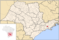 Location in São Paulo state | |
 Santa Branca Location in Brazil | |
| Coordinates: 23°23′48″S 45°53′2″W / 23.39667°S 45.88389°WCoordinates: 23°23′48″S 45°53′2″W / 23.39667°S 45.88389°W | |
| Country |
|
| Region | Southeast Region |
| State | São Paulo |
| Metrop. region | Vale do Paraíba e Litoral Norte |
| Area | |
| • Total | 272.24 km2 (105.11 sq mi) |
| Elevation | 648 m (2,126 ft) |
| Population (2015) | |
| • Total | 14,534 |
| • Density | 53/km2 (140/sq mi) |
| Time zone | BRT/BRST (UTC-3/-2) |
| Postal code | 12380-000 |
| Area code | +55-12 |
| Website |
www |
Santa Branca is a municipality in the state of São Paulo in Brazil. It is part of the Metropolitan Region of Vale do Paraíba e Litoral Norte.[1] The population is 14,534 (2015 est.) in an area of 272.24 km².[2] The elevation is 648 m. The Rodovia Governador Carvalho Pinto (SP-070) passes north of Santa Branca.
The municipality contains part of the 292,000 hectares (720,000 acres) Mananciais do Rio Paraíba do Sul Environmental Protection Area, created in 1982 to protect the sources of the Paraíba do Sul river.[3]
References
- ↑ Assembleia Legislativa do Estado de São Paulo, Lei Complementar Nº 1.166
- ↑ Instituto Brasileiro de Geografia e Estatística
- ↑ Unidade de Conservação: Área de Proteção Ambiental Bacia Hidrográfica do Paraíba do Sul (in Portuguese), MMA: Ministério do Meio Ambiente, retrieved 2016-10-01
External links
- (in Portuguese) http://www.santabranca.sp.gov.br
- (in Portuguese) citybrazil.com.br
- (in Portuguese) Santa Branca on Explorevale
| |||||||||||||
This article is issued from
Wikipedia.
The text is licensed under Creative Commons - Attribution - Sharealike.
Additional terms may apply for the media files.