Paulo de Faria
| Paulo de Faria | |
|---|---|
| Municipality | |
 Location in São Paulo state | |
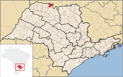
 Paulo de Faria Location in Brazil | |
| Coordinates: 20°01′49″S 49°23′40″W / 20.03028°S 49.39444°WCoordinates: 20°01′49″S 49°23′40″W / 20.03028°S 49.39444°W | |
| Country |
|
| Region | Southeast Region |
| State | São Paulo |
| Mesoregion | São José do Rio Preto |
| Area | |
| • Total | 738.4 km2 (285.1 sq mi) |
| Elevation | 444 m (1,457 ft) |
| Population (2010) | |
| • Total | 8,589 |
| • Density | 12/km2 (30/sq mi) |
| Time zone | BRT/BRST (UTC-3/-2) |
| Postal code | 15490-000 |
| Area code | +55 17 |
| Website | Prefecture of Paulo de Faria |
Paulo de Faria is a municipality in the state of São Paulo, Brazil. The city has a population of 8,589 inhabitants and an area of 738.4 km².[1] Paulo de Faria belongs to the Mesoregion of São José do Rio Preto.
Ecological estate
The ecological estate founded under the decree 17,724 (June 23, 1981) is a stational floral park and covers an area of 435 ha (4.35 km²). Situated by the Grande River (near Água Vermelha), characterizes several hills with the elevations around 400 to 495 m. The flowers features jatobá among others.[2]
References
- ↑ "2010 Census of the IBGE - Population - Table 2.1.20" (PDF) (in Portuguese). IBGE.gov.br. Retrieved 12 June 2012.
- ↑ "Paulo Faria Ecological Station" (in Portuguese). Ambiente Brasil. Retrieved 12 June 2012.
This article is issued from
Wikipedia.
The text is licensed under Creative Commons - Attribution - Sharealike.
Additional terms may apply for the media files.