Rio das Pedras, São Paulo
| Rio das Pedras Município de Rio das Pedras | |||
|---|---|---|---|
| Municipality | |||
| |||
 Location in São Paulo state | |||
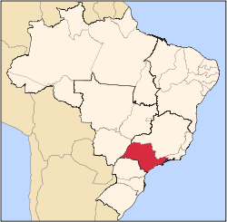
 Rio das Pedras Location in Brazil | |||
| Coordinates: 22°50′34″S 47°36′21″W / 22.84278°S 47.60583°WCoordinates: 22°50′34″S 47°36′21″W / 22.84278°S 47.60583°W | |||
| Country |
| ||
| Region | Southeast Region | ||
| State | São Paulo | ||
| Mesoregion | Piracicaba | ||
| Microregion | Piracicaba | ||
| Government | |||
| • Mayor | Júlio Cesar Barros Ayres (PPS) | ||
| Area | |||
| • Total | 226.657 km2 (87.513 sq mi) | ||
| Elevation | 625 m (2,051 ft) | ||
| Population | |||
| • Total | 29,508 | ||
| • Density | 130/km2 (340/sq mi) | ||
| Time zone | BRT/BRST (UTC-3/-2) | ||


Rio das Pedras is a municipality in the State of São Paulo, Brazil, located at the Microregion of Piracicaba. As of 2010, it has 29.508 people and an area of 226.657 square kilometers.[1]
References
- ↑ "Rio das Pedras". IBGE Cidades. Retrieved 30 October 2014.
External links
Capital: São Paulo | |||||||||||||||||||||
|  | ||||||||||||||||||||
|
| |||||||||||||||||||||
| |||||||||||||||||||||
| |||||||||||||||||||||
| |||||||||||||||||||||
| |||||||||||||||||||||
| |||||||||||||||||||||
| |||||||||||||||||||||
| |||||||||||||||||||||
| |||||||||||||||||||||
| |||||||||||||||||||||
| |||||||||||||||||||||
| |||||||||||||||||||||
This article is issued from
Wikipedia.
The text is licensed under Creative Commons - Attribution - Sharealike.
Additional terms may apply for the media files.