São Lourenço da Serra
| São Lourenço da Serra | |
|---|---|
| Municipality | |
 Location in São Paulo state | |
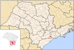
 São Lourenço da Serra Location in Brazil | |
| Coordinates: 23°51′10″S 46°56′34″W / 23.85278°S 46.94278°WCoordinates: 23°51′10″S 46°56′34″W / 23.85278°S 46.94278°W | |
| Country |
|
| Region | Southeast Region |
| State | São Paulo |
| Metrop. region | São Paulo |
| Area | |
| • Total | 186.46 km2 (71.99 sq mi) |
| Population (2015) | |
| • Total | 15,177 |
| • Density | 81/km2 (210/sq mi) |
| Time zone | BRT/BRST (UTC-3/-2) |
| Postal code | 06890 |
| Area code | +55-11 |
São Lourenço da Serra (Portuguese for "Saint Lawrence of the mountain") is a suburban municipality in the southeastern part of the state of São Paulo in Brazil. It is part of the Metropolitan Region of São Paulo.[1] The population is 15,177 (2015 est.) in an area of 186.46 km².[2] The southern part of the municipality is heavily forested with the Serra do Mar mountain range, the central and the northern parts are predominantly hilly and partially urbanized.
The neighborhood of Itapecerica da Serra became a separate municipality in 1991.
Population history
| Historical population | ||
|---|---|---|
| Year | Pop. | ±% |
| 2003 | 13,645 | — |
| 2004 | 14,608 | +7.1% |
| 2015 | 15,177 | +3.9% |
References
External links
- (in Portuguese) http://www.saolourencoserra.sp.gov.br
- (in Portuguese) citybrazil.com.br
Places adjacent to São Lourenço da Serra | ||||||||||
|---|---|---|---|---|---|---|---|---|---|---|
| ||||||||||
This article is issued from
Wikipedia.
The text is licensed under Creative Commons - Attribution - Sharealike.
Additional terms may apply for the media files.