Porto Ferreira
| Porto Ferreira | ||
|---|---|---|
| Municipality | ||
| ||
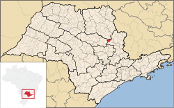 Location in São Paulo state | ||
 Porto Ferreira Location in Brazil | ||
| Coordinates: 21°51′14″S 47°28′44″W / 21.85389°S 47.47889°WCoordinates: 21°51′14″S 47°28′44″W / 21.85389°S 47.47889°W | ||
| Country |
| |
| Region | Southeast Region | |
| State | São Paulo | |
| Mesoregion | Campinas | |
| Microregion | Pirassununga | |
| Government | ||
| • Mayor | Rômulo Rippa (PSD) | |
| Area | ||
| • Total | 244.9 km2 (94.6 sq mi) | |
| Elevation | 559 m (1,834 ft) | |
| Population (2015) | ||
| • Total | 54,761 | |
| • Density | 220/km2 (580/sq mi) | |
| Time zone | BRT/BRST (UTC-3/-2) | |
| Postal code | 1366-000 | |
| Area code | (19) | |

Porto Ferreira is a municipality in the state of São Paulo in Brazil. It is situated on the Mojiguaçu River at an altitude of 559 meters. The population is 54,761 (2015 est.) in an area of 244.9 km².[1]
History
The valley where Porto Ferreira now lies used to be inhabited by Payaguá people. The settlement Porto Ferreira on the Mojiguaçu River was founded in the 1860s, at the place of a ferry. It was named Ferreira after the ferryman João Inácio Ferreira. The settlement grew because of its strategic location on the way to the coffee plantations in the region of Ribeirão Preto. Porto Ferreira was officially established on 9 February 1888, as a part of the municipality Descalvado. It was detached from Descalvado and attached to Pirassununga on 1 October 1892. It became an independent municipality on 29 July 1896.[2]
Demography
Data of the Census - 2010 Total population: 58.797
- Urban: 56.901
- Rural: 1.896
- Male: 29.240
- Female: 29.550
- Infant mortality up to 1 year (for a thousand): 12,76
- Life expectancy (years): 81,82
- Fertility rate (children per woman): 1,95
- Literacy rate: 96.34%
- Human Development Index (IDH-M): 0,812
- IDH-M Income: 0,845
- IDH-M Longevity: 0,850
- IDH-M Education: 0,880 (Source: IPEA DATE)
Per capita income: U$$3879,56 (estimative of 2010) Urbanization rate: 96.61% Annual Population Growth rate: 1.86% Number of hospital beds: 45 (per thousand inhabitants - 0,73)
Population that has access:
- Water supply: 98.5%
- Sewage: 97.6%
- Garbage collection: 100%
Source: IBGE
Geography
The highest point of the city is the High Mount, with 798 meters. The lowest point is the Island of the Ducks, with 545 meters. In the Railroad station the altitude is of 549.7 meters above sea level.
The municipality holds the 611 hectares (1,510 acres) Porto Ferreira State Park, created in 1987.[3]
Climate
annual average
- Temperature: 23°C annual total
- Precipitation: 1300-1500 millimeters
- Predominant wind direction: Southeast
Topography
The general city landscape is plain, with small hills, slightly inclined towards the basins of the Moji Guaçu river and its tributaries. To the north, is possible to figure some mountains.
Ways of Communication
The city is served by two state highways, Rodovia Anhangüera (SP 230), SP 215. There are also the deactivated rails from the former state railroad company, FEPASA.
Soil
Four types of soil are found, thus distributed for the area of the city: Yellow Red Latosol (62 km ²), Purple Latosol (74 km ²), Hidromórfico (27 km ²) and Dark Red Latosol (77 km ²).
Hydrography
- Mojiguaçu River
- River Santa Rosa
- Amaros stream
References
- ↑ Instituto Brasileiro de Geografia e Estatística
- ↑ IBGE, history
- ↑ Parque Estadual Porto Ferreira completa 50 anos (in Portuguese), Fundação Florestal, 21 November 2012, retrieved 2017-01-22