Leme, São Paulo
| Leme | |||
|---|---|---|---|
| Municipality | |||
| |||
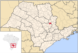 Location in São Paulo state | |||
 Leme Location in Brazil | |||
| Coordinates: 22°11′10″S 47°23′26″W / 22.18611°S 47.39056°WCoordinates: 22°11′10″S 47°23′26″W / 22.18611°S 47.39056°W | |||
| Country |
| ||
| Region | Southeast Region | ||
| State | São Paulo | ||
| Mesoregion | Piracicaba | ||
| Microregion | Limeira | ||
| Government | |||
| • Mayor | Wagner Ricardo Antunes Filho (PSD) | ||
| Area | |||
| • Total | 403,077 km2 (155,629 sq mi) | ||
| Elevation | 619 m (2,031 ft) | ||
| Population (2015) | |||
| • Total | 99,388 | ||
| • Density | 0.25/km2 (0.64/sq mi) | ||
| Time zone | BRT/BRST (UTC-3/-2) | ||
| Website | http://leme.sp.gov.br | ||


Leme is a municipality in the state of São Paulo in Brazil. The population is 99,388 (2015 est.) in an area of 403 km².[1][2] At the 2000 census, it had 80,757 residents, 40,830 of whom are men and 39,927 women. 65,885 residents are 10 years old or older, and of these, 59,991, or 91.1%, are literate.[3]
Economy
Its economy is based on agriculture, like sugar cane, cotton, oranges, coffee. The industrial sector is very varied, with producs at food, machines, Christmas decoration, plastic and building material areas.
References
State of São Paulo, Brazil | |||||||||||||
|---|---|---|---|---|---|---|---|---|---|---|---|---|---|
| |||||||||||||
| |||||||||||||
| |||||||||||||
