Tietê, São Paulo
| Tietê | |||
|---|---|---|---|
| Municipality | |||
 | |||
| |||
|
Motto(s): Flumen Meun Gloriae Iter "My River, Way of Glory" | |||
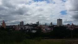
 Location in São Paulo state | |||
 Tietê Location in Brazil | |||
| Coordinates: 23°6′7″S 47°42′53″W / 23.10194°S 47.71472°WCoordinates: 23°6′7″S 47°42′53″W / 23.10194°S 47.71472°W | |||
| Country |
| ||
| Region | Southeast Brazil | ||
| State | São Paulo | ||
| Metropolitan Region | Sorocaba | ||
| Government | |||
| • Prefect |
Vlamir Sandei (PSDB) (2017 – 2020) | ||
| Area | |||
| • Total | 404.40 km2 (156.14 sq mi) | ||
| Elevation | 508 m (1,667 ft) | ||
| Population (2015) | |||
| • Total | 40,194 | ||
| • Density | 99/km2 (260/sq mi) | ||
| Time zone | UTC-3 (BRT) | ||
| • Summer (DST) | UTC-2 (BRST) | ||
| Postal code | 18530-000 | ||
| Phone code | 15 | ||


Tietê is a Brazilian municipality in the state of São Paulo, located in the Metropolitan Region of Sorocaba, in the Meso-region of Piracicaba and in the Microregion of Piracicaba. It is located at latitude 23º06'07 "south and at a longitude 47º42'53" west, being at an altitude of 508 meters. Its estimated population in 2009 was 36 211 inhabitants. It has an area of 392,509 km². This corresponds to a population density of 86.6 inhab / km².
It is the hometown of the President of the Republic, Michel Temer.
History
The history of Tietê had origins with the bandeirantes that explored the interior of São Paulo sailing along the Tietê river.
The fertility of the soil has attracted a large number of adventurers and crop aficionados who came here. Almost at the mouth of Ribeirão do Pito Acceso (Ribeirão da Serra), there was an anchorage of canoes that, forming the monsoons demanded of Cuiabá loaded with gold and precious stones. At the river bank, residents built the first dwellings, thus forming the village of Pirapora do Curuçá. It was named after a stone located on the left bank of the river, which the Indians called Curuçu-Guaçu (which in Tupi means cross) because there was a carved cross in it.
In 1570, as reported by Father José de Anchieta, a shipwreck occurred between Porto Feliz and Tietê. This report indicates the presence of colonizers from the beginning of the discovery. During the monsoon, at the end of the 18th century, Pirapora do Curuçá was the first and most important port of resupply and rest for the bandeirantes leaving Araritaguaba (Porto Feliz).
In 1747, the vicar Francisco Campos making a brief survey that can be considered the first census of Tietê, found that in the region that descended the river a distance of four leagues from the matrix existed about one hundred and forty houses.
On August 3, 1811, Pirapora do Curuçá was elevated to the parish status of the Holy Trinity of Pirapora do Curuçá.
On March 8, 1842, the parish became a municipality and the name of the village lasted until 1867 when it was moved to Tietê.
References
https://pt.wikipedia.org/wiki/Tiet%C3%AA
State of São Paulo, Brazil | |||||||||||||
|---|---|---|---|---|---|---|---|---|---|---|---|---|---|
| |||||||||||||
| |||||||||||||
| |||||||||||||
