Arapiles, Castile and León
| Arapiles | |||
|---|---|---|---|
| Municipality | |||
 | |||
| |||
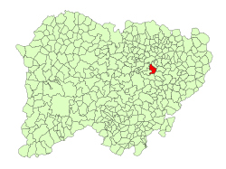 Location in Salamanca | |||
 Arapiles Location in Spain | |||
| Coordinates: 40°53′39″N 5°38′41″W / 40.89417°N 5.64472°WCoordinates: 40°53′39″N 5°38′41″W / 40.89417°N 5.64472°W | |||
| Country | Spain | ||
| Autonomous community | Castile and León | ||
| Province | Salamanca | ||
| Comarca | Campo de Salamanca | ||
| Government | |||
| • Mayor | Sigifredo Marcos Rodríguez (People's Party) | ||
| Area[1] | |||
| • Total | 25 km2 (10 sq mi) | ||
| Elevation[1] | 840 m (2,760 ft) | ||
| Population (2016)[2] | |||
| • Total | 645 | ||
| • Density | 26/km2 (67/sq mi) | ||
| Time zone | UTC+1 (CET) | ||
| • Summer (DST) | UTC+2 (CEST) | ||
| Postal code | 37796 | ||


Arapiles is a village and municipality in the province of Salamanca, western Spain, and part of the autonomous community of Castile and León. It is located 8 kilometres (5.0 mi) from the city of Salamanca and has a population of 645 people. The municipality covers an area of 25 km2 (9.7 sq mi).[1]
The village lies 840 metres (2,760 ft) above sea level.
The post code is 37796.
History
In 1812 there was a battle in the vicinity known as the Battle of Salamanca (Batalla de los Arapiles) fought in the Peninsular War.
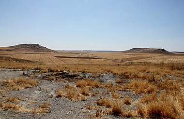 Seen from the village, the Lesser Arapile (Arapil Chico) is on the left
 Sign showing the battlefield at Arapiles
References
- 1 2 3 "Municipio:Arapiles". www.lasalina.es. Retrieved 2017-10-25.
- ↑ "Salamanca: Población por municipios y sexo". www.ine.es (in Spanish). Retrieved 2017-10-25.
This article is issued from
Wikipedia.
The text is licensed under Creative Commons - Attribution - Sharealike.
Additional terms may apply for the media files.