Miami-Dade County, Florida
Miami-Dade County is a county in the southeastern part of the U.S. state of Florida. According to a 2019 census report,[7] the county had a population of 2,716,940,[8] making it the most populous county in Florida and the seventh-most populous county in the United States.[9] It is also Florida's third largest county in terms of land area, with 1,946 square miles (5,040 km2). The county seat is Miami, the principal city in South Florida.[10]
Miami-Dade County, Florida | |
|---|---|
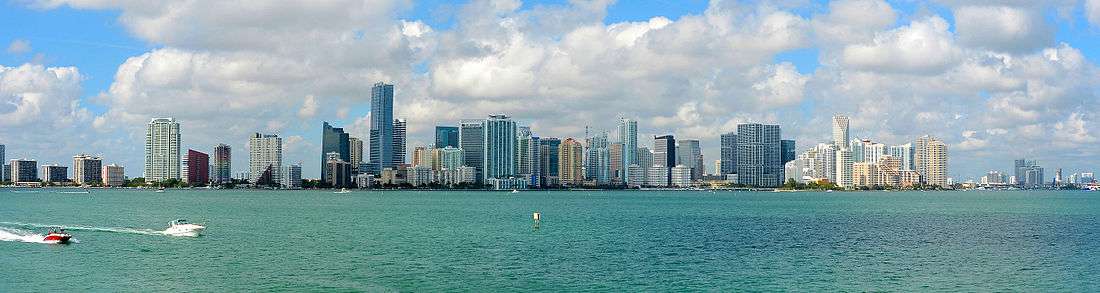  .jpg)   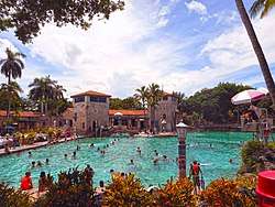 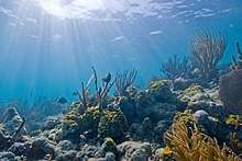 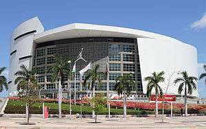  Images, from top down, left to right: Downtown Miami skyline; Lifeguard station on South Beach; Miami Design District's Palm Court; Wynwood Walls in Wynwood Art District; Ocean Drive in Miami Beach; Venetian Pool; Biscayne National Park; American Airlines Arena; Anhinga Trail boardwalk in Everglades National Park | |
 Flag  Seal | |
| Nickname(s): "Dade County", "Dade", "Metro-Dade", "Greater Miami" | |
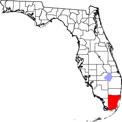 | |
 Miami-Dade County, Florida Location within the United States | |
| Coordinates: 25°36′38″N 80°29′50″W[1] | |
| Country | |
| State | |
| Region | South Florida |
| Metro area | Miami |
| Founded | January 18, 1836 |
| Named for | Francis L. Dade |
| County seat | |
| Largest city | Miami |
| Incorporated municipalities | 34 |
| Government | |
| • Type | Two-tier federation |
| • Body | Miami-Dade Board of County Commissioners |
| • Miami-Dade Board of County Commissioners[2] | Commissioners
|
| • Mayor | Carlos A. Giménez (R) |
| Area | |
| • Total | 2,431.178 sq mi (6,296.72 km2) |
| • Land | 1,898.753 sq mi (4,917.75 km2) |
| • Water | 532.425 sq mi (1,378.97 km2) |
| Highest elevation | 34-40 ft (22 m) |
| Lowest elevation | 0 ft (0 m) |
| Population | |
| • Total | 2,498,018 |
| • Estimate (2019)[5] | 2,716,940 |
| • Density | 1,000/sq mi (400/km2) |
| Time zone | UTC−5 (Eastern Time Zone) |
| • Summer (DST) | UTC−4 (Eastern Daylight Time) |
| Zip code | 33002, 33010-33018, 33030-33035, 33039, 33054, 33056, 33090, 33092, 33101-33102, 33106, 33109, 33111-33112, 33114, 33116, 33119, 33122, 33124-33147, 33149-33158, 33160-33170, 33172-33199, 33206, 33222, 33231, 33233-33234, 33238-33239, 33242-33243, 33245, 33247, 33255-33257, 33261, 33265-33266, 33269, 33280, 33283, 33296, 33299 |
| Area codes | 305/786, |
| FIPS code | 12086 |
| GNIS feature ID | 295755 |
| GDP | $146 billion[6] |
| Primary Airport | Miami International Airport MIA (Major/International) |
| Secondary Airport | Miami Executive Airport- TMB (Regional)- Miami-Opa Locka Executive Airport- OPF (Regional)- Miami Homestead General Aviation Airport- X51 (Regional) |
| Interstates | |
| U.S. Routes | |
| State Routes | |
| Rapid Transit | Metrorail |
| Commuter Rail | Amtrak, Virgin Trains USA, Tri-Rail |
| Website | www |
Miami-Dade County is one of the three counties in South Florida that make up the Miami metropolitan area, which was home to an estimated 6,198,782 people in 2018.[11]
The county is home to 34 incorporated cities and many unincorporated areas.[12] The northern, central and eastern portions of the county are heavily urbanized with many high-rise buildings along the coastline, including South Florida's central business district, Downtown Miami. Southern Miami-Dade County includes the Redland and Homestead areas, which make up the agricultural economy of the region. Agricultural Redland makes up roughly one third of Miami-Dade County's inhabited land area, and is sparsely populated, a stark contrast to the densely populated, urban northern portion of the county.
The county also includes portions of two national parks. To the west it extends into the Everglades National Park and is populated only by a Miccosukee tribal village. East of the mainland, in Biscayne Bay, is Biscayne National Park and the Biscayne Bay Aquatic Preserves.[13][14]
History
Native people
The earliest evidence of Native American settlement in the Miami region came from about 12,000 years ago.[15] The first inhabitants settled on the banks of the Miami River, with the main villages on the northern banks.
The inhabitants at the time of first European contact were the Tequesta people, who controlled much of southeastern Florida, including what is now Miami-Dade County, Broward County, and the southern part of Palm Beach County. The Tequesta Indians fished, hunted, and gathered the fruit and roots of plants for food, but did not practice agriculture. They buried the small bones of the deceased with the rest of the body, and put the larger bones in a box for the village people to see. The Tequesta are credited with making the Miami Circle.[16]
European explorers and settlers
Juan Ponce de León was the first European to visit the area in 1513 by sailing into Biscayne Bay. His journal records he reached Chequescha, a variant of Tequesta, which was Miami's first recorded name.[17] It is unknown whether he came ashore or made contact with the natives. Pedro Menéndez de Avilés and his men made the first recorded landing when they visited the Tequesta settlement in 1566 while looking for Avilés' missing son, shipwrecked a year earlier.[18] Spanish soldiers led by Father Francisco Villarreal built a Jesuit mission at the mouth of the Miami River a year later but it was short-lived. After the Spaniards left, the Tequesta Indians were left to fend themselves from European-introduced diseases like smallpox. By 1711, the Tequesta sent a couple of local chiefs to Havana, Cuba, to ask if they could migrate there. The Cubans sent two ships to help them, but Spanish illnesses struck and most of the Tequesta died.[19]
The first permanent European settlers arrived in the early 19th century. People came from the Bahamas to South Florida and the Keys to hunt for treasure from the ships that ran aground on the treacherous Great Florida Reef. Some accepted Spanish land offers along the Miami River. At about the same time, the Seminole Indians arrived, along with a group of runaway slaves. The area was affected by the Second Seminole War, during which Major William S. Harney led several raids against the Indians. Most non-Indian residents were soldiers stationed at Fort Dallas. It was the most devastating Indian war in American history, causing almost a total loss of population in Miami.
After the Second Seminole War ended in 1842, William English re-established a plantation started by his uncle on the Miami River. He charted the "Village of Miami" on the south bank of the Miami River and sold several plots of land. In 1844, Miami became the county seat, and six years later a census reported there were ninety-six residents in the area.[20] The Third Seminole War was not as destructive as the second, but it slowed the settlement of southeast Florida. At the end of the war, a few of the soldiers stayed.
Establishment
Dade County was created on January 18, 1836, under the Territorial Act of the United States. The county was named after Major Francis L. Dade, a soldier killed in 1835 in the Second Seminole War, at what has since been named the Dade Battlefield.[21] At the time of its creation, Dade County included the land that now contains Palm Beach and Broward counties, together with the Florida Keys from Bahia Honda Key north and the land of present-day Miami-Dade County. The county seat was originally at Indian Key in the Florida Keys; then in 1844, the County seat was moved to Miami. The Florida Keys from Key Largo to Bahia Honda were returned to Monroe County in 1866. In 1888 the county seat was moved to Juno, near present-day Juno Beach, Florida, returning to Miami in 1899. In 1909, Palm Beach County was formed from the northern portion of what was Dade County, and then in 1915, Palm Beach County and Dade County contributed nearly equal portions of land to create what is now Broward County. There have been no significant boundary changes to the county since 1915.[22][23][24]
Hurricanes
The third-costliest natural disaster to occur in the United States was Hurricane Andrew, which hit Miami in the early morning of Monday, August 24, 1992. It struck the southern part of the county from due east, south of Miami and very near Homestead, Kendall, and Cutler Ridge (now the Town of Cutler Bay). Damages numbered over US$25 billion in the county alone, and recovery has taken years in these areas where the destruction was greatest. This was the costliest natural disaster in US history until Hurricane Katrina struck the Gulf region in 2005.
Name change
On November 13, 1997, voters changed the name of the county from Dade to Miami-Dade to acknowledge the international name recognition of Miami.[25] Voters were acting pursuant to home rule powers granted to Dade County, including the ability to change the name of the county without the consent of the Florida Legislature.[26] The change in name also addressed a source of public dissatisfaction with the name "Dade" which was chosen to honor Francis L. Dade, who had been killed in the Dade Massacre in the 1830s. The massacre did not occur in South Florida, but in the west central part of the state, in present-day Sumter County, near Bushnell. There is also a Dade City, which is closer to the site of the massacre.
Geography

| Miami, Florida[27] | ||||||||||||||||||||||||||||||||||||||||||||||||||||||||||||
|---|---|---|---|---|---|---|---|---|---|---|---|---|---|---|---|---|---|---|---|---|---|---|---|---|---|---|---|---|---|---|---|---|---|---|---|---|---|---|---|---|---|---|---|---|---|---|---|---|---|---|---|---|---|---|---|---|---|---|---|---|
| Climate chart (explanation) | ||||||||||||||||||||||||||||||||||||||||||||||||||||||||||||
| ||||||||||||||||||||||||||||||||||||||||||||||||||||||||||||
| ||||||||||||||||||||||||||||||||||||||||||||||||||||||||||||
According to the U.S. Census Bureau, the county has an area of 2,431 square miles (6,300 km2), of which 1,898 square miles (4,920 km2) is land and 533 square miles (1,380 km2) (21.9%) is water.[28] It is the third-largest county in Florida by land area and second-largest by total area. Most of the water is in the Biscayne Bay, with another significant portion in the adjacent Atlantic Ocean.
Miami-Dade County is only about 6 feet (1.8 m) above sea level. It is rather new geologically and is at the eastern edge of the Florida Platform, a carbonate plateau created millions of years ago. Eastern Dade is composed of Oolite limestone while western Dade is composed mostly of Bryozoa.[29] Miami-Dade is among the last areas of Florida to be created and populated with fauna and flora, mostly in the Pleistocene.
The bay is divided from the Atlantic Ocean by the many barrier isles along the coast, one of which is where well-known Miami Beach is located, home to South Beach and the Art Deco district. The Florida Keys, which are also barrier islands are only accessible through Miami-Dade County, but which are otherwise part of neighboring Monroe County. Miami is seventy miles from West Palm Beach, and thirty miles from Fort Lauderdale.
Communities
Miami-Dade County includes 34 incorporated areas, 38 census-designated places, and 16 unincorporated regions.
Adjacent counties
- Broward County – north
- Monroe County – southwest
- Collier County – northwest
National protected areas
Demographics
| Historical population | |||
|---|---|---|---|
| Census | Pop. | %± | |
| 1840 | 446 | — | |
| 1850 | 159 | −64.3% | |
| 1860 | 83 | −47.8% | |
| 1870 | 85 | 2.4% | |
| 1880 | 257 | 202.4% | |
| 1890 | 861 | 235.0% | |
| 1900 | 4,955 | 475.5% | |
| 1910 | 11,933 | 140.8% | |
| 1920 | 42,753 | 258.3% | |
| 1930 | 142,955 | 234.4% | |
| 1940 | 267,739 | 87.3% | |
| 1950 | 495,084 | 84.9% | |
| 1960 | 935,047 | 88.9% | |
| 1970 | 1,267,792 | 35.6% | |
| 1980 | 1,625,781 | 28.2% | |
| 1990 | 1,937,094 | 19.1% | |
| 2000 | 2,253,362 | 16.3% | |
| 2010 | 2,496,435 | 10.8% | |
| Est. 2019 | 2,716,940 | [30] | 8.8% |
| U.S. Decennial Census[31] 1790–1960[32] 1900–1990[33] 1990–2000[34] 2010–2019[8] | |||
2010 U.S. Census


U.S. Census Bureau 2010 Ethnic/Race Demographics:[35][36]
- Hispanic or Latino of any race: 65.0% [36][37]
- White (non-Hispanic): 15.4% (White total 73.8% when including White Hispanics)[35]
- Black (non-Hispanic): 17.1% (6.9% (Black total 18.9% when including Black Hispanics)[38]
- Asian: 1.5%[35][36]
- Two or more races: 2.4%
- American Indian and Alaska Native: 0.2%
- Native Hawaiian and Other Pacific Islander: <0.1%[35][36]
- Other Races: 3.2% (0.6% Arab)[35]
In 2010, the largest ancestry groups were:[35]
In 2010, Cubans made up the largest population of immigrants (with more than half of the population) with Colombians coming in second, Haitians in third, followed by Nicaraguans in fourth place, then Dominicans, Venezuelans, Peruvians, Jamaicans, Mexicans, and Argentinians among the highest group of immigrants.[39]
There were 867,352 households out of which 30.6% had children under the age of 18 living with them, 43.8% were married couples living together, 18.8% had a female householder with no husband present, and 30.5% were non-families. 23.6% of all households were made up of individuals and 8.4% (2.5% male and 5.9% female) had someone living alone who was 65 years of age or older. The average household size was 2.83 and the average family size was 3.33.[36][40]
The age distribution is 21.9% under the age of 18, 9.9% from 18 to 24, 28.6% from 25 to 44, 25.6% from 45 to 64, and 14.1% who were 65 years of age or older. The median age was 38.2 years. For every 100 females, there were 93.8 males. For every 100 females age 18 and over, there were 91.0 males.[40]
The median income for a household in the county was $43,605, and the median income for a family was $50,065. Males had a median income of $35,096 versus $29,980 for females. The per capita income for the county was $22,957. About 13.8% of families and 17.2% of the population were below the poverty line, including 22.0% of those under age 18 and 22.1% of those aged 65 or over.[41]
In 2010, 51.1% of the county's population was foreign born, with 48.7% being naturalized American citizens. Of foreign-born residents, 93.0% were born in Latin America, 3.2% were born in Europe, 2.7% born in Asia, 0.5% born in Africa, 0.5% in North America, and 0.1% were born in Oceania.[35]
| Population | Miami-Dade |
|---|---|
| 2018 Estimate | 2,761,581 |
| 2010 Census | 2,496,435 |
| 2000 Census | 2,253,362 |
| 1990 Census | 1,937,094 |
2000 U.S. Census
As of the census of 2000, there were 2,253,362 people, 776,774 households, and 548,402 families in the county, with an average population density of 1,158 inhabitants per square mile (447/km2). There were 852,278 housing units with an average density of 438 per square mile (169/km2). The county's racial makeup was 69.7% White (49% White Hispanic, 20.7% Non-Hispanic White),[44] 20.3% African American and Black (with a large part of Caribbean descent), 0.2% Native American, 1.4% Asian, <0.1% Pacific Islander, 4.60% from other races, and 3.8% from two or more races. 57.3% of the population were Hispanic or Latino of any race. In relation to ancestry (excluding the various Hispanic and Latino ancestries), 5% were Haitian, 5% American, 2% Italian, 2% Jamaican, 2% German, 2% Irish, and 2% English ancestry.[45]
There were 776,774 households out of which 33.8% had children under the age of 18 living with them, 47.7% were married couples living together, 17.2% had a female householder with no husband present, and 29.4% were non-families. 23.3% of all households were made up of individuals and 8.6% had someone living alone who was 65 years of age or older. The average household size was 2.84 and the average family size was 3.35.
The age distribution is 24.8% under the age of 18, 9.1% from 18 to 24, 31.0% from 25 to 44, 21.7% from 45 to 64, and 13.3% who were 65 years of age or older. The median age was 36 years. For every 100 females, there were 93.5 males. For every 100 females age 18 and over, there were 90.2 males.
The county's median household income was $35,966, and the median family income was $40,260. Males had a median income of $30,120 versus $24,686 for females. The county's per capita income was $18,497. About 14.5% of families and 18.0% of the population were below the poverty line, including 22.9% of those under age 18 and 18.9% of those age 65 or over.
Languages
As of 2010, 28.1% of the population spoke only English at home, while 63.8% of the population spoke Spanish, 4.2% spoke French Creole (mainly Haitian Creole), 0.6% French, and 0.6% Portuguese.[46] About 52% of the county residents were born outside the United States, while 71.9% of the population spoke a language other than English at home.[46]
Religious statistics
In 2010 statistics, the largest religious group in Miami-Dade County was the Archdiocese of Miami with 544,449 Catholics in 65 parishes, followed by 96,749 non-denominational adherents with 197 congregations, 80,123 SBC Baptists with 313 congregations, 47,921 NBC Baptists with 44 congregations, 27,901 Seventh-day Adventists in 62 congregations, 25,244 AoG Pentecostals with 45 congregations, an estimated 23,064 Muslims with 15 congregations, 14,628 LDS Mormons with 18 congregations, 12,569 TEC Episcopalians with 30 congregations, and 11,880 UMC Methodists with 32 congregations. Altogether, 39.8% of the population was claimed as members by religious congregations, although members of historically African-American denominations were underrepresented due to incomplete information.[47] In 2014, Miami-Dade County had 731 religious organizations, the 14th most out of all US counties.[48]
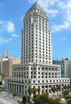
Law, government, and politics
Miami-Dade County has operated under a unique metropolitan system of government, a "two-tier federation", since 1957. This was made possible when Florida voters approved a constitutional amendment in 1956 that allowed the people of Dade County (as it was known) to enact a home rule charter. Prior to this year, home rule did not exist in Florida, and all counties were limited to the same set of powers by the Florida Constitution and state law.
Unlike a consolidated city-county, where the city and county governments merge into a single entity, these two entities are separate. Instead there are two "tiers", or levels, of government: city and county. There are 34 municipalities in the county, the City of Miami being the largest.
Cities are the "lower tier" of local government, providing police and fire protection, zoning and code enforcement, and other typical city services within their jurisdiction. These services are paid for by city taxes. The County is the "upper tier", and it provides services of a metropolitan nature, such as emergency management, airport and seaport operations, public housing and health care services, transportation, environmental services, solid waste disposal etc. These are funded by county taxes, which are assessed on all incorporated and unincorporated areas.
Of the county's 2.6 million total residents (as of 2013), approximately 52% live in unincorporated areas, the majority of which are heavily suburbanized. These residents are part of the Unincorporated Municipal Services Area (UMSA). For these residents, the County fills the role of both lower- and upper-tier government, the County Commission acting as their lower-tier municipal representative body. Residents within UMSA pay a UMSA tax, equivalent to a city tax, which is used to provide County residents with equivalent city services (police, fire, zoning, water and sewer, etc.). Residents of incorporated areas do not pay UMSA tax.
Structure of county government
The Mayor of Miami-Dade County is elected countywide to serve a four-year term and is considered a "strong mayor." The mayor is not a member of the County Commission, appoints all 25 directors who oversee the operations of the County Departments and has veto power over the Commission. A mayoral appointment and veto can only be overridden by a two-thirds majority of the County Commission. The post is occupied by Carlos A. Giménez.
The Board of County Commissioners is the legislative body, consisting of 13 members elected from single-member districts. Members are elected to serve four-year terms, and elections of members are staggered. The Board chooses a Chairperson, who presides over the Commission, as well as appoints the members of its legislative committees. The Board has a wide array of powers to enact legislation, create departments, and regulate businesses operating within the County. It also has the power to override the Mayor's veto with a two-thirds vote.
Florida's Constitution provides for six elected officials to oversee executive and administrative functions for each county (called "Constitutional Officers"): Sheriff, Property Appraiser, Supervisor of Elections, Tax Collector, Clerk of the Circuit Court and Comptroller. However, the Constitution allows voters in home-rule counties (including Miami-Dade) to abolish the offices and reorganize them as subordinate County departments; Miami-Dade voters chose this option for Sheriff, Supervisor of Elections, Controller and Tax Collector. The office of Clerk of the Circuit Court, and the judicial offices of State Attorney, and Public Defender, are still branches of State government and are, therefore, independently elected and not part of County government.
Miami-Dade is the only county in Florida that does not have an elected sheriff or a "Sheriff's Office". Instead, the county's law enforcement agency is known as the Miami-Dade Police Department, and its leader is known as the Metropolitan Sheriff and Director of the Miami-Dade Police Department. (Nonetheless, Miami-Dade Police badges bear the inscription, "Deputy Sheriff, Sheriff's Office, Dade County, Fla.".)
Politics
Overview
Miami-Dade County has voted for the Democratic Party candidate in most of the presidential elections in the past four decades, and has gone Democratic in every election since 1992. However, it did vote twice for Ronald Reagan (1980, 1984) and once for George H. W. Bush (1988). From 1904 to 1972 it supported the Democratic candidate in all but four elections. In 2008 and 2012 approximately 59.69% of the electorate voted for Democrat Barack Obama. In 2016, Democrat Hillary Clinton won 63.22% of the vote.
| Year | GOP | DEM | Others |
|---|---|---|---|
| 2016 | 33.83% 333,999 | 63.22% 624,146 | 2.94% 29,046 |
| 2012 | 37.87% 332,981 | 61.58% 541,440 | 0.54% 4,758 |
| 2008 | 41.70% 360,551 | 57.81% 499,831 | 0.49% 4,254 |
| 2004 | 46.61% 361,095 | 52.89% 409,732 | 0.50% 3,899 |
| 2000 | 46.29% 289,574 | 52.57% 328,867 | 1.14% 7,111 |
| 1996 | 37.87% 209,740 | 57.34% 317,555 | 4.79% 26,487 |
| 1992 | 43.19% 235,313 | 46.73% 254,609 | 10.08% 54,921 |
| 1988 | 55.26% 270,937 | 44.26% 216,970 | 0.48% 2,358 |
| 1984 | 59.17% 324,414 | 40.83% 223,863 | 0.01% 35 |
| 1980 | 50.65% 265,888 | 40.17% 210,868 | 9.17% 48,149 |
| 1976 | 40.45% 211,148 | 58.06% 303,047 | 1.48% 7,747 |
| 1972 | 58.87% 256,529 | 40.78% 177,693 | 0.35% 1,541 |
| 1968 | 37.02% 135,222 | 48.37% 176,689 | 14.62% 53,391 |
| 1964 | 35.99% 117,480 | 64.01% 208,941 | |
| 1960 | 42.35% 134,506 | 57.65% 183,114 | |
| 1956 | 55.37% 130,938 | 44.63% 105,559 | |
| 1952 | 56.77% 122,174 | 43.23% 93,022 | |
| 1948 | 37.04% 41,301 | 53.52% 59,681 | 9.44% 10,530 |
| 1944 | 33.56% 30,357 | 66.44% 60,100 | |
| 1940 | 32.70% 25,224 | 67.30% 51,921 | |
| 1936 | 26.88% 10,295 | 73.12% 28,007 | |
| 1932 | 34.16% 9,244 | 65.84% 17,820 | |
| 1928 | 60.15% 15,860 | 38.44% 10,136 | 1.41% 372 |
| 1924 | 26.01% 2,753 | 32.83% 3,474 | 41.16% 4,356[50] |
| 1920 | 38.09% 3,077 | 53.08% 4,288 | 8.83% 713 |
| 1916 | 21.94% 629 | 57.69% 1,654 | 20.37% 584 |
| 1912 | 5.56% 99 | 65.71% 1,171 | 28.73% 512 |
| 1908 | 17.34% 275 | 60.59% 961 | 22.07% 350 |
| 1904 | 24.08% 307 | 69.57% 887 | 6.35% 81 |
Voter registration
| Population and registered voters as of 7/2/2019[51] | ||
|---|---|---|
| Total population[5] | 2,761,581 | |
| Registered voters[52] | 1,441,187 | 52.18% |
| Democratic | 600,258 | 41.65% |
| Republican | 378,196 | 26.24% |
| Democratic–Republican spread | +222,062 | +22.69% |
| Independence | 7,214 | 0.50% |
| Libertarian | 1,817 | 0.12% |
| Green | 633 | 0.04% |
| Reform | 152 | 0.06% |
| Constitution | 90 | 0.00% |
| Other | 135 | 0.00% |
| No party preference | 452,692 | 31.41% |
Economy
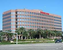

Brightstar Corporation,[53] Burger King,[54] Intradeco Holdings,[55] Latin Flavors,[56] Norwegian Cruise Line,[57] and Ryder have their headquarters in unincorporated areas in the county.[58] Centurion Air Cargo, Florida West International Airways, IBC Airways, and World Atlantic Airlines have their headquarters on the grounds of Miami International Airport in an unincorporated area in the county.[59][60][61][62][63]
Hewlett Packard's main Latin America offices are on the ninth floor of the Waterford Building in unincorporated Miami-Dade County.[64]
Other companies with offices in an unincorporated area not in any CDP:
- AstraZeneca's Latin American headquarters[65]
- Gate Group's Latin American headquarters[66]
- Unicomer Group's United States offices[67]
- Goya Foods's Miami office[68]
Several defunct airlines, including Airlift International, Arrow Air, National Airlines, and Rich International Airways, were headquartered on or near the airport property.[69][70][71][72]
After Frank Borman became president of Eastern Airlines in 1975, he moved Eastern's headquarters from Rockefeller Center in Midtown Manhattan, New York City to an unincorporated area in Miami-Dade County[73][74] Around 1991 the Miami-Dade County lost a few corporations, including Eastern Airlines, which folded in 1991.[75]
At one time the cruise line ResidenSea had its headquarters in an unincorporated area in the county.[76]
Top private employers
According to Miami's Beacon Council, the top private employers in 2014 in Miami-Dade were:[77]
| # | Employer | # of employees |
|---|---|---|
| 1 | University of Miami | 12,818 |
| 2 | Baptist Health South Florida | 11,353 |
| 3 | American Airlines | 11,031 |
| 4 | Carnival Cruise Lines | 3,500 |
| 5 | Miami Children's Hospital | 3,500 |
| 6 | Mount Sinai Medical Center | 3,321 |
| 7 | Florida Power and Light Co. | 3,011 |
| 8 | Royal Caribbean International | 2,989 |
| 9 | Wells Fargo | 2,050 |
| 10 | Bank of America | 2,000 |
Top government employers
According to Miami's Beacon Council, the top government employers in 2014 in the county were:[77]
| # | Employer | # of employees |
|---|---|---|
| 1 | Miami-Dade County Public Schools | 33,477 |
| 2 | Miami-Dade County | 25,502 |
| 3 | Federal Government | 19,200 |
| 4 | Florida State Government | 17,100 |
| 5 | Jackson Health System | 9,800 |
Public services
Fire rescue
The Miami-Dade County Fire Rescue Department is the agency that provides fire protection and emergency medical services for Miami-Dade County, Florida. The department serves 29 municipalities and all unincorporated areas of Miami-Dade County from 60 fire stations.[78] The Department also provides fire protection services for Miami International Airport, Miami Executive Airport and Opa-locka Airport.[79]
The communities served are Aventura, Bal Harbour, Bay Harbor Islands, Biscayne Park, Cutler Bay, Doral, El Portal, Florida City, Golden Beach, Hialeah Gardens, Homestead, Indian Creek, Medley, Miami Gardens, Miami Lakes, Miami Shores, Miami Springs, North Bay Village, North Miami, North Miami Beach, Opa-locka, Palmetto Bay, Pinecrest, South Miami, Surfside, Sweetwater, Sunny Isles Beach, Virginia Gardens, and West Miami.[80]
Miami-Dade Fire Rescue is also the home to Urban Search and Rescue Florida Task Force 1 as well as EMS operations consisting of 57 Advanced Life Support units staffed by 760 state-certified paramedics and 640 state-certified emergency medical technicians.
Police department
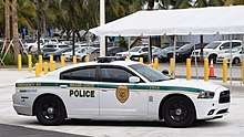
The Miami-Dade Police Department is a full-service metropolitan police department serving Miami-Dade County's unincorporated areas, although it has lenient mutual aid agreements with other municipalities, most often the City of Miami Police Department. With 4,700 employees, it is Florida's largest police department. The Department is often referred to by its former name, the Metro-Dade Police or simply Metro.
The Miami-Dade Police Department operates out of nine districts throughout the county and has two special bureaus. The director of the department is Juan Perez, who succeeded J.D. Patterson, Jr.[81] The Department's headquarters are in Doral, Florida.
Water and sewer department
Miami-Dade Water and Sewer Department (MDWASD) is one of the largest public utilities in the United States, employing approximately 2,700 employees as of 2007. It provides service to over 2.4 million customers, operating with an annual budget of almost $400 million. Approximately 330 million gallons of water are drawn every day from the Biscayne Aquifer for consumer use. MDWASD has over 7,100 miles (11,400 km) of water lines, a service area of 396 square miles (1,026 km2) and 14 pump stations. MDWASD has over 3,600 miles (5,800 km) of sewage pipes, a service area of 341 square miles (883 km2) and 954 pump stations.[82] Miami-Dade County is also in the jurisdiction of the South Dade Soil and Water Conservation District.
Corrections department
Miami-Dade County Corrections and Rehabilitation Department is the correction agency.
Aviation department
The Miami-Dade Aviation Department (MDAD) operates Miami International Airport, Miami Executive Airport, Opa-locka Executive Airport, Homestead General Aviation Airport, and Dade-Collier Training and Transition Airport.[83]
County representation
The Florida Department of Juvenile Justice operates the Miami-Dade Regional Juvenile Detention Center in an unincorporated area in the county.[84]
Public libraries
The Miami-Dade Public Library System serves a population of 2,496,435. It has 50 branches and 2 bookmobiles. Their mission is to provide extraordinary services, spaces and experiences that promote literacy and learning, personal growth and limitless opportunities. The Miami-Dade Public Library provides services for the Miami-Dade County except for the cities of Bal Harbour, Hialeah, Miami Shores, North Miami, North Miami Beach and Surfside. The Miami-Dade County Board of County Commissioners governs the Miami-Dade Public Library System.
Education
In Florida, each county is also a school district. Miami-Dade County Public Schools, is operated by an independently elected School Board. A professional Superintendent of Schools appointed by the School Board manages the district's day-to-day operations. As of 2014, the Miami-Dade County Public School District is the fourth-largest public school district in the nation with almost 360,000 students.[85]
The Miami-Dade Public Library is one of the country's largest public library systems. It has 50 branch locations and others under construction.[86]
Colleges and universities
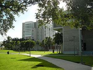
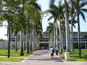
Miami-Dade County is home to many private and public universities and colleges.
- University of Miami (private)
- Florida International University (public)
- Miami Dade College (public)
- Barry University (private/Catholic)
- Nova Southeastern University (private)
- Florida National University (private)
- Florida Memorial University (private/historically black)
- St. Thomas University (private/Catholic)
- Johnson and Wales University (private)
- Carlos Albizu University (private)
- Miami International University of Art & Design (private)
- Talmudic University (private/Jewish)
- Miami Ad School (private)
Sites of interest
Museums


- Bass Museum of Art, Miami Beach
- Coral Castle, Homestead Miami
- Fairchild Tropical Botanic Garden, Coral Gables
- Frost Art Museum, (Florida International University, Miami)
- Gold Coast Railroad Museum, Miami
- HistoryMiami, Downtown Miami
- Holocaust Memorial, Miami Beach
- Jewish Museum of Florida, Miami Beach
- Lowe Art Museum, (University of Miami, Coral Gables)
- Miami Children's Museum, Miami
- Museum of Contemporary Art, North Miami
- Pérez Art Museum Miami, Miami
- Phillip and Patricia Frost Museum of Science, Miami
- Vizcaya Museum and Gardens, Miami
- Wings Over Miami Museum, Miami
- Wolfsonian, (Florida International University, Miami Beach)
Culture and wildlife


- Adrienne Arsht Center for the Performing Arts, Downtown Miami
- Ancient Spanish Monastery, North Miami Beach
- Bayfront Park Amphitheatre, Downtown Miami
- Bayside Marketplace, Downtown Miami
- Florida Grand Opera, Miami
- Gusman Center for the Performing Arts, Downtown Miami
- Jungle Island, Miami
- Miami Seaquarium, Miami
- Monkey Jungle, Miami
- Vizcaya Museum and Gardens, Miami
- Wertheim Performing Arts Center, (Florida International University, Miami)
- Zoo Miami, Miami
Other areas and attractions

|
|
|
Parks
Sports venues
.jpg)
Miami-Dade County holds the majority of sports arenas, stadiums and complexes in South Florida. Some of these sports facilities are:
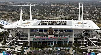
- Hard Rock Stadium – Miami Dolphins (football) and plays host to the Miami Hurricanes football team during their regular season.
- Marlins Park – Miami Marlins (baseball)
- American Airlines Arena – Miami Heat (basketball)
- Tennis Center at Crandon Park – Sony Ericcson Open
- FIU Stadium – FIU Panthers (football)
- FIU Arena – FIU Panthers (basketball)
- FIU Baseball Stadium – FIU Panthers (baseball)
- Watsco Center – Miami Hurricanes (basketball)
- Tropical Park Stadium
- Homestead-Miami Speedway
- Calder Race Course
- Hialeah Park Race Track
- Alex Rodriguez Park at Mark Light Field – Miami Hurricanes (baseball)
- Cobb Stadium - Miami Hurricanes (soccer, track and field)
Former venues include:
- Bobby Maduro Miami Stadium
- Miami Arena
- Miami Orange Bowl
- Miami Marine Stadium
Planned:
- Miami MLS stadium
Transportation
Airports
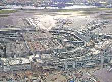
Miami International Airport, in an unincorporated area in the county, is the Miami area's primary international airport. One of the busiest international airports in the world, it serves over 35 million passengers a year. Identifiable locally, as well as several worldwide authorities, as MIA or KMIA, the airport is a major hub and the single largest international gateway for American Airlines, the world's largest passenger air carrier. Miami International is the United States’ third largest international port of entry for foreign air passengers (behind New York's John F. Kennedy International Airport and Los Angeles International Airport), and is the seventh largest such gateway in the world. The airport's extensive international route network includes non-stop flights to over seventy international cities in North and South America, Europe, Asia, and the Middle East.
- Homestead General Aviation Airport
- Miami Executive Airport
- Opa-Locka Executive
- Homestead Air Reserve Base, east of Homestead in an unincorporated area, serves military traffic.
- Miami Seaplane Base
- Dade-Collier
Public transit

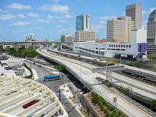
Public transit in Miami-Dade County is operated by Miami-Dade Transportation and Public Works,[87] and is the largest public transit in Florida. Miami-Dade Transportation and Public Works operates a heavy rail metro system Metrorail, an elevated people mover in Downtown Miami, Metromover and the bus system, Metrobus.[88]
Tri-Rail also services the county.
Major expressways
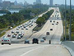
Miami-Dade County has 10 major expressways and 1 minor expressway in Downtown Miami.
County roads
This is a list of Miami-Dade county roads. Miami-Dade County has fewer county roads than any other county in Florida, despite its large population. None are signed.
| # | Road Name(s) | Direction and Termini | Notes | ||||
|---|---|---|---|---|---|---|---|
| Ives Dairy Road | SR 817 | US 1 | former SR 854 (east of US 441)[89] | ||||
| Crandon Boulevard / Rickenbacker Causeway | extension of SR 913 | ||||||
| Lindgren Road | extension of SR 825 | ||||||
| Southwest 57th Avenue | extension of SR 959 | ||||||
| Galloway Road | extension of SR 973 | ||||||
| Coral Reef Drive | extension of SR 992 | ||||||
| Northwest 67th Avenue Northwest 68th Avenue |
N/S | SR 826 | Palm Springs North | Broward County line | Palm Springs North | ||
Sources:
- FDOT Map of Miami-Dade County, Florida
- FDOT GIS data, accessed January 2014
Street grid
A street grid stretches from downtown Miami throughout the county. This grid was adopted by the City of Miami following World War I after the United States Post Office threatened to cease mail deliveries in the city because the original system of named streets, with names often changing every few blocks and multiple streets in the city sharing the same name, was too confusing for the mail carriers.[90] The new grid was later extended throughout the county as the population grew west, south, and north of city limits.
The grid is laid out with Miami Avenue as the meridian going north–south and Flagler Street the baseline going east-west. The grid is primarily numerical so that, for example, all street addresses north of Flagler and west of Miami Avenue have NW in their address (e.g. NW 27th Avenue). Because its point of origin is in downtown Miami which is close to the coast, the NW and SW quadrants are much larger than the SE and NE quadrants. Many roads, especially major ones, are also named, although, with a few notable exceptions, the number is in more common usage among locals.
Although this grid is easy to understand once one is oriented to it, it is not universal in the entire county. Hialeah uses its own grid system which is entirely different in its orientation. Coral Gables and Miami Lakes use named streets almost exclusively, and various smaller municipalities such as Florida City and Homestead use their own grid system along with the Miami-Dade grid system adding to the confusion. In the beach cities and parks of Miami Beach, Surfside, Bal Harbour, Sunny Isles, and Golden Beach, the streets are coordinated with the main grid; however, their avenues are named.
Communities
Notable people
Sister cities
Miami-Dade County has 23 sister cities, as designated by Sister Cities International:
|
|
See also
References
- https://www2.census.gov/geo/docs/maps-data/data/gazetteer/2018_Gazetteer/2018_gaz_counties_12.txt
- "Agencies and Officials".
- "Miami-Dade County High Point - Peakbagger.com". www.peakbagger.com.
- Sea level at the Atlantic Ocean.
- "U.S. Census Bureau QuickFacts: Miami-Dade County, Florida".
- "GDP by County | U.S. Bureau of Economic Analysis (BEA)".
- "U.S. Census Bureau QuickFacts: Miami-Dade County, Florida; UNITED STATES". www.census.gov.
- "State & County QuickFacts". United States Census Bureau. Archived from the original on May 19, 2001. Retrieved November 6, 2015.
- "MiamiHerald.com".
- "Find a County". National Association of Counties. Retrieved 2011-06-07.
- "U.S. Census Bureau QuickFacts: Miami-Dade County, Florida; Broward County, Florida; Palm Beach County, Florida".
- "Miami-Dade County Municipalities". www8.miamidade.gov. Retrieved 2019-02-20.
- "Biscayne Bay Aquatic Preserves | Florida Department of Environmental Protection". floridadep.gov.
- "Biscayne Bay Aquatic Preserve". Florida Department of Environmental Protection. Florida Department of Environmental Protection. July 8, 2015. Retrieved December 14, 2015.
- Parks, Arva Moore (1991). Miami: The Magic City. Miami: Centennial Press. p. 12. ISBN 0-9629402-2-4.
- "Miami Circle to Brickell Avenue – From Native to NOW! – HistoryMiami Museum". www.historymiami.org.
- Parks, p 13
- Parks, p 14
- Parks, p 14-16
- History of Miami-Dade county retrieved January 26, 2006 Archived January 10, 2006, at the Wayback Machine
- Publications of the Florida Historical Society. Florida Historical Society. 1908. p. 30.
- "Miami-Dade County Annual Report for Bondholders. For the Fiscal Year of 1998" (PDF). Miami-Dade County, Florida. 1998. Retrieved April 7, 2007.
- History of Indian Key – retrieved September 13, 2007
- Muir, Helen. (1953) Miami, U.S.A. Coconut Grove, Florida. Hurricane House Publishers. Pp. 33, 100
- "Miami-Dade County Government". Archived from the original on April 3, 2007.
- Fla. Const. of 1885, art. VIII, s. 11(h), continued in force by, Fla. Const. art. VIII, s. 9(e).
- "Miami-Dade County, FL Weather - USA.com™". www.usa.com.
- "US Gazetteer files: 2010, 2000, and 1990". United States Census Bureau. 2011-02-12. Retrieved 2011-04-23.
- "Notes on Florida Geography, Florida International University".
- "Population and Housing Unit Estimates". Retrieved March 26, 2020.
- "U.S. Decennial Census". United States Census Bureau. Retrieved June 15, 2014.
- "Historical Census Browser". University of Virginia Library. Retrieved June 15, 2014.
- "Population of Counties by Decennial Census: 1900 to 1990". United States Census Bureau. Retrieved June 15, 2014.
- "Census 2000 PHC-T-4. Ranking Tables for Counties: 1990 and 2000" (PDF). United States Census Bureau. Retrieved June 15, 2014.
- "Miami-Dade County: Selected Social Characteristics in the United States 2006–2010 American Community Survey 5-Year Estimates". United States Census Bureau. Retrieved October 19, 2015.
- "Miami–Dade County Demographic Characteristics". ocala.com. Archived from the original on January 31, 2016. Retrieved October 19, 2015.
- "Hispanic or Latino by Type: 2010 Census Summary File 1". United States Census Bureau. Retrieved October 19, 2015.
- "Miami-Dade County, Florida First Ancestry Reported Universe: Total population – 2006–2010 American Community Survey 5-Year Estimates". United States Census Bureau. Retrieved November 11, 2015.
- "3.2% county population rise in year". Miami Today. 2013-07-18. Retrieved September 8, 2013.
- "Miami-Dade County: Age Groups and Sex: 2010 Census Summary File 1". United States Census Bureau. Retrieved October 19, 2015.
- "Miami-Dade County, Florida: Selected Economic Characteristics – 2006–2010 American Community Survey 5-Year Estimates". United States Census Bureau. Retrieved November 14, 2015.
- Services, Miami-Dade County Online. "Regulatory and Economic Resources - Miami-Dade County" (PDF). www.miamidade.gov. Archived from the original (PDF) on 2008-02-16. Retrieved 2007-12-18.
- "Regional & Local Profiles". flhousingdata.shimberg.ufl.edu. Archived from the original on 2008-01-27. Retrieved 2007-12-18.
- "Demographics of Miami-Dade County, FL". MuniNetGuide.com. Archived from the original on June 7, 2008. Retrieved June 23, 2008.
- "Miami-Dade County, FL Detailed Profile: 2000 Census". city-data.com. Retrieved June 23, 2008.
- "Modern Language Association Data Center Results of Miami-Dade County, Florida". Modern Language Association. Retrieved July 27, 2013.
- "County Membership Report Miami-Dade County (Florida)". The Association of Religion Data Archives. 2010. Retrieved January 2, 2020.
- "Social Capital Variables Spreadsheet for 2014". PennState College of Agricultural Sciences, Northeast Regional Center for Rural Development. December 8, 2017. Retrieved December 30, 2019.
- Leip, David. "Dave Leip's Atlas of U.S. Presidential Elections". uselectionatlas.org.
- The leading "other" candidate, Prohibition candidate Herman P. Faris, received 3,170 votes while Progressive candidate Robert M. La Follette received 2,753 votes and American Party candidate Gilbert Nations received 172 votes.
- "Voter Registration Statistics".
- https://www.miamidade.gov/elections/library/reports/voter-registration-statistics-cumulative.pdf
- "Contact Us Archived December 28, 2009, at the Wayback Machine." Brightstar Corporation. Retrieved on January 9, 2010.
- "We're Listening Archived July 25, 2008, at the Wayback Machine." Burger King. Retrieved on January 31, 2009.
- "Contact Us Archived April 26, 2009, at the Wayback Machine." Intradeco Holdings. Retrieved on January 9, 2010.
- "Contact Us Archived May 14, 2011, at the Wayback Machine." Latin Flavors. Retrieved on January 9, 2010.
- "Contact Us." Norwegian Cruise Line. Retrieved on January 9, 2010.
- "Contact Us." Ryder. Retrieved on January 9, 2010.
- "Contact Us Archived August 2, 2010, at the Wayback Machine." (Direct link to image Archived May 12, 2011, at the Wayback Machine) Centurion Air Cargo. Retrieved on July 1, 2010. "Head Office 1851 NW 68 Ave., Bldg 706 Miami, FL 33126. This address may incorrectly be mapped to a residential subdivision. The proper location is at Miami International Airport
- Home page Archived November 6, 2005, at the Wayback Machine. Florida West International Airways. Retrieved on January 7, 2010.
- "Locations Archived April 14, 2008, at the Wayback Machine." International Bonded Couriers. Retrieved on January 9, 2010.
- "Contact World Atlantic Airlines Archived January 15, 2013, at the Wayback Machine." World Atlantic Airlines. Retrieved on December 31, 2012. "5600 NW 36th Street Suite: 450 Miami, Florida 33166"
- "MIA LOST AND FOUND PUBLIC AUCTION ON MARCH 20 Archived March 12, 2013, at the Wayback Machine." Miami International Airport. March 9, 2010. Retrieved on December 31, 2012. "5600 N.W. 36th Street (Building 845), Third Floor"
- "Office Locations." Hewlett Packard. Retrieved on August 29, 2011. "Hewlett-Packard Latin America Waterford Building, 9th Floor 5200 Blue Lagoon Drive Miami, Florida 33126 USA"
- "USA." AstraZeneca. Retrieved on March 11, 2010.
- "Contact Us." Gate Group. Retrieved on September 17, 2011. "North America Regional Office11710 Plaza America Drive, Suite 800 Reston, VA 20190 USA"
- "Prelude Archived February 2, 2011, at the Wayback Machine." (Select "English", then select the mail icon in the upper right hand corner of the screen) Unicomer Group. Retrieved on March 4, 2010.
- "Contact Us." Goya Foods. Retrieved on March 26, 2016. "Goya Foods of Miami 13300 NW 25th Street Miami, FL 33182"
- "Contact Us." Arrow Air. Retrieved on January 7, 2010.
- "Walkout by 3,500 Cancels All Flights Of National Airlines." The New York Times. Sunday February 1, 1970. Page 58. Retrieved on September 24, 2009.
- "World Airline Directory." Flight International. March 14–20, 1990 "Airlift International" 57.
- "World Airline Directory." Flight International. March 23–29, 1994. 114. "Head office: PO Box 522067, 5400 NW 36th St, Miami, Florida 33152, USA."
- Bernstein, Aaron. Grounded: Frank Lorenzo and the Destruction of Eastern Airlines. Beard Books, 1999. 22. Retrieved on August 28, 2009.
- "World Airline Directory." Flight International. March 30, 1985. 72." Retrieved on June 17, 2009.
- Stieghorst, Tom. "Sings of decline." Sun Sentinel. May 6, 1991. Weekly Business 8. Retrieved on August 28, 2009.
- "Welcome to ResidenSea." ResidenSea. January 18, 2006. Retrieved on January 20, 2010.
- Beacon Council Archived September 21, 2012, at the Wayback Machine. Beacon Council. Retrieved on May 4, 2013.
- "Locations". Miami-Dade Fire Rescue Department. Miami-Dade County. Archived from the original on June 15, 2006. Retrieved August 30, 2006.
- "Airport Fire Rescue Division". Miami-Dade Fire Rescue Department. Miami-Dade County. Archived from the original on March 8, 2005. Retrieved August 30, 2006.
- "Cities Served". Miami-Dade Fire Rescue Department. Miami-Dade County. Archived from the original on October 22, 2004. Retrieved August 30, 2006.
- "Miami-Dade County News Releases" (PDF). Miami-Dade County. January 28, 2016.
- Services, Miami-Dade County Online. "Water & Sewer - Miami-Dade County". www.miamidade.gov. Archived from the original on 2006-10-09. Retrieved 2007-07-11.
- County, Miami-Dade. "Miami International Airport". www.miami-airport.com.
- "Miami-Dade Regional Juvenile Detention Center." Florida Department of Juvenile Justice. Retrieved on June 4, 2010.
- "Digest of Education Statistics, 2016". nces.ed.gov. Retrieved 2018-11-27.
- "Find a Branch | Locations of the Miami-Dade Public Library System". www.mdpls.org. Retrieved 2018-11-27.
- "Transportation & Public Works". www.miamidade.gov.
- "Miami-Dade County News" (PDF). February 1, 2016.
- "General highway map Dade County". ufdc.ufl.edu.
- Muir, Helen. (1953) Miami, U.S.A. Coconut Grove, Florida: Hurricane House Publishers. Pp. 136–7.
- Press, Europa (May 25, 2009). "La ocupación para el primer mes del vuelo Tenerife-Miami de Air Europa alcanza ya el 70 por ciento".
- "Prefeitura.Sp – Descentralized Cooperation". Archived from the original on December 24, 2008.
- "International Relations – São Paulo City Hall – Official Sister Cities". Archived from the original on May 21, 2010. Retrieved January 31, 2010.
- "Partnerská města HMP" [Prague – Twin Cities HMP]. Portál „Zahraniční vztahy" [Portal "Foreign Affairs"] (in Czech). July 18, 2013. Archived from the original on June 25, 2013. Retrieved August 5, 2013.
External links
![]()
Places adjacent to Miami-Dade County, Florida | ||||||||||
|---|---|---|---|---|---|---|---|---|---|---|
| ||||||||||
Municipalities and communities of Miami-Dade County, Florida, United States | ||
|---|---|---|
| Cities | | |
| Towns | ||
| Villages | ||
| CDPs |
| |
| Unincorporated communities | ||
| Ghost town | ||
| Indian reservation | ||
| Footnotes | ‡This populated place also has portions in an adjacent county or counties | |
| Authority control |
|
|---|